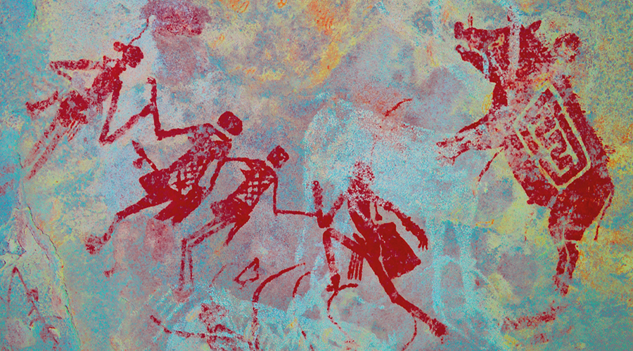


Unknown Archaeology of Browns Canyon, Colorado: the story of the people living in the upper Arkansas River valley, with artefacts dating back over 10,000 years, will now be preserved, as the archaeological resources wait to be fully surveyed and recorded.

Photo: John Fielder
A proclamation by President Barack Obama in the White House has been recently released - ESTABLISHMENT OF THE BROWNS CANYON NATIONAL MONUMENT - based on the region's wealth of scientifically significant geological, ecological, riparian, cultural, and historic resources, and as an important area for studies of paleoecology, mineralogy, archaeology, and climate change.
Quoting from the White House:
Following its descent between the Sawatch and Mosquito Ranges, the Arkansas River flows through Browns Canyon in the heart of the upper Arkansas River valley. The Arkansas River valley is the northernmost valley in the Rio Grande Rift system, one of the most significant rift systems in the world and one of few where the Earth's continental crust is actively moving apart. The 35 million-year-old R?o Grande Rift begins in the State of Chihuahua in Mexico and extends northward through New Mexico and into Colorado to a terminus in the mountains just north of Browns Canyon.
The Browns Canyon area of the upper Arkansas River valley has long offered both a permanent source of water and a means of transportation for its human inhabitants. The area lies within the transition zone between the cultural traditions of the Great Basin and Plains peoples. As a transportation corridor where stable sources of subsistence resources could be found, both migrating people and permanent inhabitants left traces of their presence in this area. Ancestors of the Ute, Apache, Eastern Shoshone, and Comanche Indians are known to have traversed this dramatic landscape while hunting and gathering.
The upper Arkansas River valley was foundational to the establishment of today's tribal configuration. It was here that the proto-Comanche (Numuna) split into two groups, the Comanche and the Eastern Shoshone. The Buffalo-Eater Band (allies of the Utes) broke away from the Eastern Shoshone in the upper Arkansas River valley vicinity sometime between the late 1600s and early 1700s, traveling south into what is present-day New Mexico, Texas, southern Colorado, western Kansas, and the panhandle of Oklahoma.
While most archaeological resources in the Browns Canyon area have not yet been surveyed or recorded, the story of people living in the upper Arkansas River valley is told through artefacts dating back over 10,000 years. Of the resources surveyed, there are 18 known archaeological sites within the Browns Canyon area, including 5 prehistoric open lithic sites that have been determined to be eligible for the National Register of Historic Places. Primarily seasonal camps, these sites include open campsites, culturally modified trees, wickiups, tipi rings, chipped stone manufacture and processing sites, a possible ceramic pottery kiln, and rock shelter sites that date to the Archaic Period. The sites range from early Archaic Period and possibly Paleo-Indian Period (around 8,000 to 13,000 years before present), which would make this among the earliest known sites in the region, to the Late Archaic Period to proto-historic period (around 3,000 years before present to the 19th century A.D.).
NOW, THEREFORE, I, BARACK OBAMA, President of the United States of America, by the authority vested in me by section 320301 of title 54, United States Code, hereby proclaim the objects identified above that are situated upon lands and interests in lands owned or controlled by the Federal Government to be the Browns Canyon National Monument (monument) and, for the purpose of protecting those objects, reserve as part thereof all lands and interests in lands owned or controlled by the Federal Government within the boundaries described on the accompanying map, which is attached to and forms a part of this proclamation.
Visit the American Rock Art Archive:
http://www.bradshawfoundation.com/america/index.php
by Bradshaw Foundation
Monday 04 December 2023
by Bradshaw Foundation
Friday 30 June 2023
by Bradshaw Foundation
Thursday 06 April 2023
by Bradshaw Foundation
Thursday 24 November 2022
by Bradshaw Foundation
Tuesday 27 September 2022
by Bradshaw Foundation
Thursday 08 September 2022
by Bradshaw Foundation
Tuesday 19 July 2022
by Bradshaw Foundation
Monday 06 June 2022
by Bradshaw Foundation
Friday 11 March 2022
by Bradshaw Foundation
Wednesday 02 March 2022
by Bradshaw Foundation
Thursday 26 August 2021
by Bradshaw Foundation
Monday 16 August 2021
by Bradshaw Foundation
Tuesday 06 July 2021
by Bradshaw Foundation
Thursday 06 May 2021
by Bradshaw Foundation
Thursday 06 May 2021
by Bradshaw Foundation
Tuesday 16 March 2021
by Bradshaw Foundation
Monday 04 December 2023
by Bradshaw Foundation
Friday 30 June 2023
by Bradshaw Foundation
Thursday 06 April 2023
by Bradshaw Foundation
Thursday 24 November 2022
by Bradshaw Foundation
Tuesday 27 September 2022
by Bradshaw Foundation
Thursday 08 September 2022
by Bradshaw Foundation
Tuesday 19 July 2022
by Bradshaw Foundation
Monday 06 June 2022
by Bradshaw Foundation
Friday 11 March 2022
by Bradshaw Foundation
Wednesday 02 March 2022
by Bradshaw Foundation
Thursday 26 August 2021
by Bradshaw Foundation
Monday 16 August 2021
by Bradshaw Foundation
Tuesday 06 July 2021
by Bradshaw Foundation
Thursday 06 May 2021
by Bradshaw Foundation
Thursday 06 May 2021
by Bradshaw Foundation
Tuesday 16 March 2021
Friend of the Foundation


