Rock Art of Northumberland
The Rock Art of Northumberland
Archaeology in the Northernmost County of England
Dr Aron Mazel
Rock Art of Northumberland Archaeology
Dr Aron Mazel

Aron Mazel is a Reader in Heritage Studies in Media, Culture, Heritage at Newcastle University and a Research Associate in the School of Geography, Archaeology and Environmental Sciences at the University of the Witwatersrand
Aron Mazel is a Reader in Heritage Studies in Media, Culture, Heritage at Newcastle University and a Research Associate in the School of Geography, Archaeology and Environmental Sciences at the University of the Witwatersrand. Aron had a 25-year career in archaeological research and heritage and museum management in South Africa (SA) before moving to the United Kingdom (UK) in 2002. Management posts he has held include Assistant Director of the Natal Museum (1994-1997), Director of the South African Cultural History Museum (1998-2002), and Director of the International Centre for Cultural and Heritage Studies, Newcastle University (2012-2015). His publications have comprised archaeological investigations, including rock-art; museum and archaeology histories; digital heritage; and the safeguarding and interpretation of tangible and intangible cultural heritage.

Rock Art of Northumberland Archaeology
Aron Mazel is a member of the Rock Art Network, established by the Getty Conservation Institute and the Bradshaw Foundation, the network comprises individuals and institutions committed to the promotion, protection, and conservation of rock art globally.

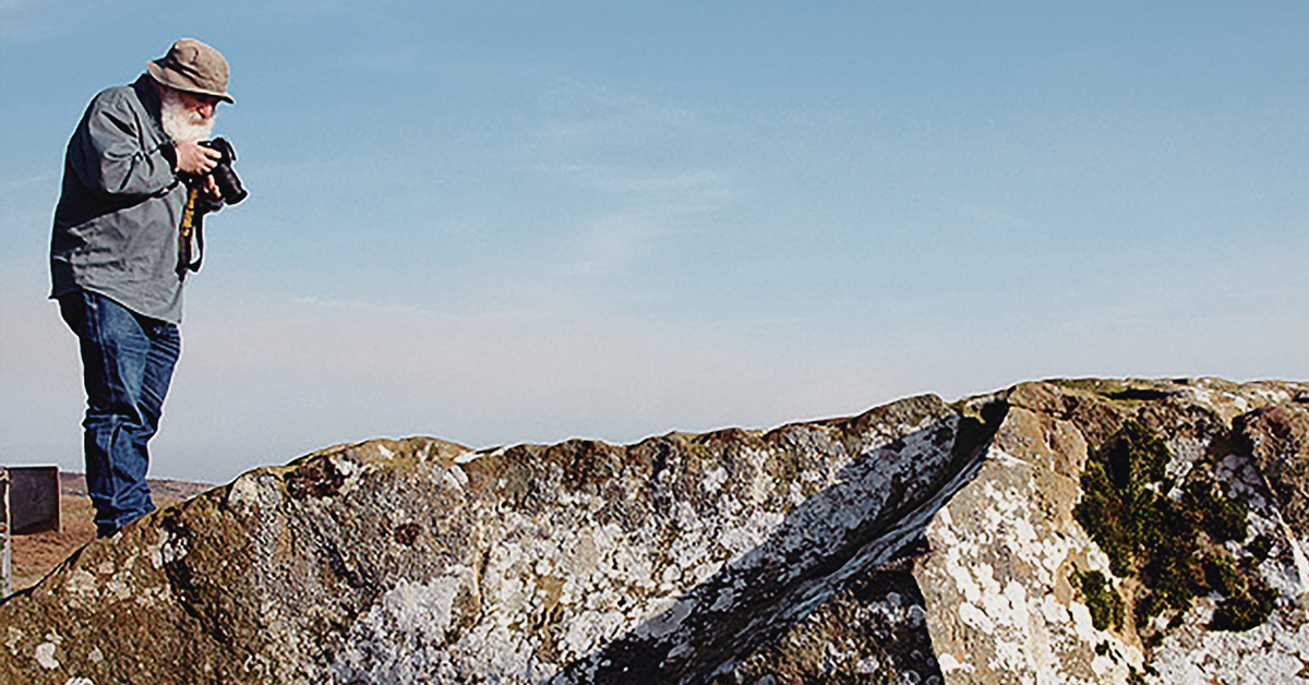
In terms of rock art, Aron has done extensive recording of rock paintings in the uKhahlamba-Drakensberg (South Africa) and carved panels in Northumberland (UK). His rock-art publications have included the management and public presentation of rock art, the distribution of different painted themes, the role of acoustics in the location of rock-art, domestic animals in rock-art, animal seasonality, colonial rock-art, chronology and dating, and integrating rock-art with excavation datasets to improve our understanding of hunter-gatherer history.

Northumberland

Rock Art of Northumberland Archaeology
Northumberland is the northernmost county of England. Scotland to the north, Cumbria to the west, and its North Sea coastline to the east.

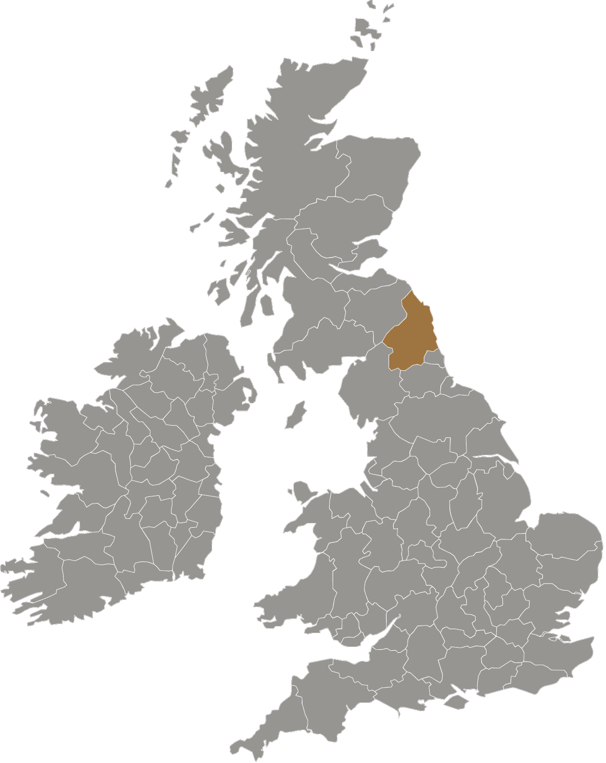
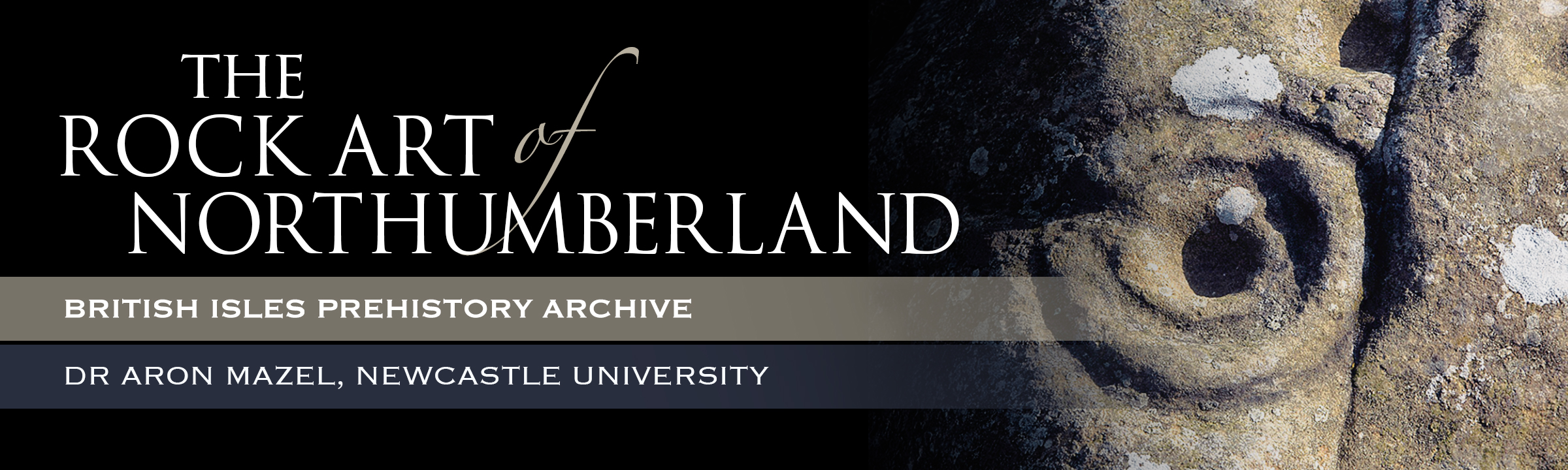
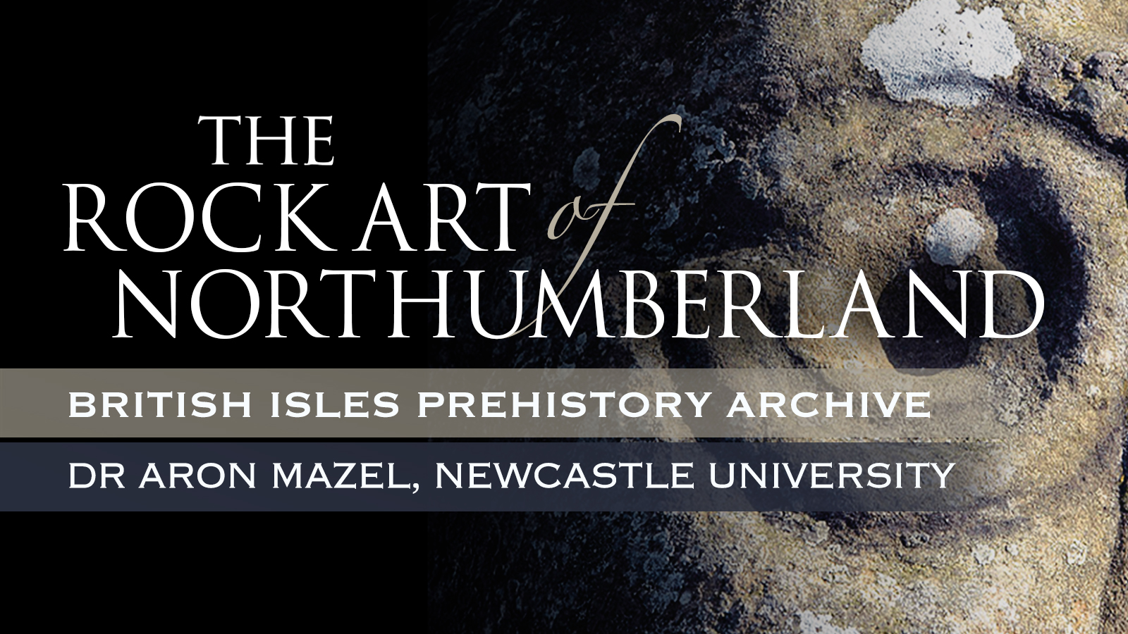
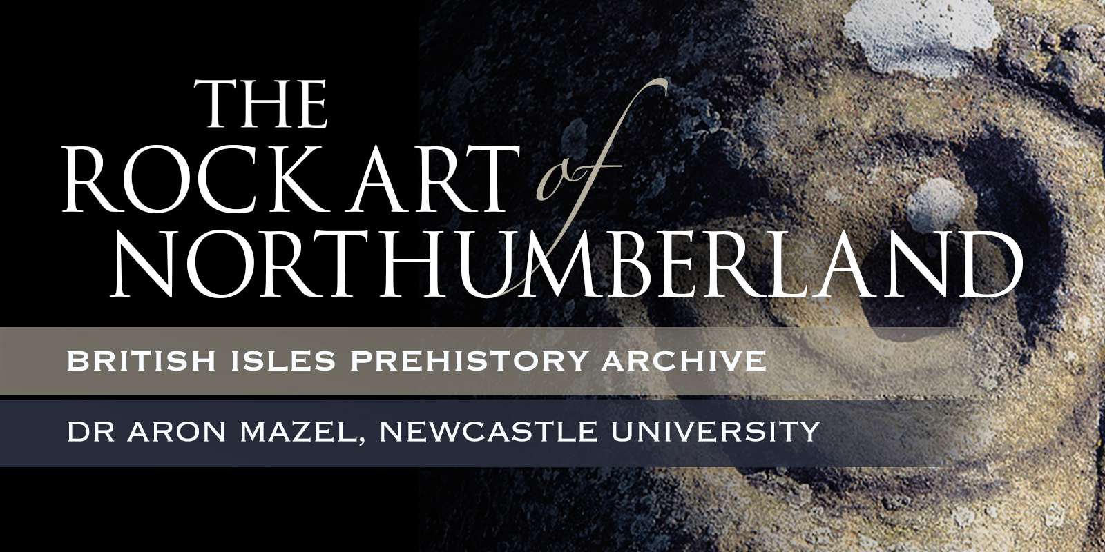
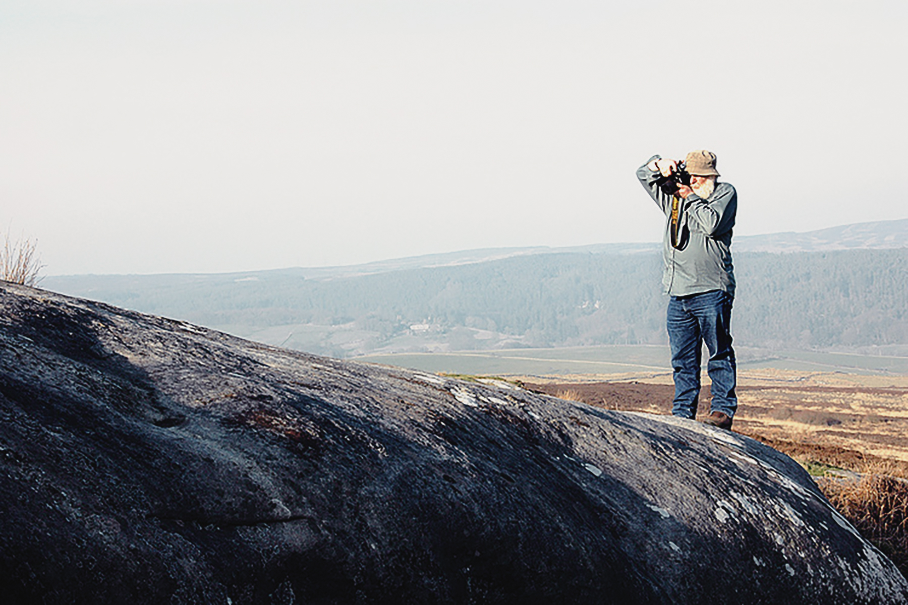
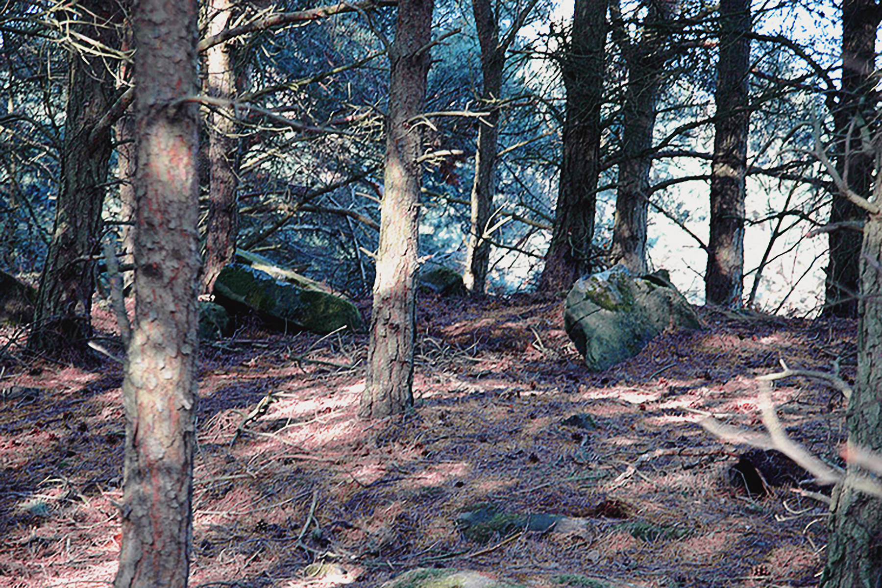
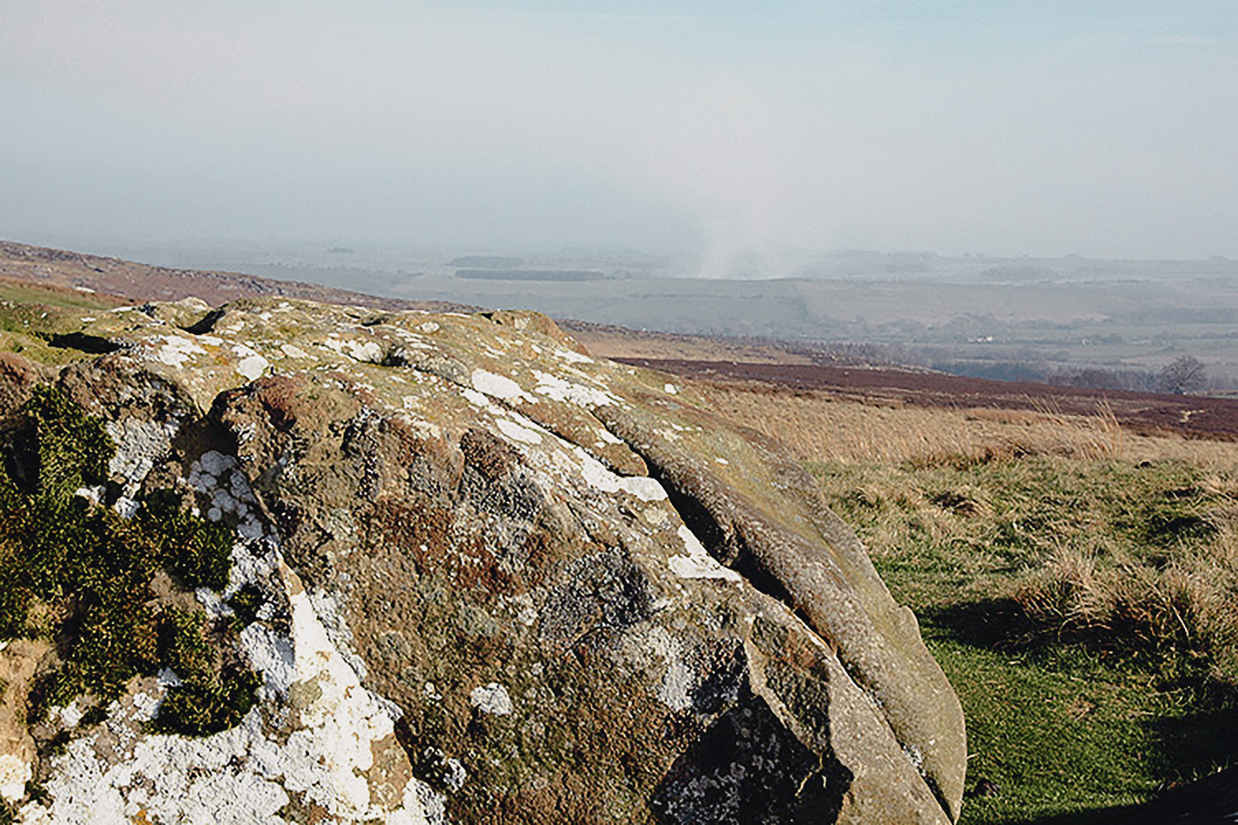
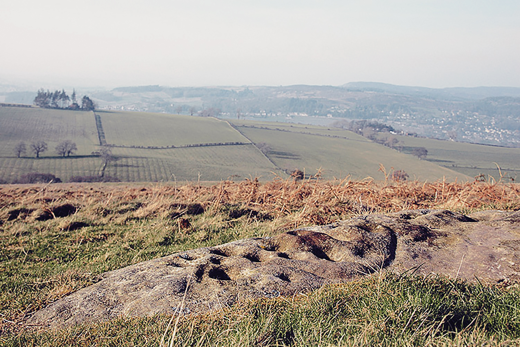
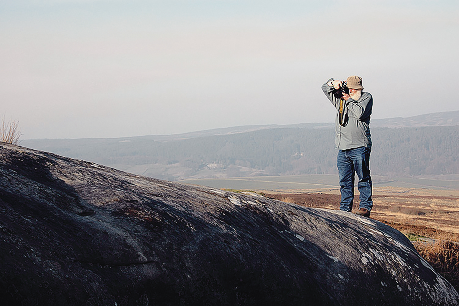
Northumberland is defined by its undeveloped landscape of high moorland. This undeveloped landscape, however, harbours well over a thousand examples of ancient occupation in the form of rock art, made by Neolithic and Early Bronze Age people between 6000 and 3500 years ago. And yet despite being one of the most important collections of prehistoric art in the British Isles, the precise meaning still eludes us. Dr Aron Mazel, of Newcastle University, invited me to Northumberland to see the exquisite abstract carvings, explain the theories that surround them, and demonstrate how these prehistoric petroglyphs are being preserved and shared with us in the 21st Century. My visit included three spectacular rock art sites: Roughting Linn, Weetwood Moor and Lordenshaw.

The rock art of Northumberland - its importance and extent - was first lauded by Dr. Stan Beckensall. In the mid-1960s, Beckensall visited the rock art panel of Old Bewick 1a in northern Northumberland, and saw cup and ring rock carvings for the first time.

This visit sparked a lifelong interest that led him to record prehistoric open-air rock carvings in Northumberland, Durham, Cumbria, North Yorkshire and parts of Scotland and Ireland. It is estimated that Beckensall has recorded over 1500 carved rocks, ranging from Roughting Linn, described by Beckensall as 'justifiably one of the finest rock art panels in the world' to isolated cup-marks on individual cobbles. Beckensall donated his Northumberland rock art archive to the Newcastle University. A subsequent researcher Richard Bradley noted that 'Stan Beckensall has been one of the most patient and thorough recorders of British rock art, and his eye for the details of the individual carvings is as keen as his grasp of the countryside as a whole.'

Northumberland is defined by its undeveloped landscape of high moorland
© Bradshaw Foundation
 
Dr Aron Mazel recording the rock art carvings of Northumberland, England
© Bradshaw Foundation
 
Prehistoric open-air cup and ring rock carvings from Northumberland
© Bradshaw Foundation
 
A variety of tools were used to create the Northumberland rock carvings
© Bradshaw Foundation
 
The rock art carvings are mostly found in the central and northern uplands
© Bradshaw Foundation
 
Dr Aron Mazel recording the rock art carvings of Northumberland, England
© Bradshaw Foundation

The discovery, documentation and management of the rock art that has been carried out since then has led to a far greater understanding of the rich and colourful past of Northumberland, an area that has tended to be dominated by another potent symbol of past occupation: Hadrian's Wall. Built as a Roman frontier in the years AD 122-30 by order of the Emperor Hadrian, it was 73 miles long and ran from Wallsend-on-Tyne in the east to Bowness on the Solway Firth in the west, and made use of ridges and crags, particularly Whin Sill.

Today, it is fascinating to wonder what the Romans made of the intricate geometric carvings.

What was the Purpose of the Rock Carvings?

Rock Art of Northumberland Archaeology
Rock art - ancient carvings 'pecked' onto natural stone surfaces - forms a hugely significant part of the heritage of the North East of England. The abstract motifs, often referred to as 'cup and ring marks', provide a tangible and iconic link to our prehistoric ancestors which extends beyond the basic activities of everyday survival, to hint at a much richer, creative, and potentially spiritual dimension to their lives. Mostly found in situ, on outcrops and large, earth-fast boulders, rock art also reflects the intimate relationship that Neolithic and Bronze Age people had with the natural landscapes they inhabited between 6000 and 3500 years ago.

Rock art in the North East of England presents a concentration of approximately 1600 panels of various sizes and details representing a significant proportion of the known rock art panels recorded in the whole of England. The purpose or meaning of the cups and rings remains shrouded in mystery and continues to challenge archaeologists.

Where are the Rock Art Carvings Located?

Circular Cup Depression Prehistoric open-air cup ring rock art  carvings from Northumberland Archaeology
Circular Cup Depression
© Bradshaw Foundation
The rock art carvings are mostly found in the central and northern uplands of Northumberland. Many of the carved rock art panels are located on sandstone outcrops at prominent viewpoints over the surrounding landscapes of North East England. The rock art carvings which are located on outcrop rock and earth boulders, are mostly placed on gently sloping and horizontal surfaces.

Style of the Rock Art Carvings

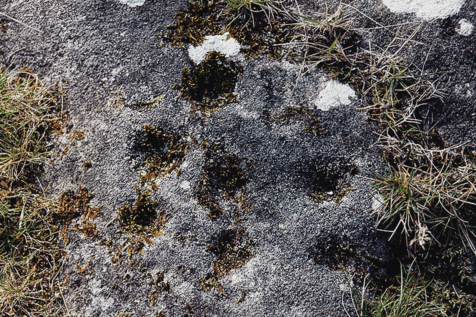
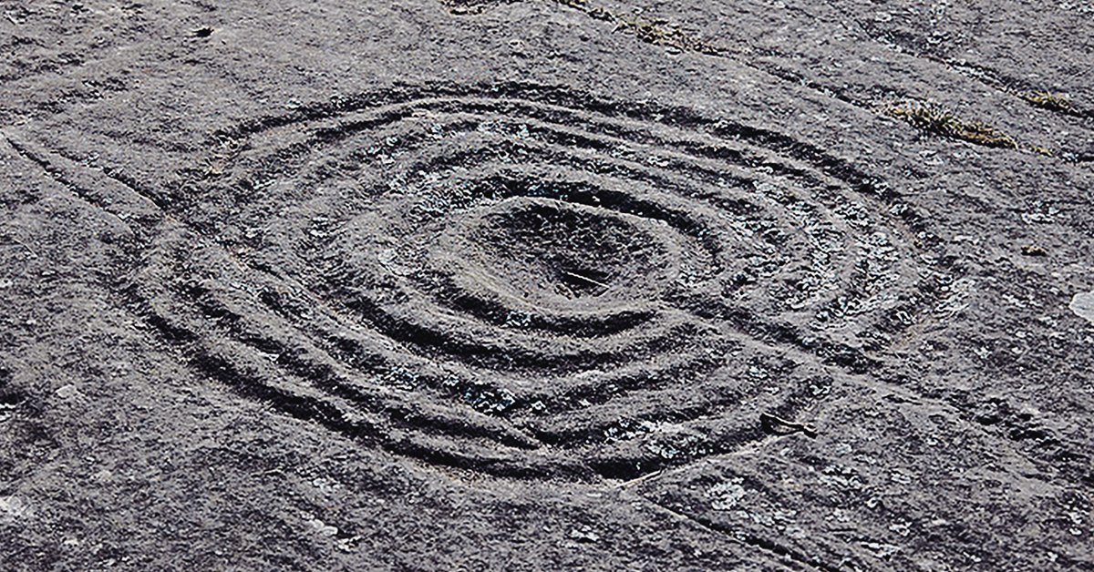
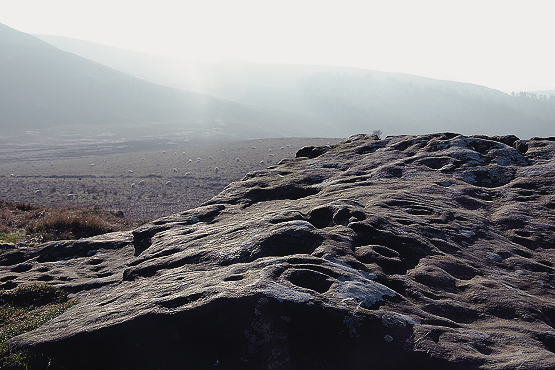
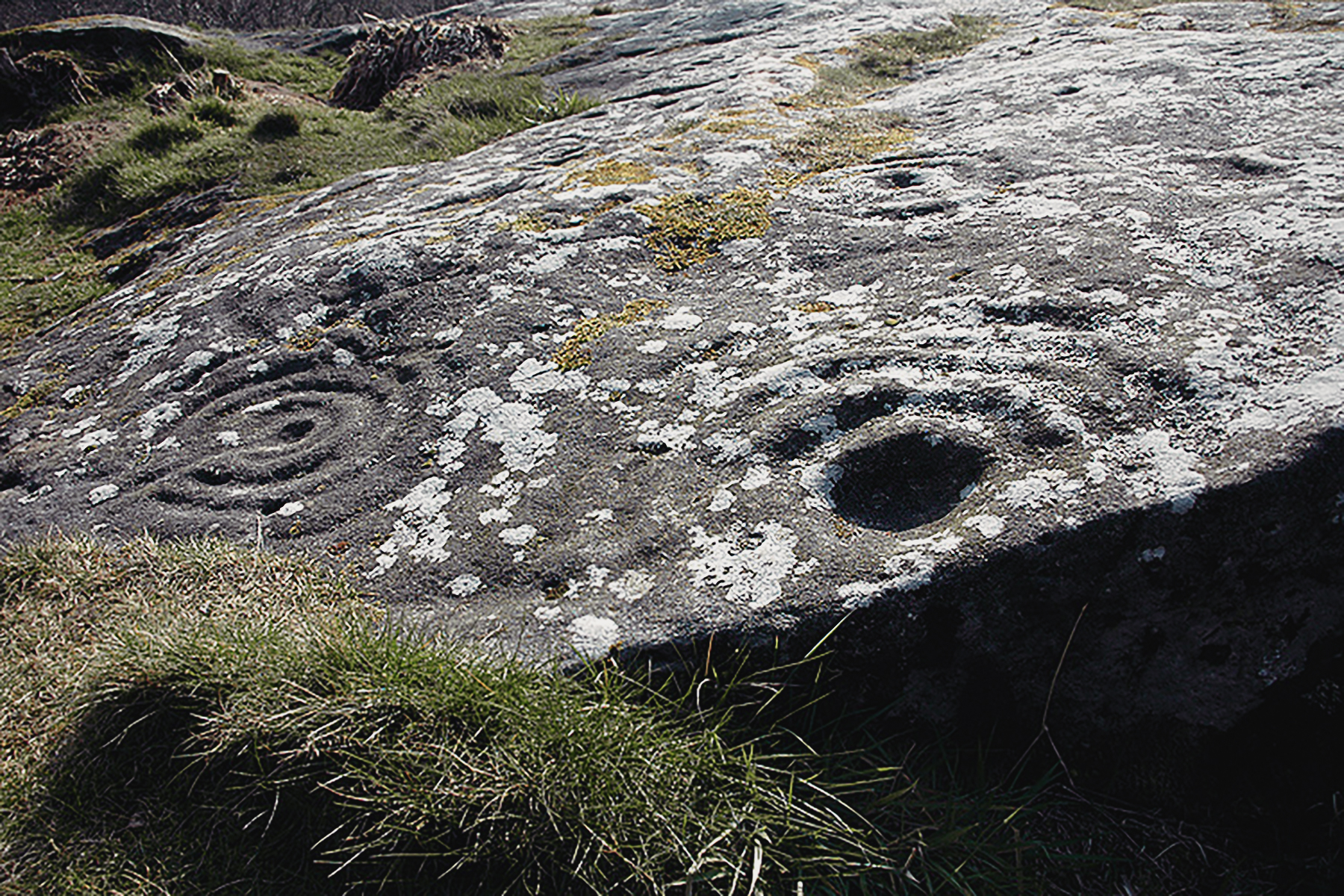
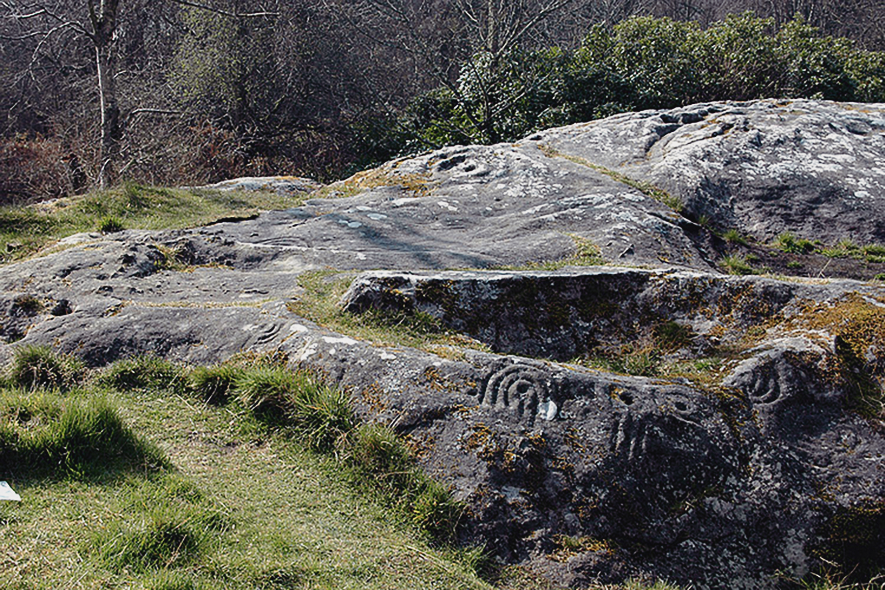
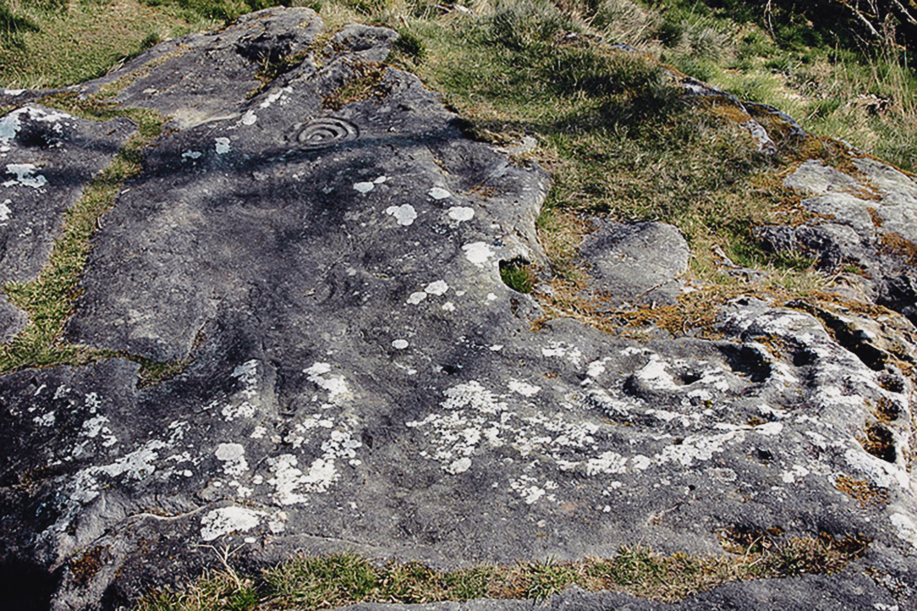
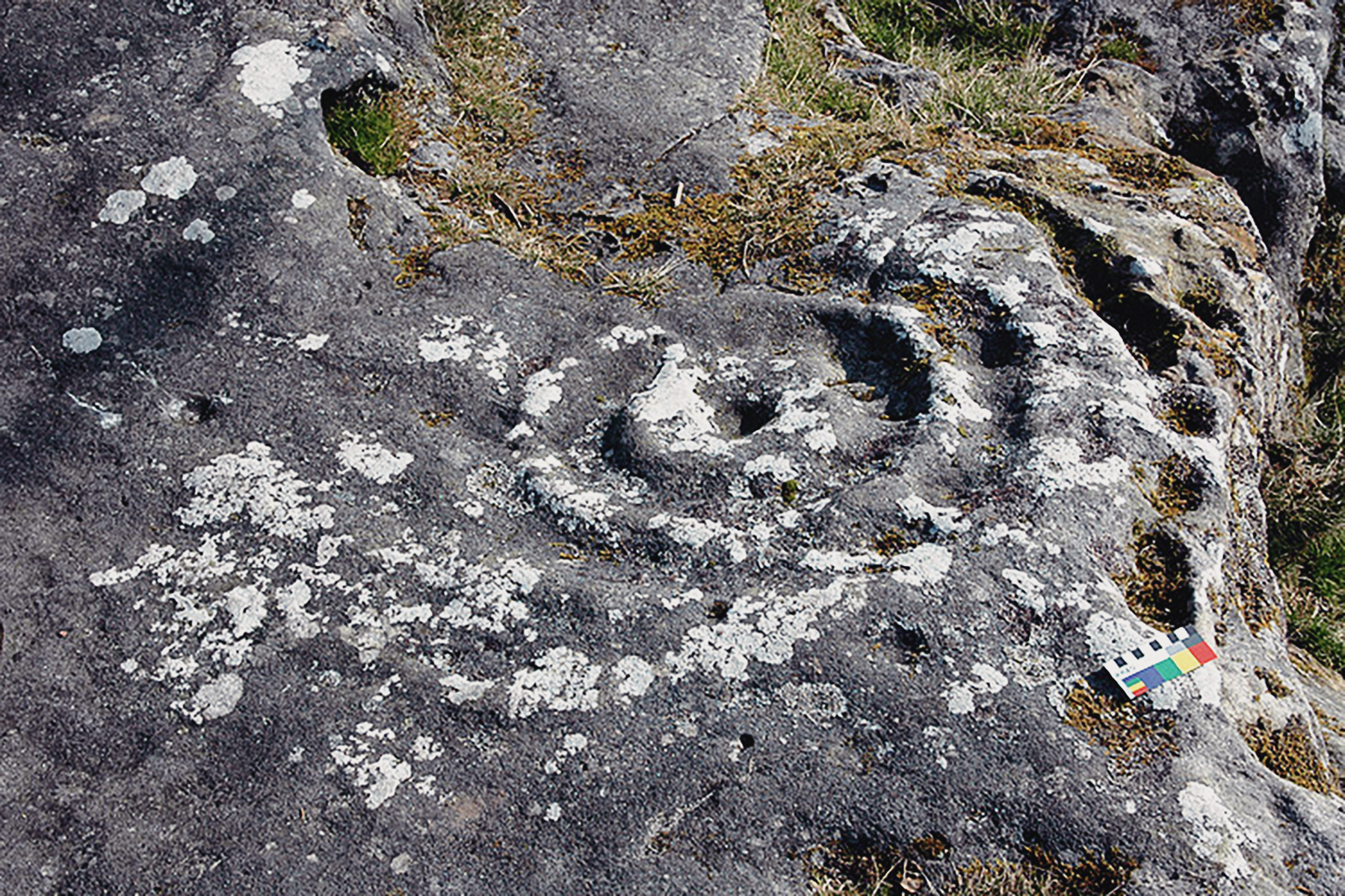
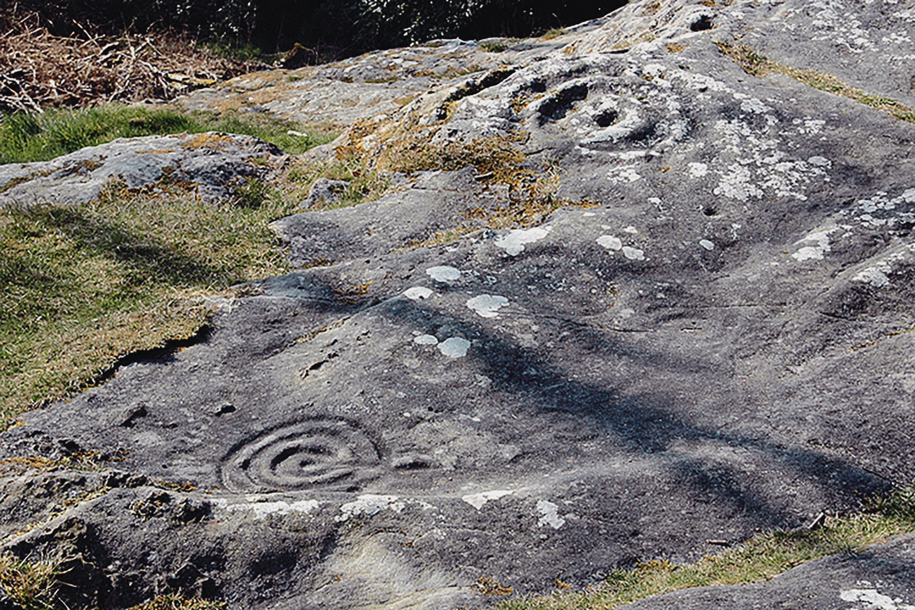
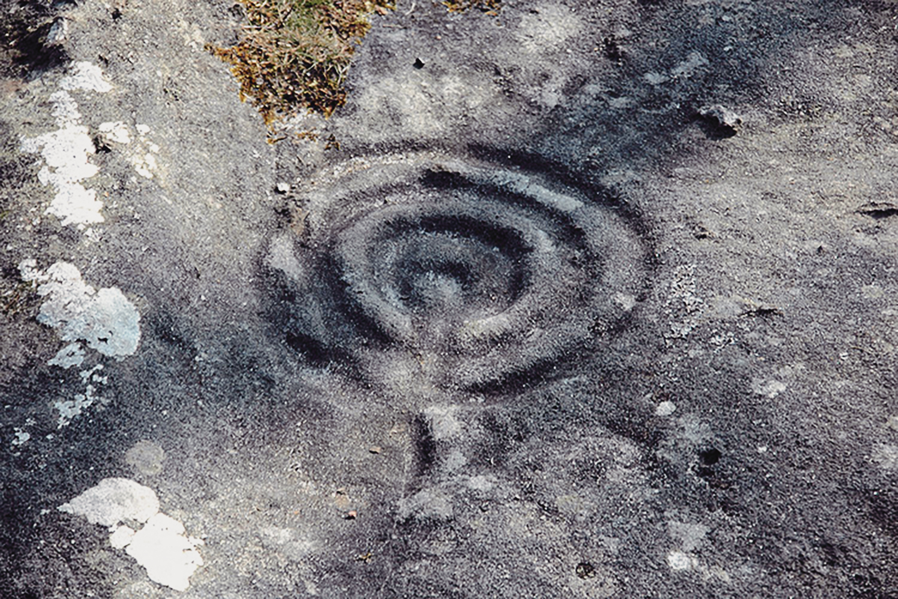
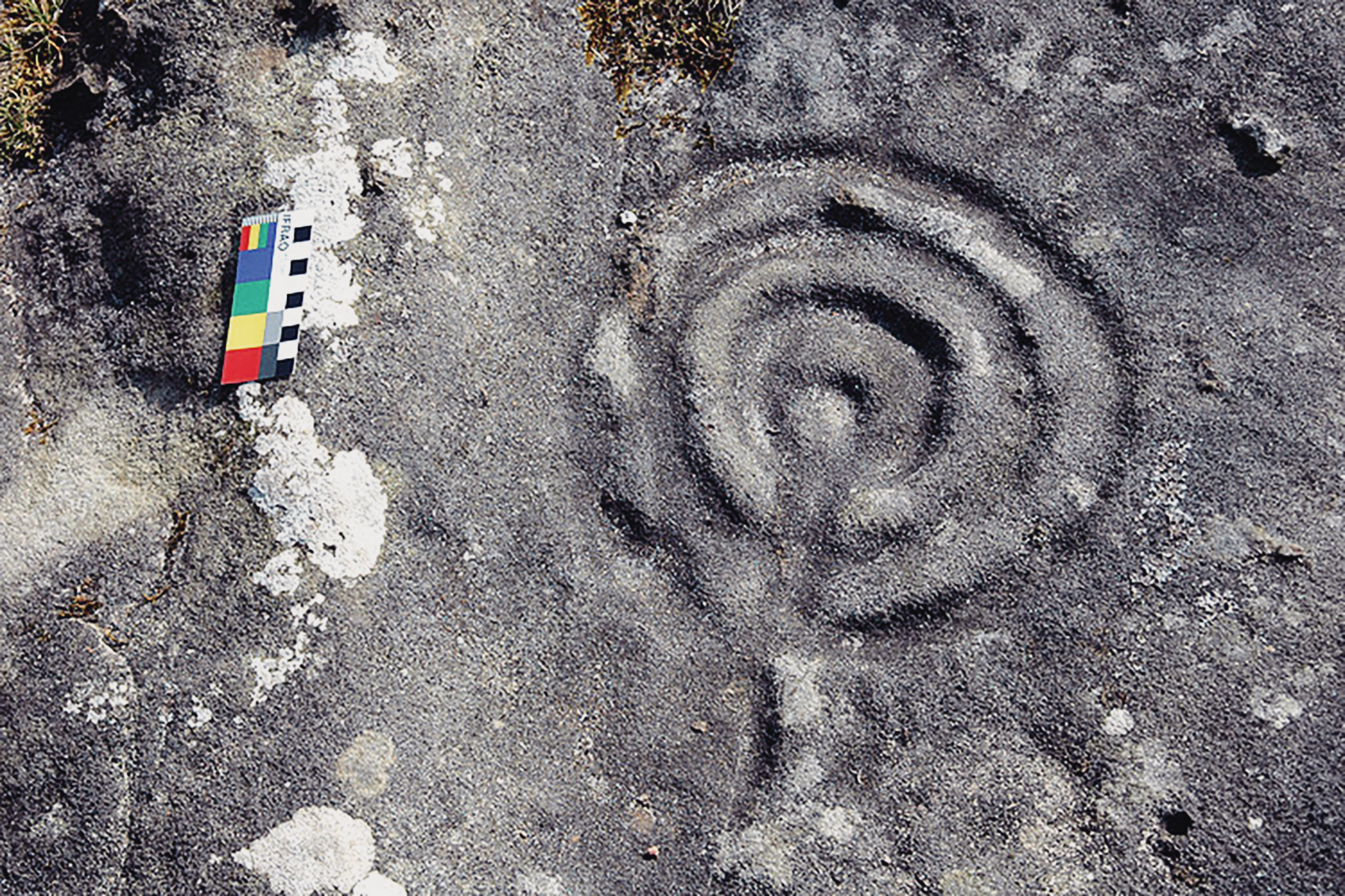
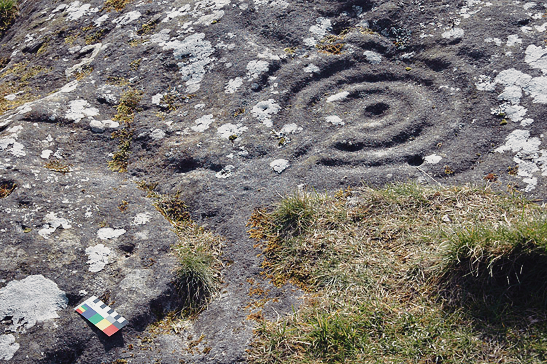
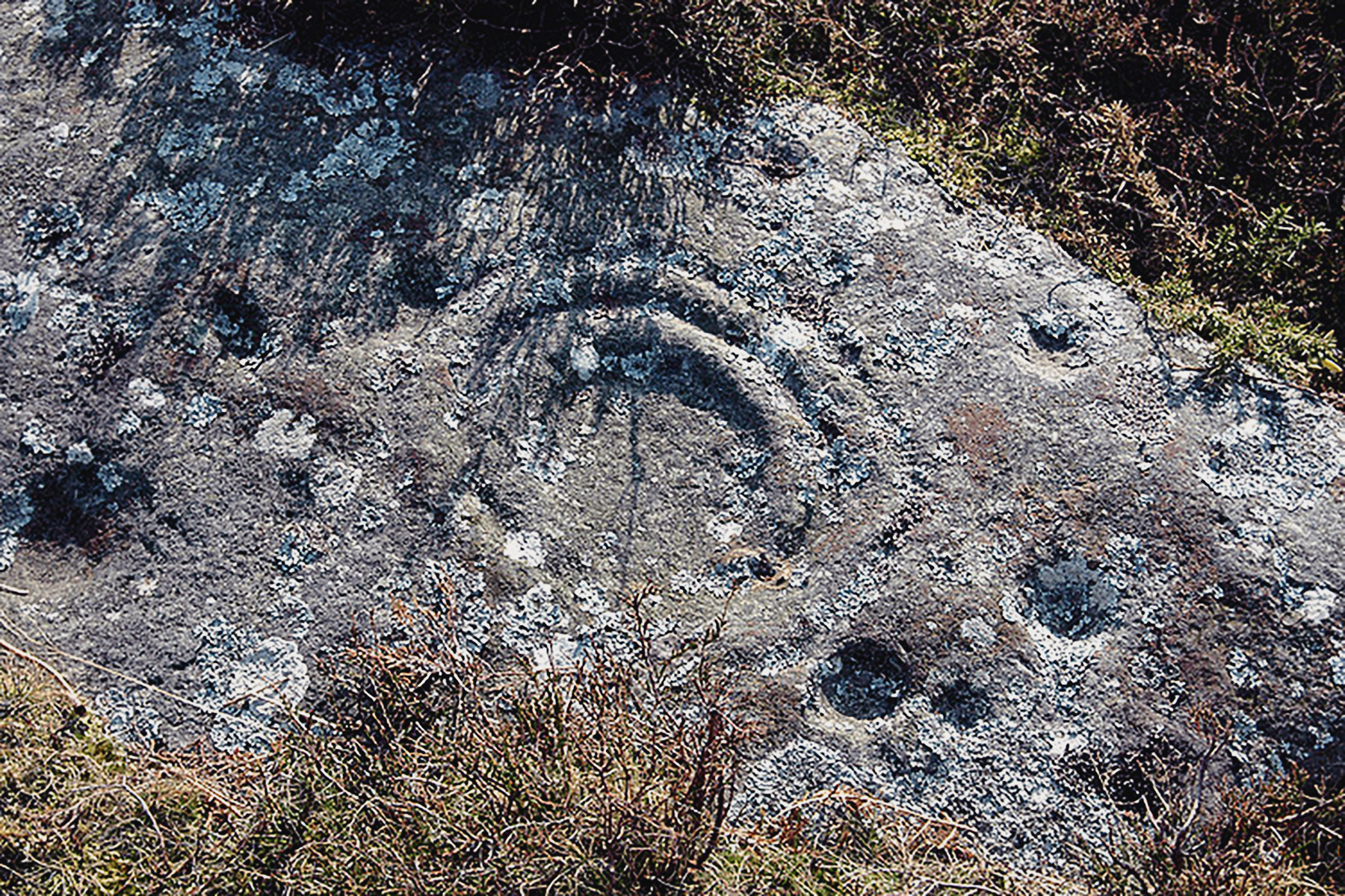
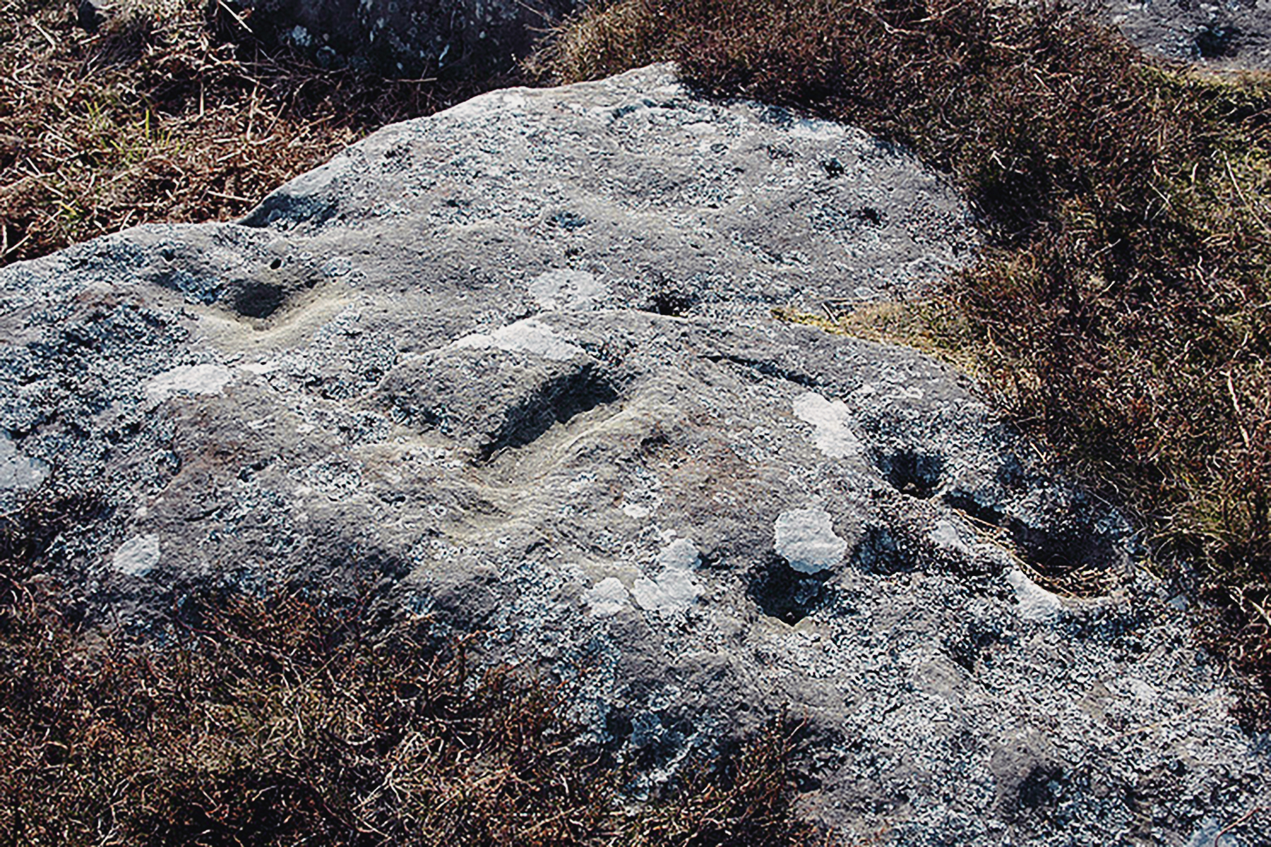
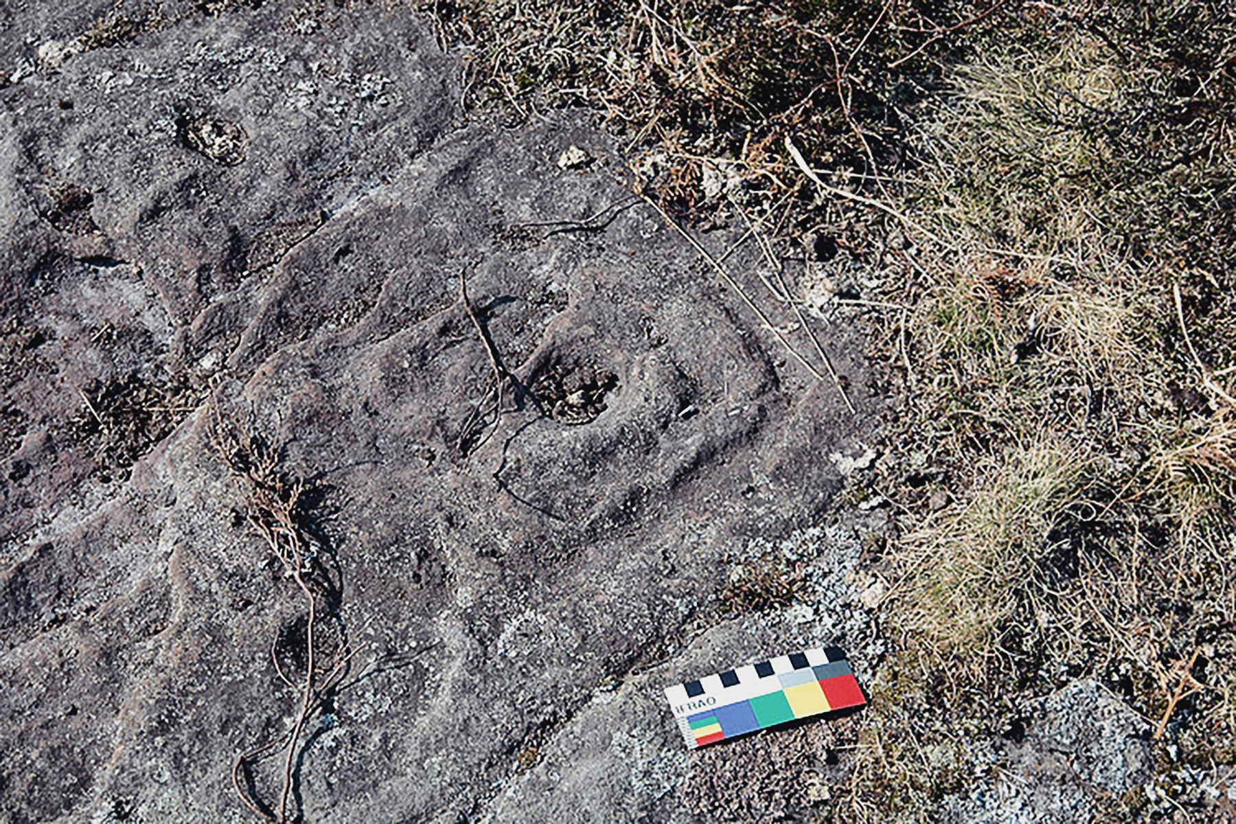
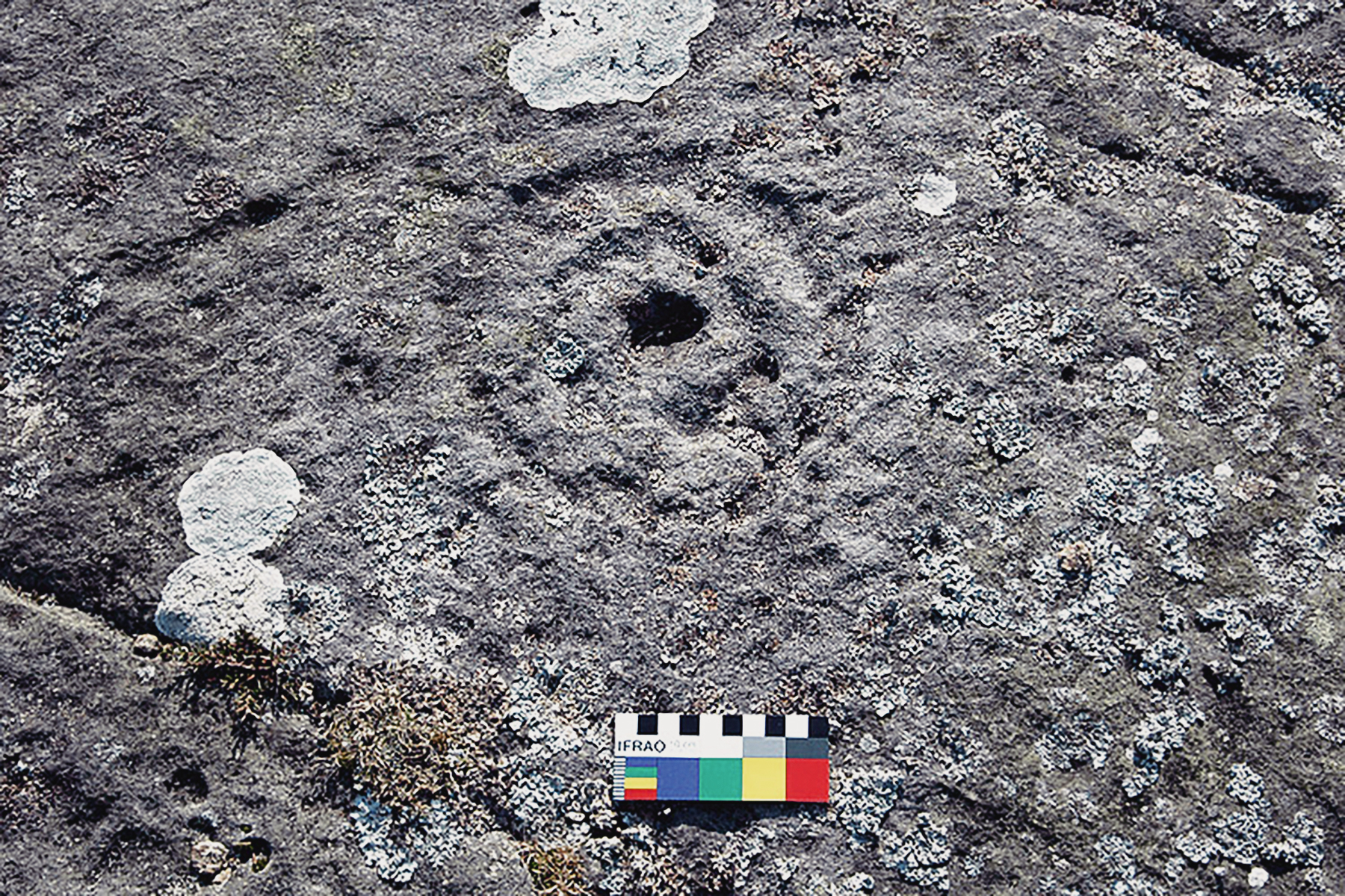
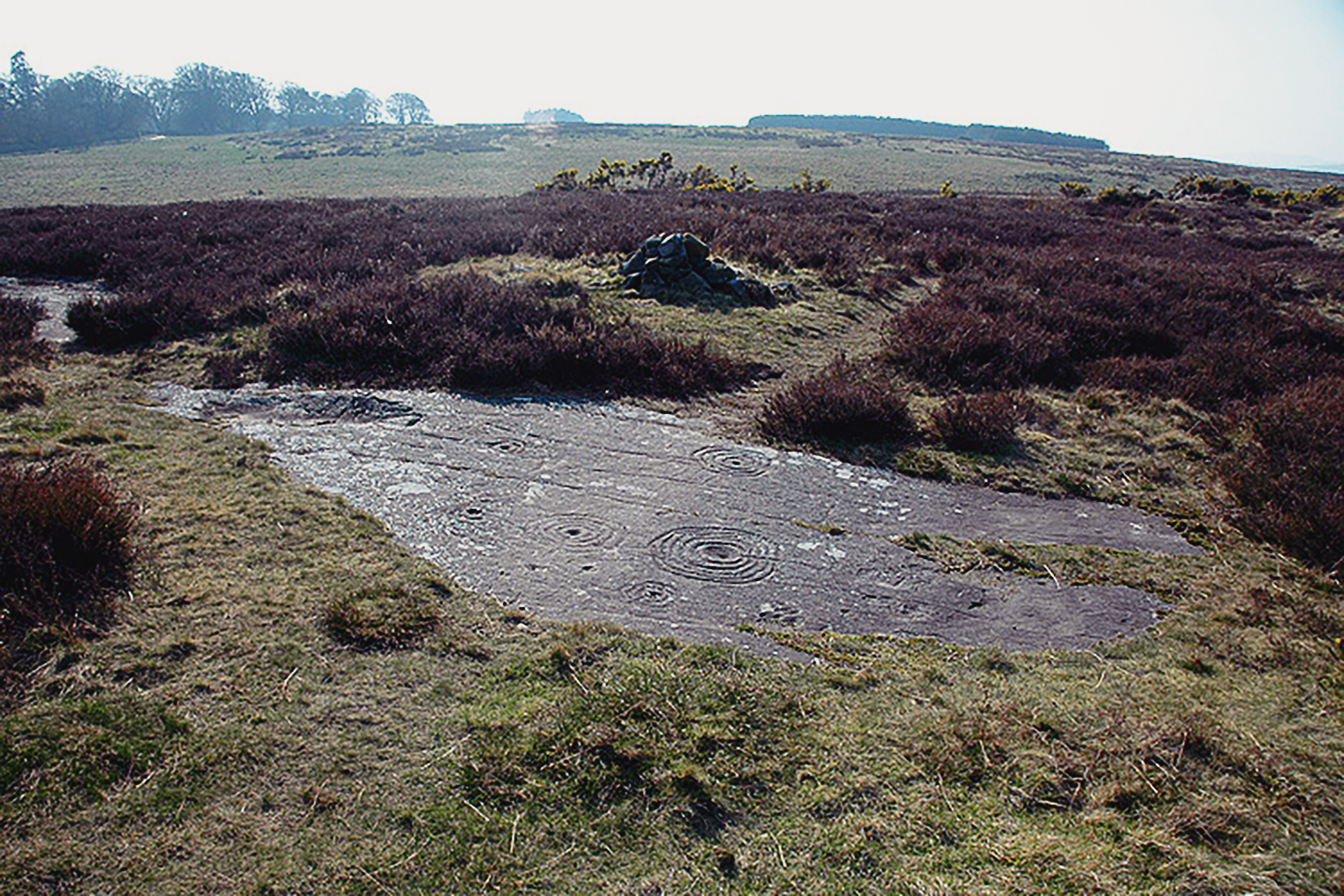
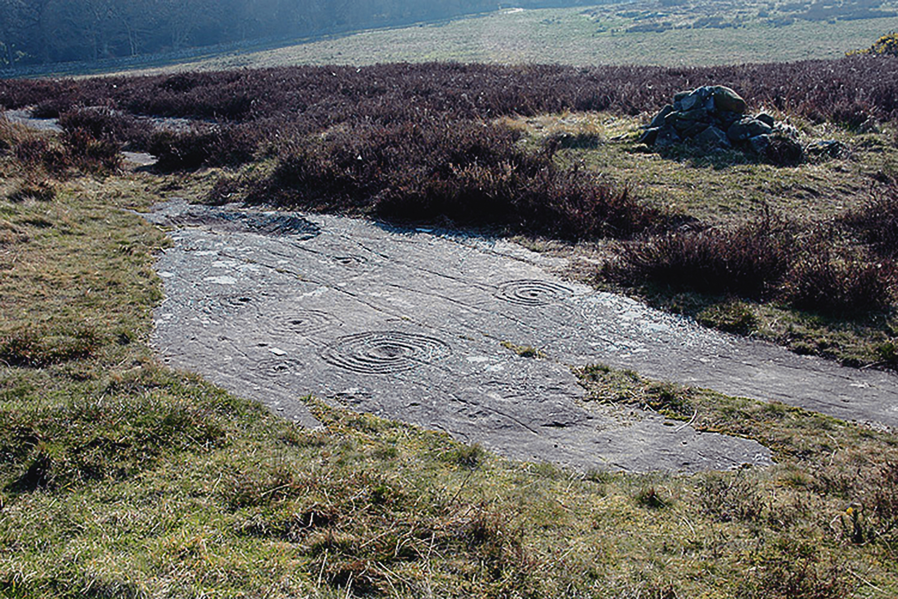
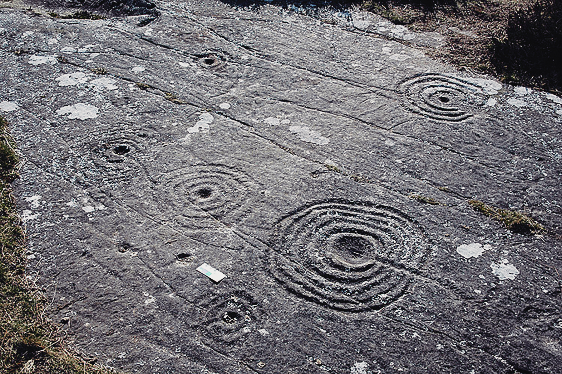
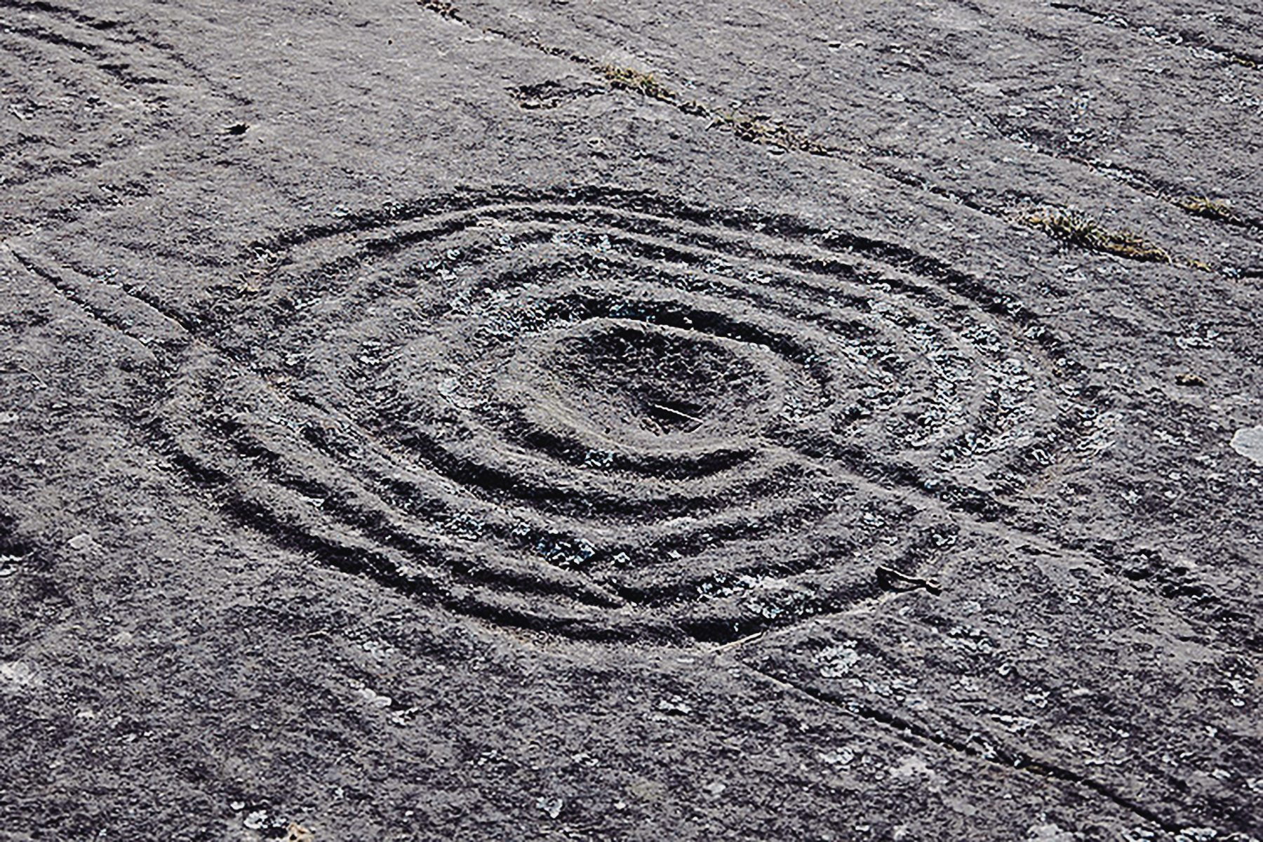
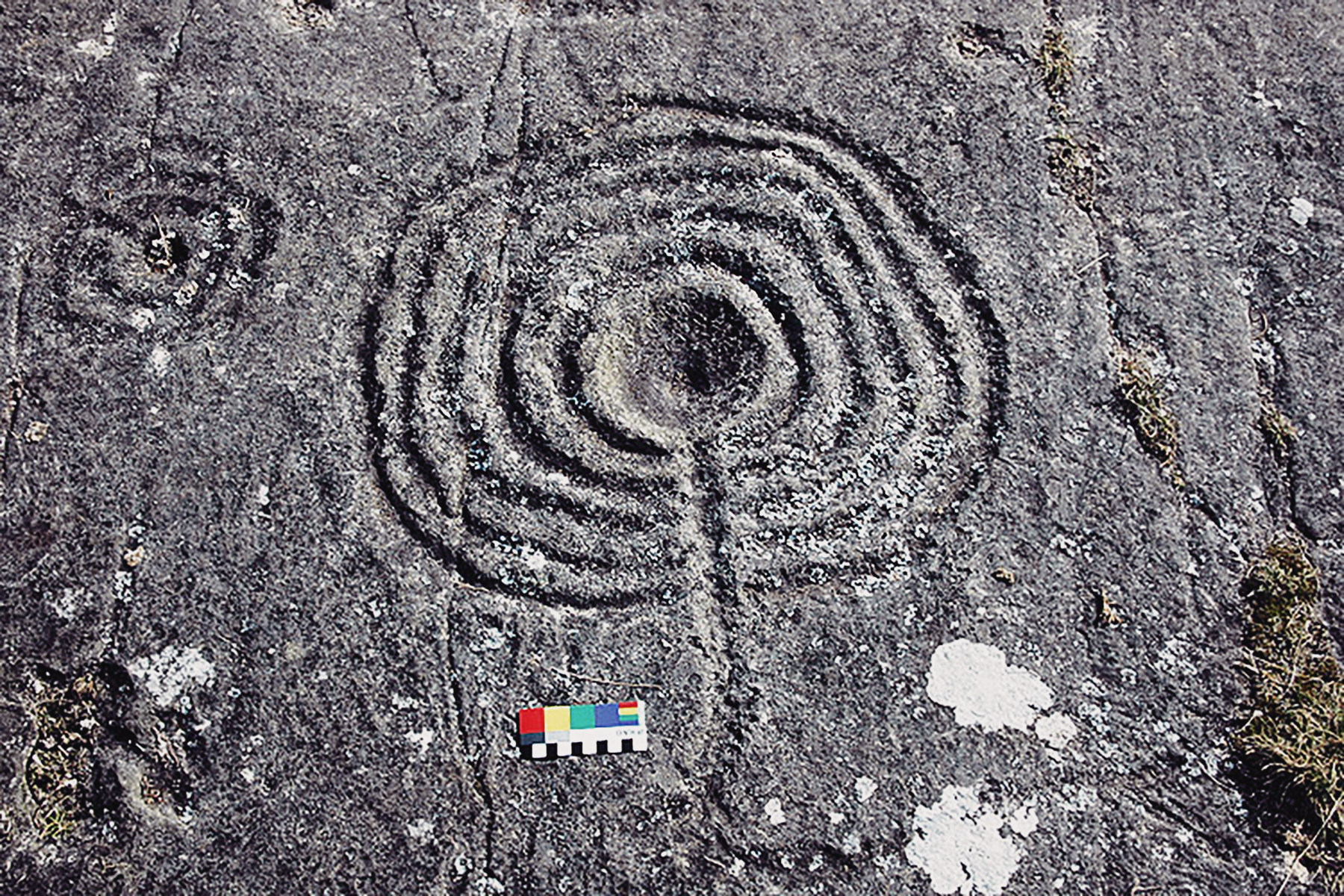
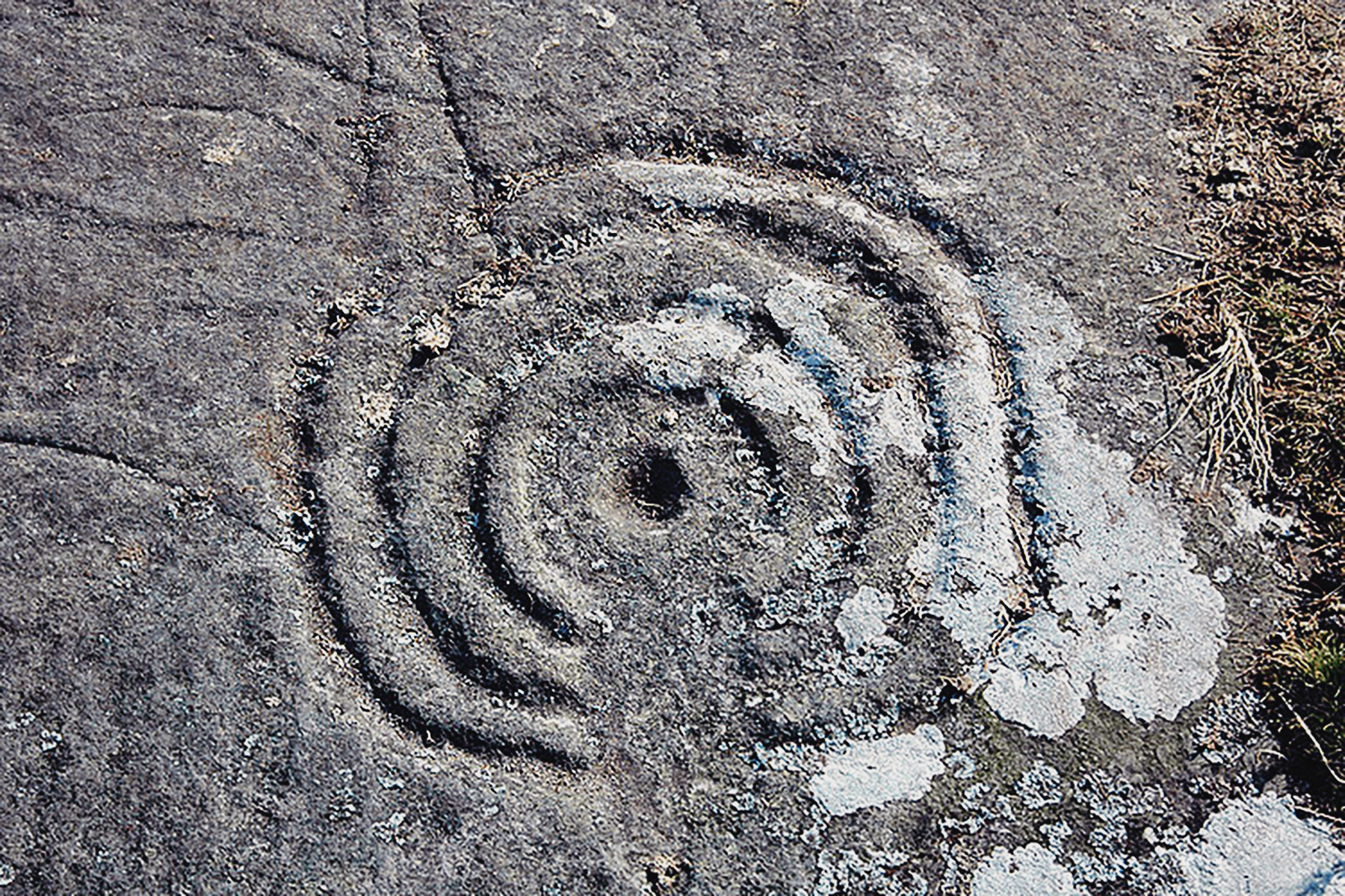
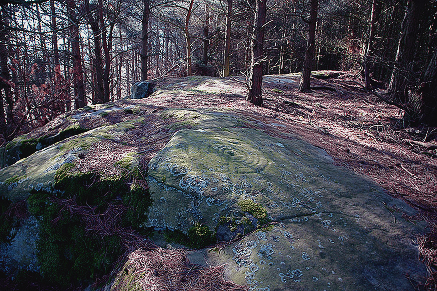
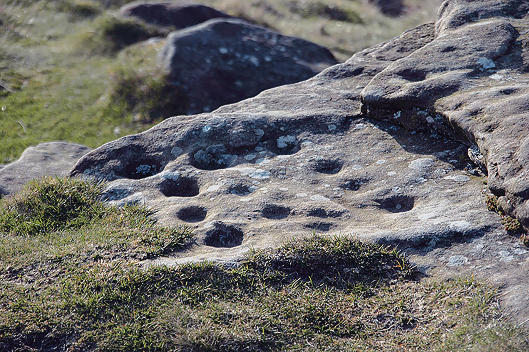
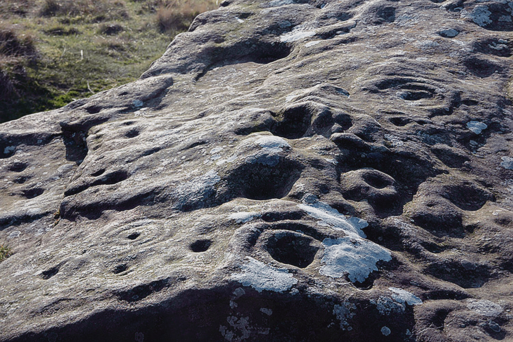
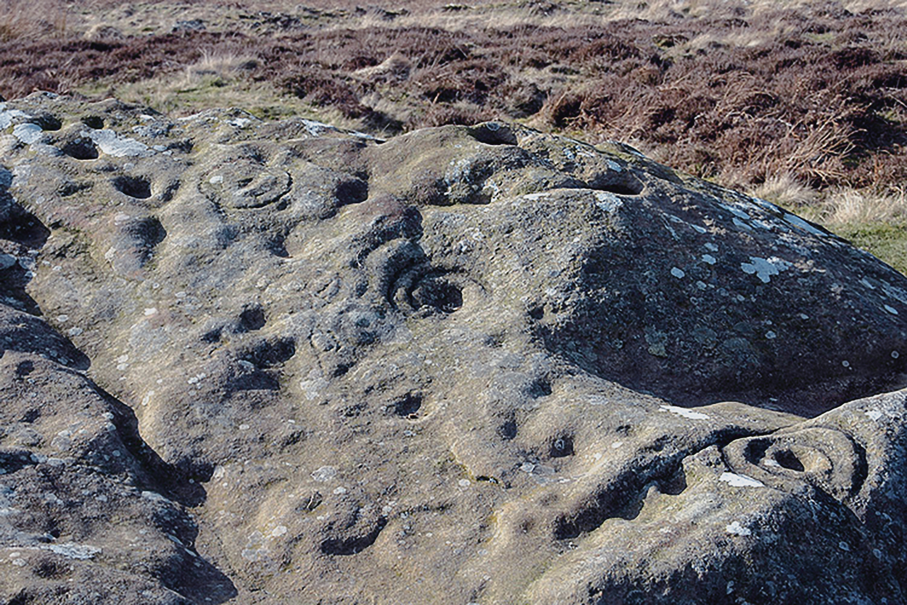
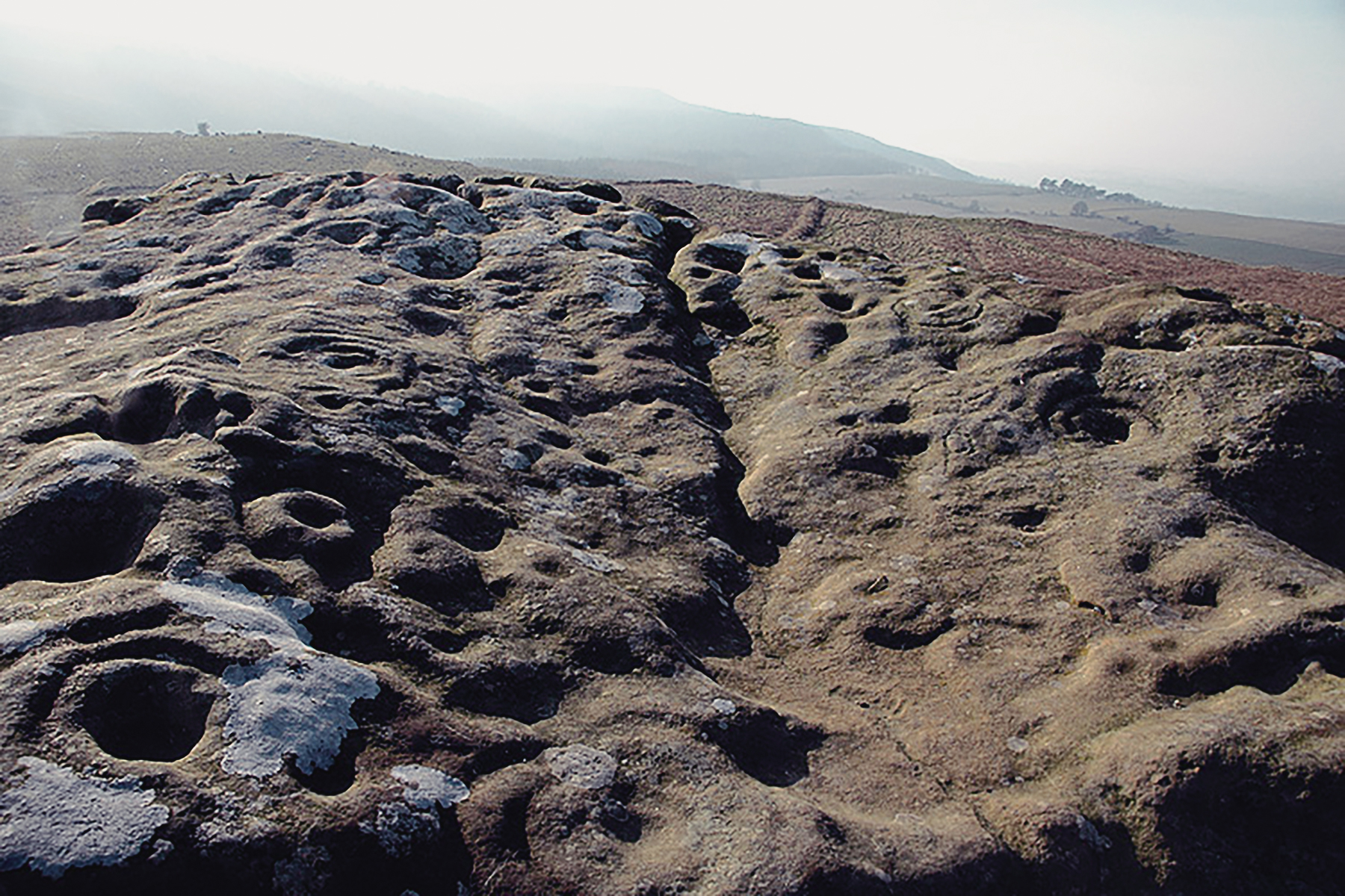
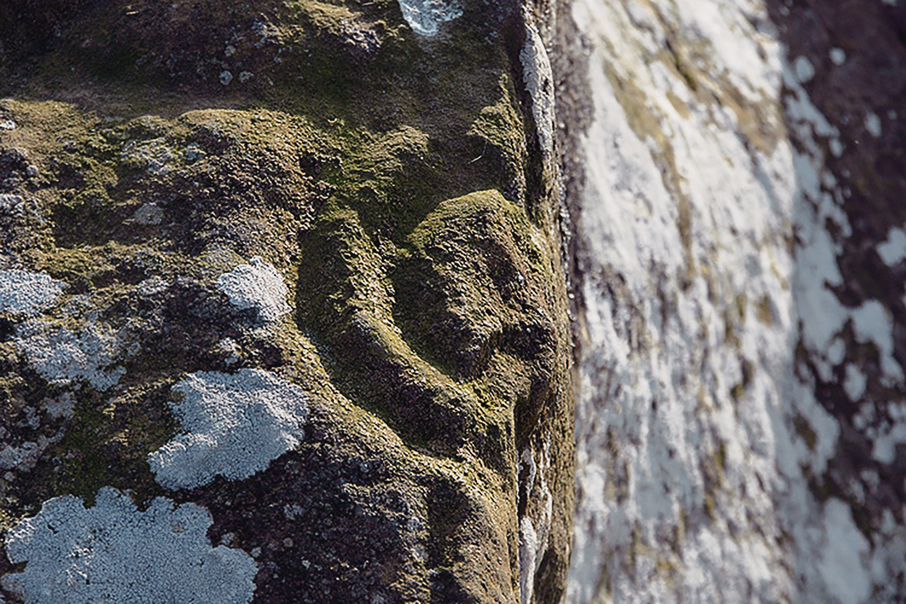
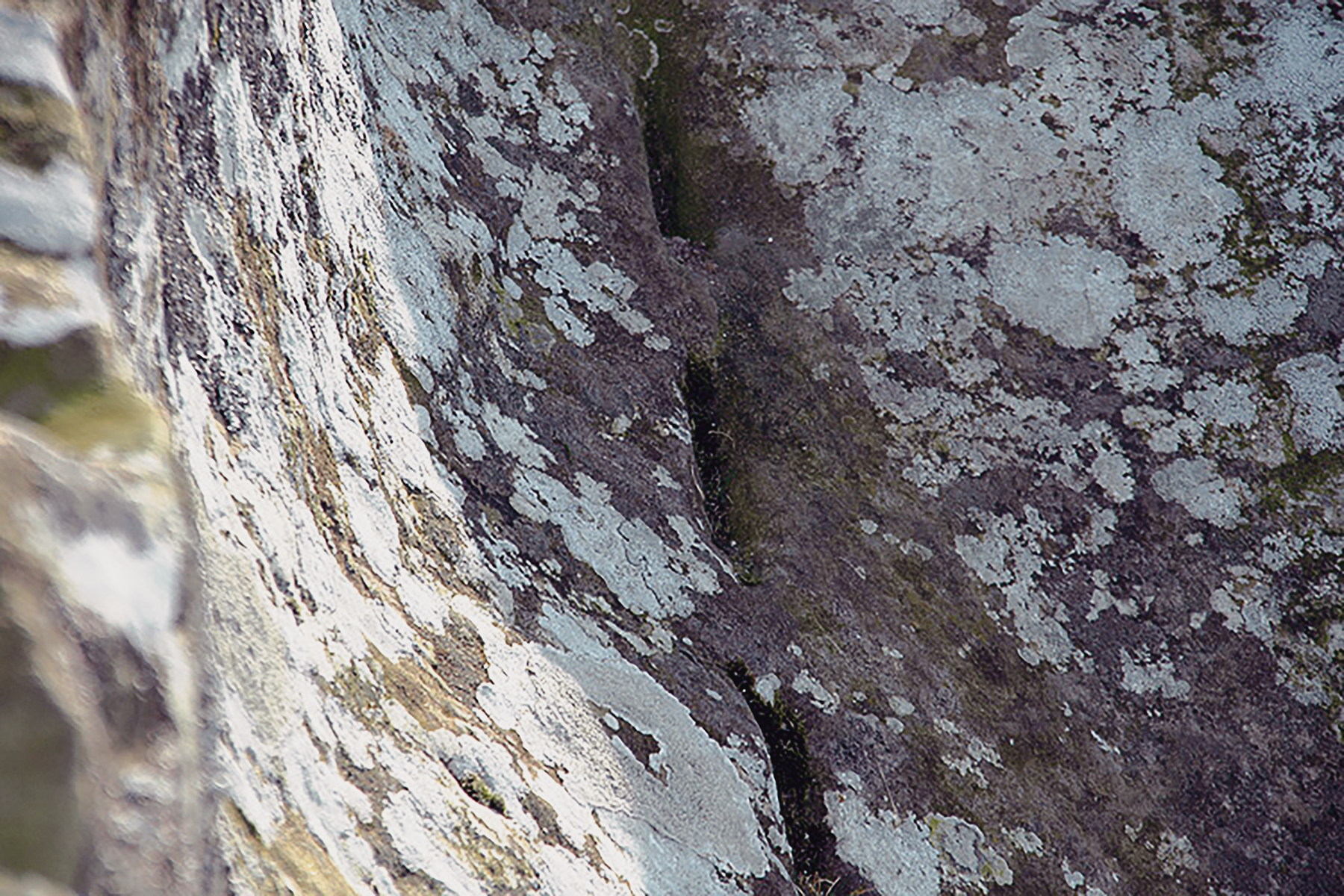
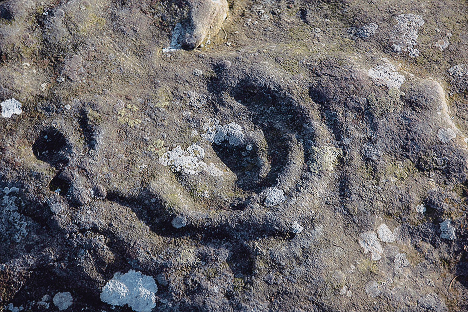
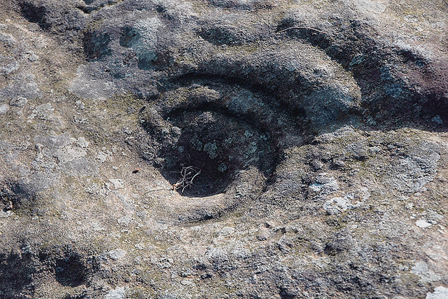
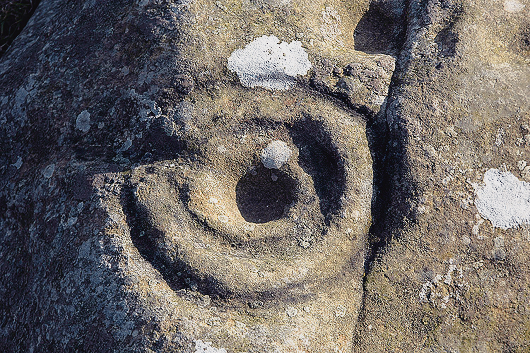
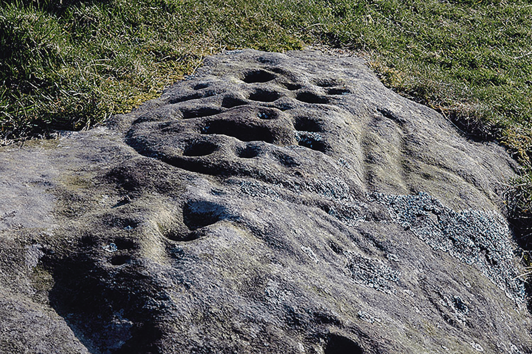
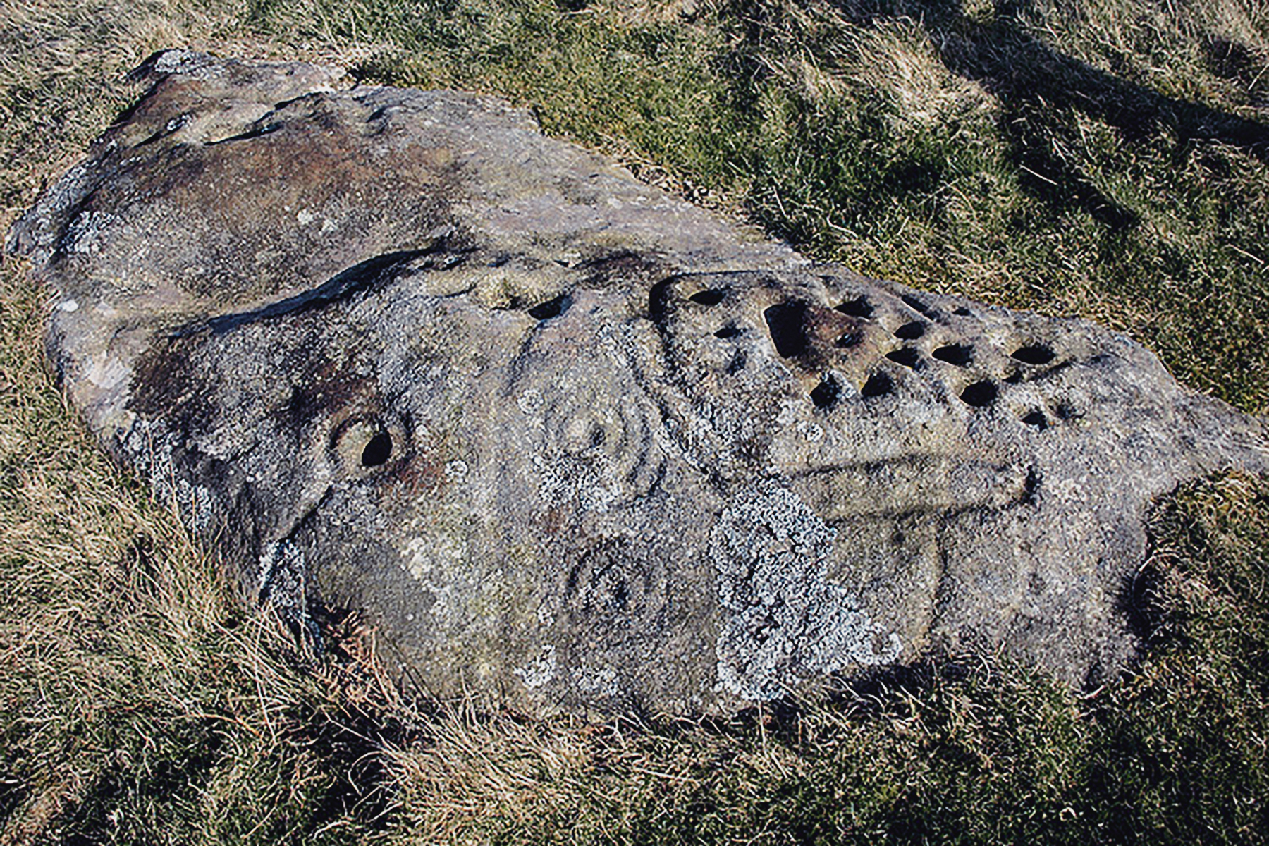
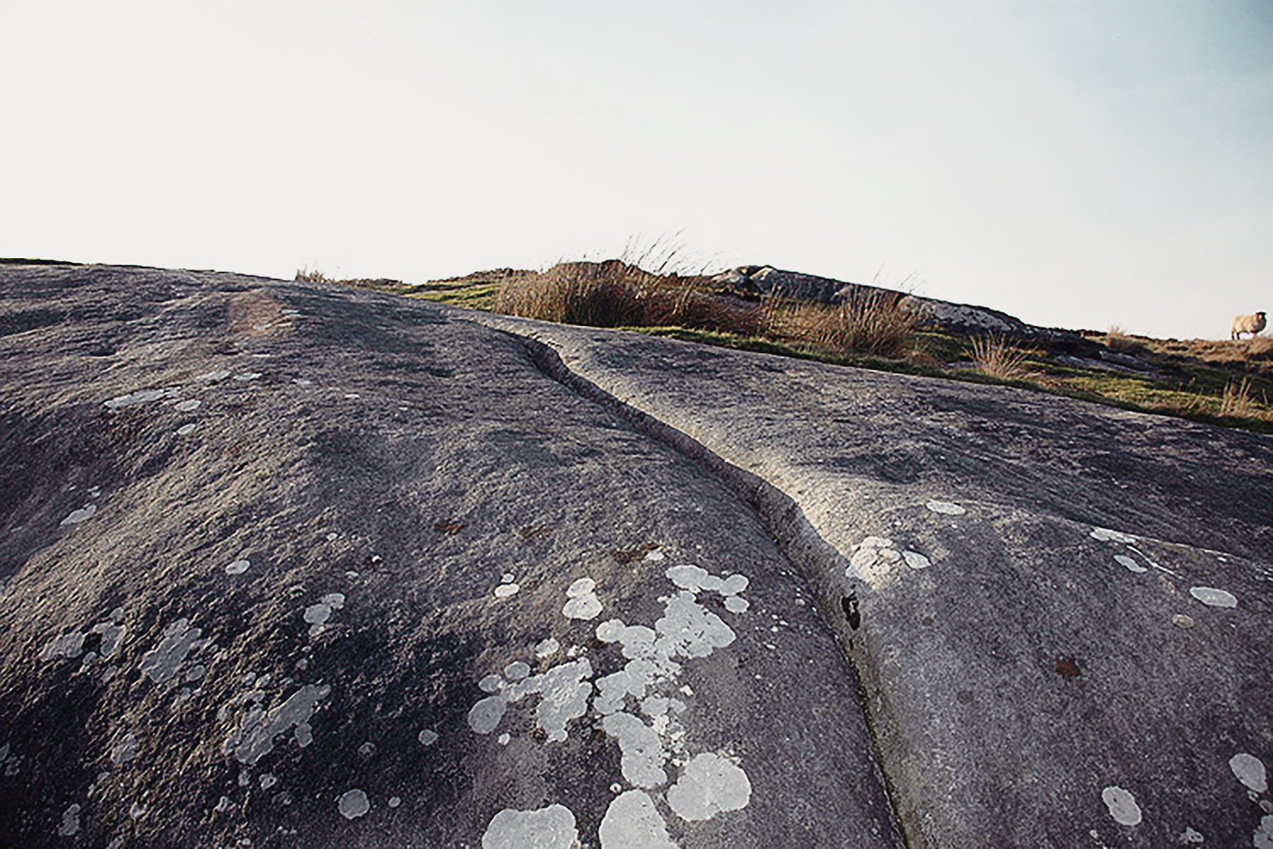
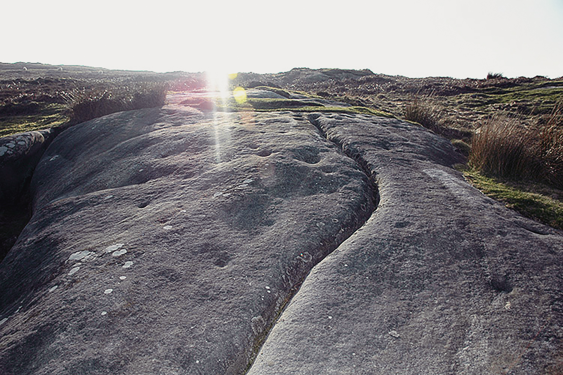
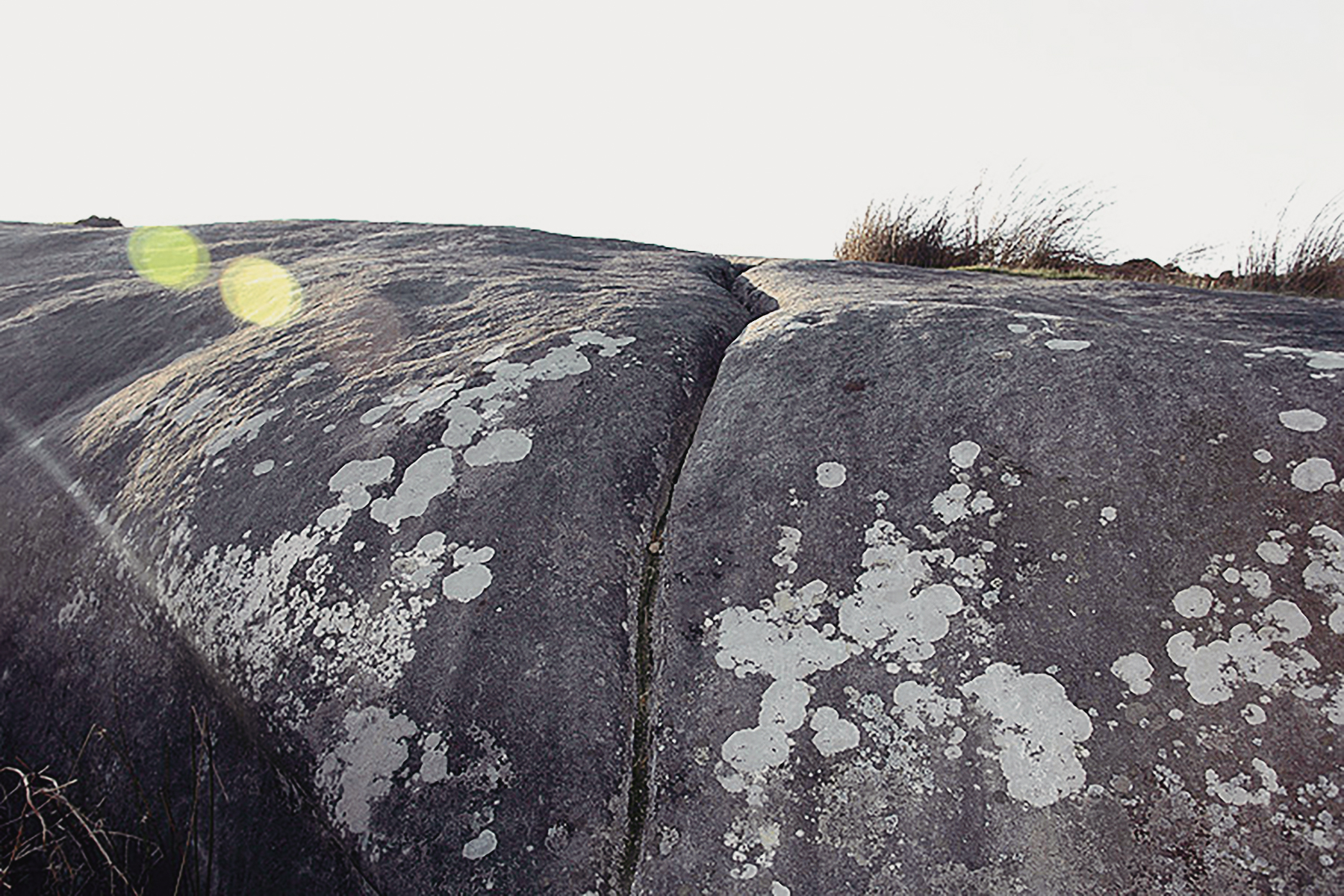
Northumberland rock art is abstract and mostly curvilinear. The carvers used a relatively small number of motifs to create designs that vary from the simple to the more complex, representing an artistic and symbolic tradition that lasted for millenia.

Motifs of the Rock Art Carvings

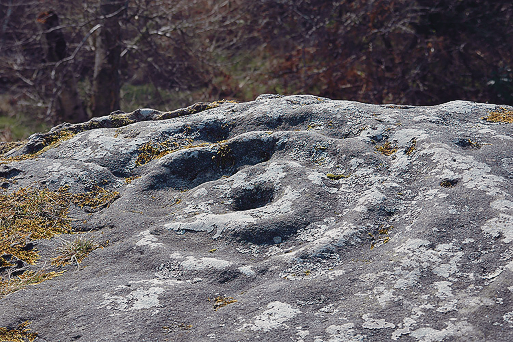
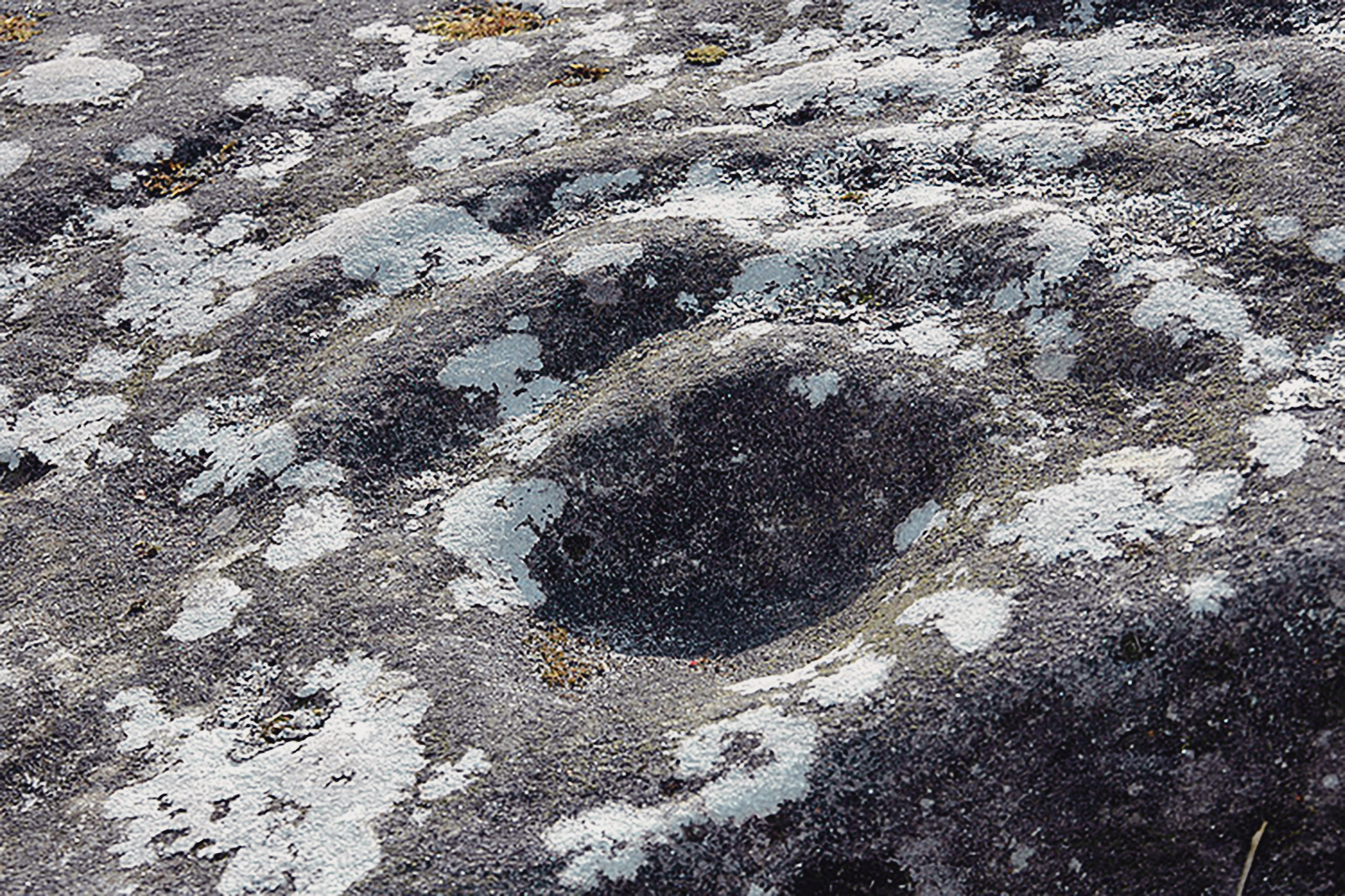
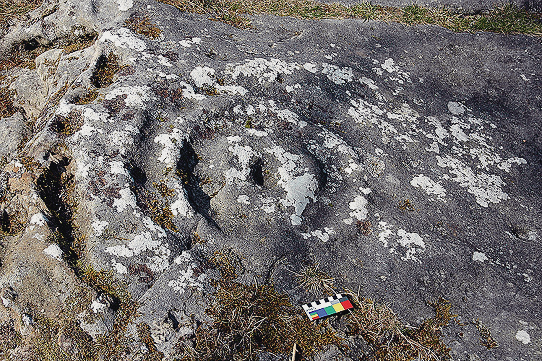
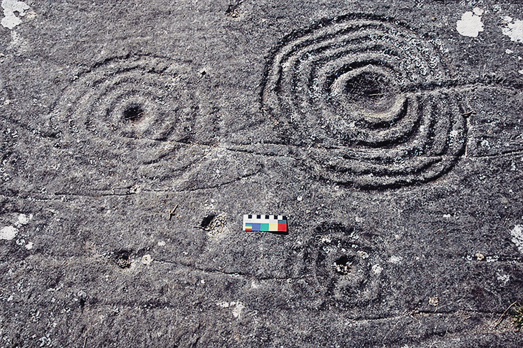
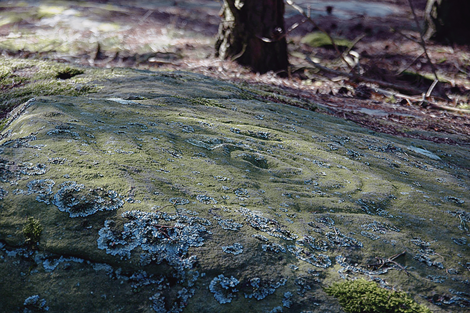
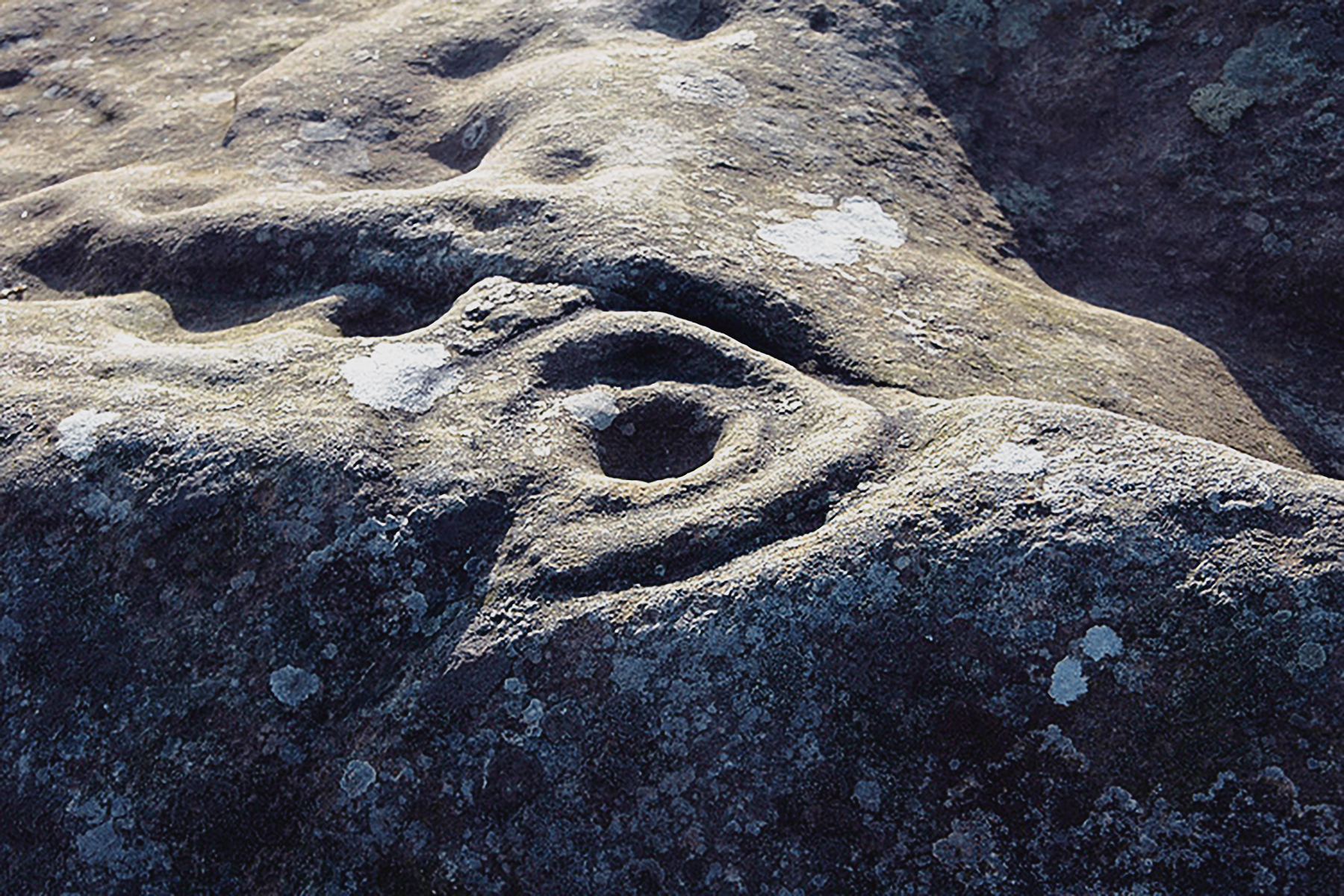
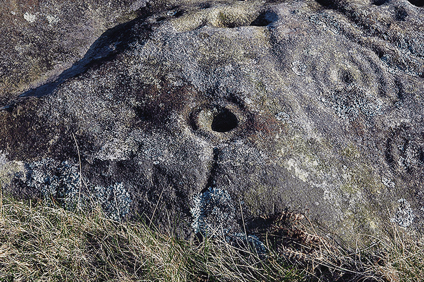
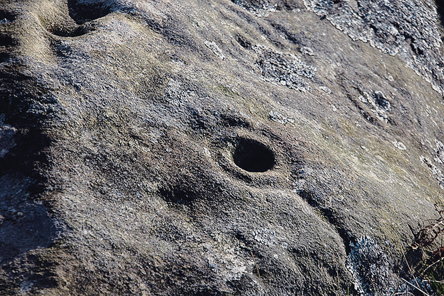
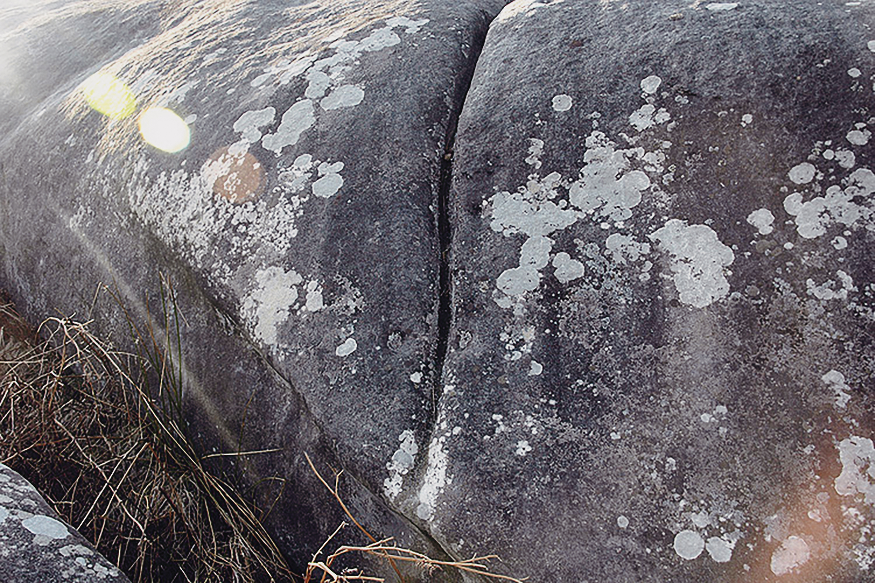
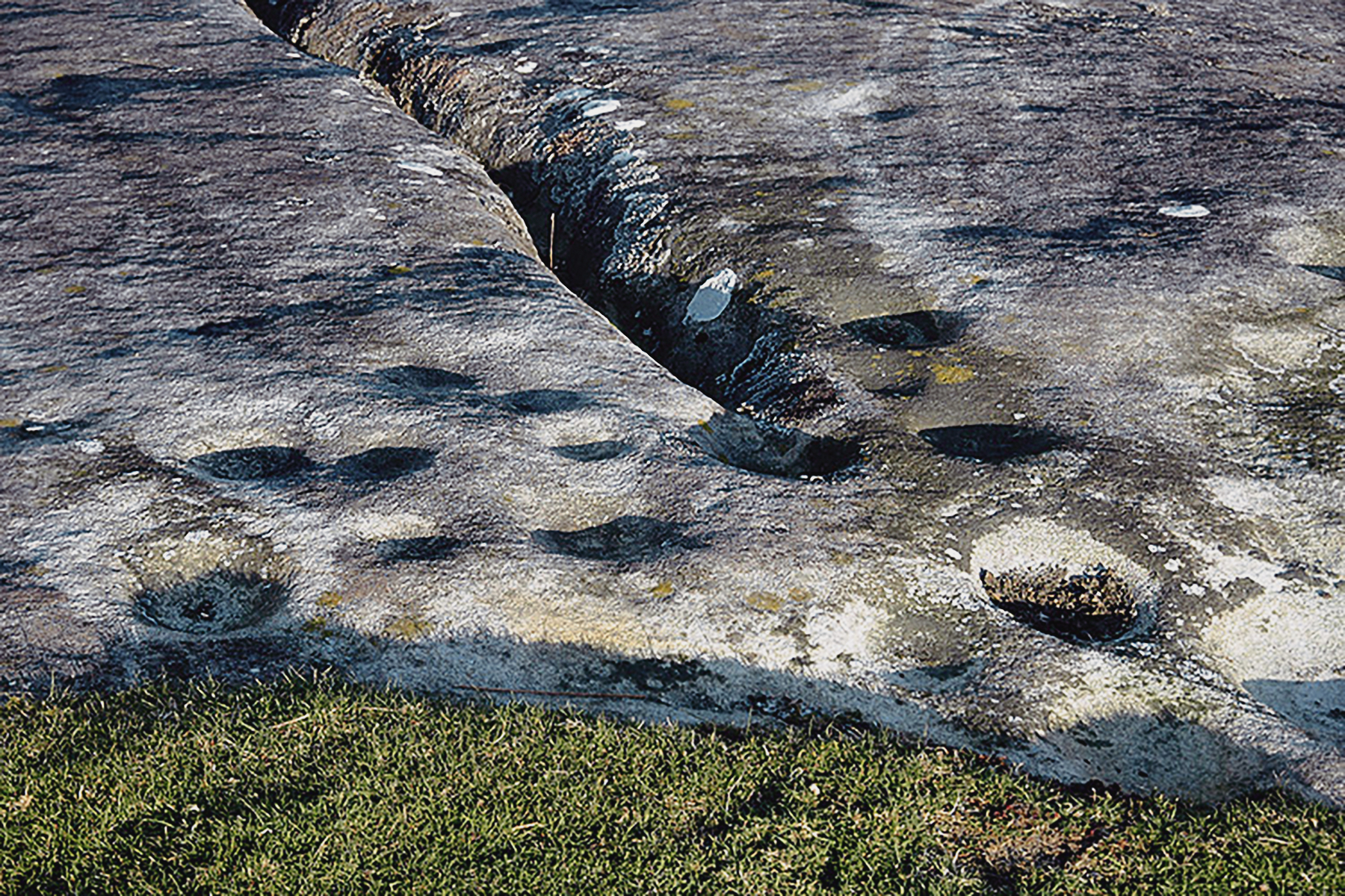
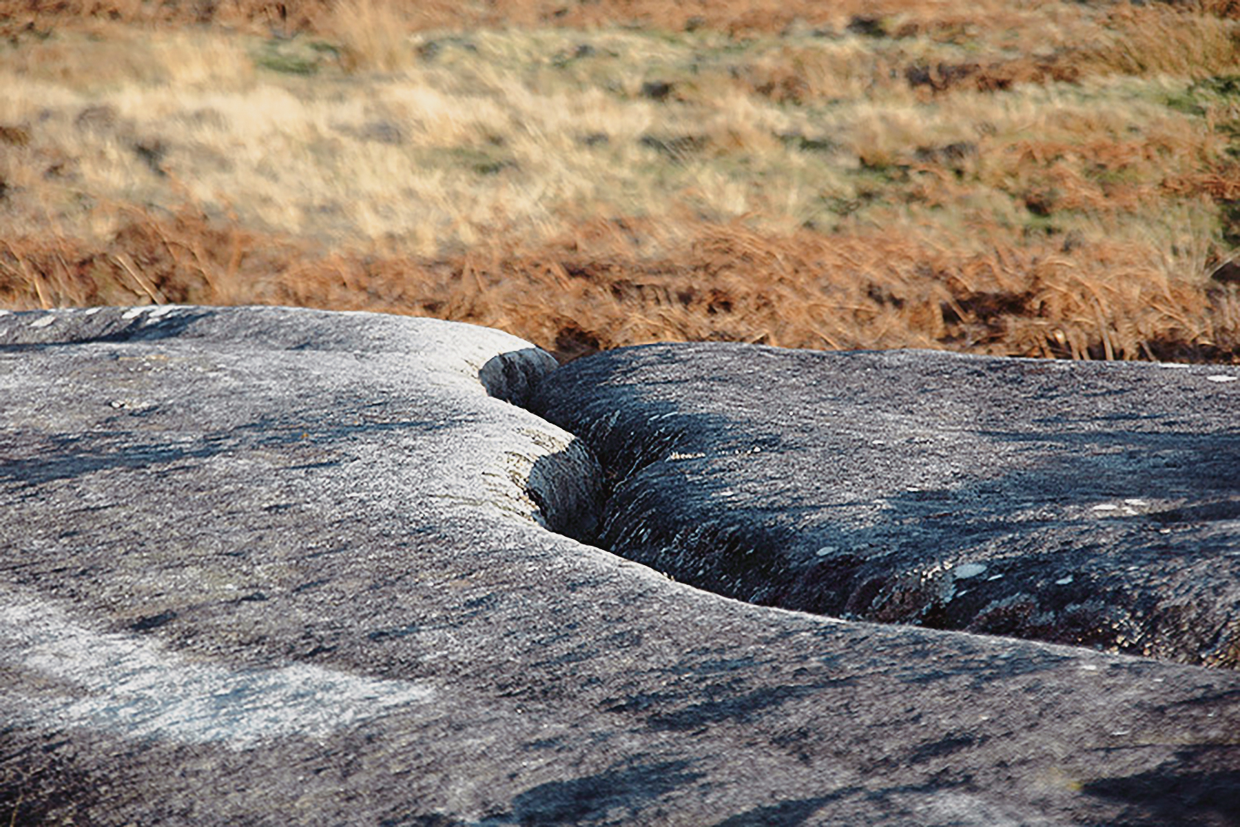
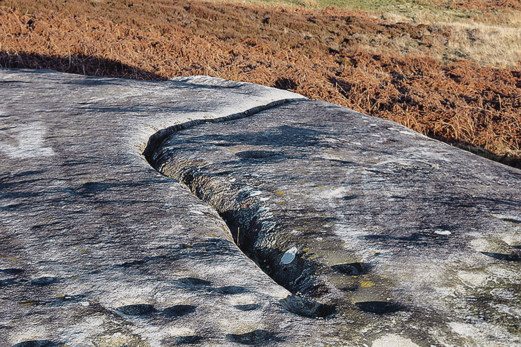
The principal element of Northumberland rock art is a cup - a circular, shallow, depression. These were carved either in isloation, or scattered, or in patterned groups which sometimes included grooves - grooved rings. Gapped circles - arcs and penannulars - were also carved. Grooves in the sandstone, sometimes originally natural but then enhanced with grinding, often link the panels, possibly to allow the flow of water.

Chronology of the Rock Art

Absolute dating of Northumberland rock art through scientific techniques, such as radiocarbon dating, is not possible. This means that the dating has to be done through associations made with archaeological material. It was once thought that the rock art of Northumberland was made during the Early Bronze Age, which dates to between 4000 and 3500 years ago. This perception was built up because of the discovery, in Northumberland (and elsewhere in the UK), during the nineteenth century of carved slabs in or near graves belonging to the Early Bronze Age. However, some of the carvings from Early Bronze Age cairns showed signs of erosion, suggesting that they had already been exposed for many years before being incorporated into burials. Researchers now believe the original phase of carvings on outcrops and boulders was made sometime in the early Neolithic - 6,000 to 5,200 years ago. This continued into the late Neolithic - 5,200 to 4,000 years ago. In the Early Bronze Age - 4,000 to 3,500 years ago - the carving tradition was associated with cairns and funerary monuments.

Method of creating the Rock Art Carvings

Gapped Circles Prehistoric open-air cup ring rock art  carvings from Northumberland Archaeology
Gapped Circles
© Bradshaw Foundation
Nearly all of the carvings were made on sandstone. 'The size of the 'picking' or 'pecking' shows that a variety of tools was used, some with a fine nail-like point and others with a broad chisel, with other varieties in between.' Beckensall (2001). This would require a harder rock, such as whinstone or andesite, either held in the hand or hit with a mallet. Although it is possible to use a sharp pointed piece of andesite held in the hand, it is more likely that a mallet was used to impact the tool against the rock. So far no definite tool has been found; the nearest we have come to it is at a recent Dod Law excavation, where the pick was found close to peck marks on rocks subsequently covered over by building in the Iron Age' (Beckensall 2001:13).

Interpreting the Rock Art Carvings

Initial ideas were that the carvings were an 'outward and visible sign or symbol of something related to the spiritual future of their departed.' In the 1990s, Richard Bradley proposed that there was a relationship between the complexity of carved designs and their position in the landscape - the more complex on higher ground; higher ground would not have supported year-round prehistoric occupation. Therefore, they may have played a role in the organisation of the landscape - paths and boundaries on the the margins of landscapes. This may have related to a changing relationship with the land and the natural world (Waddington 1998) - in the Early Neolithic, from being hunter-gatherers to pastoralists. He proposed that the carvings, which were inspired by patterns occurring in nature, acted to disguise the degree of cultural control that people were beginning to exert over the natural world. During the Early Bronze Age, as the emphasis of the art changed, Waddington believed the carvings represented the demise of the ancient symbolic system and a greater demonstration of the control over the landscape.

Roughting Linn
Northumberland Rock Art Carvings

Roughting Linn Northumberland Rock Art Carvings Archaeology Archaeology
Roughting Linn is named after a nearby small waterfall, the two elements being 'linn', a pool, and 'roughting', a bellowing noise. Roughting Linn is located near Kimmerston, Wooler.

Roughting Linn is a huge natural, whaleback shape of sandstone outcrop, an elongated domed ridge, 20m long and 12m wide, slightly higher than the land to the NW that flattens out before plunging into a gully formed by two small streams that join before flowing towards the Milfield Plain. It is the largest decorated rock in northern England, and perhaps the most famous.

Roughting Linn Northumberland Rock Art Carvings Archaeology Archaeology
The rock art is of the cup and ring type, quite deeply pecked in, especially on the circumference. This site also has a great variety of rock art motifs. Near the top of the dome slope are flower-like stems with heads made of a cup surrounded by a ring. Some of these grooves join each other, and some end in small cups. There are clusters of cups enclosed by grooves, interconnecting with other enclosed cups. There are, uniquely, nine radiates springing from the outer of two penannulars around a cup, itself connected to other figures. On the south east slope there are concentric inverted arcs, and a variation of the cup and ring theme is the use of parallel grooves, six in the case of two linked figures.

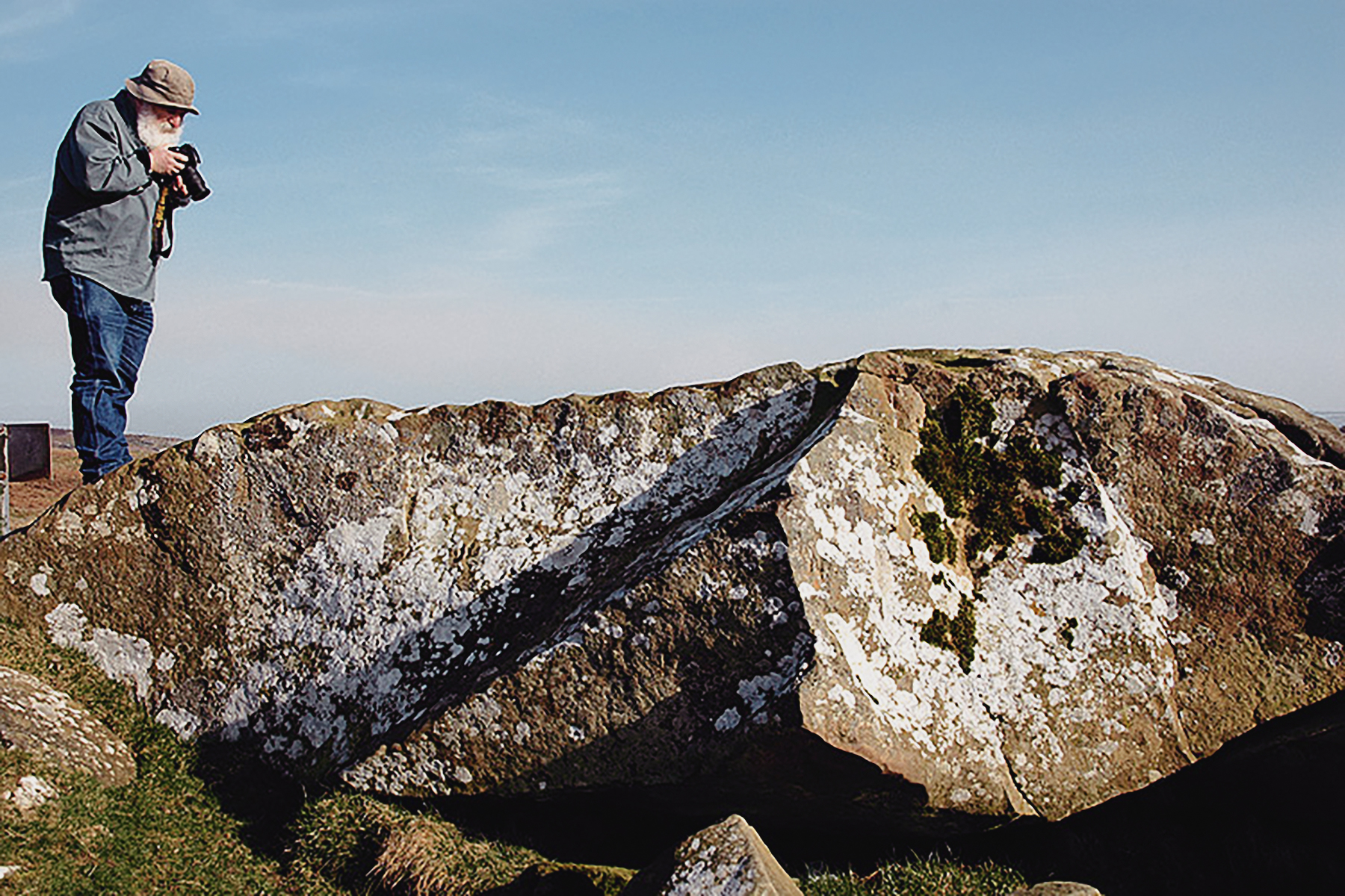
On the sunny morning that Aron and I visited this site, the journey from Newcastle University allowed Aron the chance to describe Roughting Linn and its rock art, as well as the sense of place that the decorated outcrop commands in this relatively remote part of Northumberland. Therefore it was of no surprise when we arrived to find the site 'occupied' by two delightful ladies of a most spiritual nature quietly enjoying this sense of place.

Roughting Linn Northumberland Rock Art Carvings Archaeology
Roughting Linn
© Bradshaw Foundation
 
Roughting Linn Northumberland Rock Art Carvings Archaeology
Roughting Linn
© Bradshaw Foundation
 
Roughting Linn Northumberland Rock Art Carvings Archaeology
Roughting Linn
© Bradshaw Foundation
 
Roughting Linn Northumberland Rock Art Carvings Archaeology
Roughting Linn
© Bradshaw Foundation
 
Roughting Linn Northumberland Rock Art Carvings Archaeology
Roughting Linn
© Bradshaw Foundation
 
Roughting Linn Northumberland Rock Art Carvings Archaeology
Roughting Linn
© Bradshaw Foundation
Roughting Linn Northumberland Rock Art Carvings Archaeology
Roughting Linn
© Bradshaw Foundation
 
Roughting Linn Northumberland Rock Art Carvings Archaeology
Roughting Linn
© Bradshaw Foundation
 
Roughting Linn Northumberland Rock Art Carvings Archaeology
Roughting Linn
© Bradshaw Foundation
 
Roughting Linn Northumberland Rock Art Carvings Archaeology
Roughting Linn
© Bradshaw Foundation
 
Roughting Linn Northumberland Rock Art Carvings Archaeology
Roughting Linn
© Bradshaw Foundation
 
Roughting Linn Northumberland Rock Art Carvings Archaeology
Roughting Linn
© Bradshaw Foundation
Roughting Linn Northumberland Rock Art Carvings Archaeology
Roughting Linn
© Bradshaw Foundation
 
Roughting Linn Northumberland Rock Art Carvings Archaeology
Roughting Linn
© Bradshaw Foundation
 
Roughting Linn Northumberland Rock Art Carvings Archaeology
Roughting Linn
© Bradshaw Foundation
 
Roughting Linn Northumberland Rock Art Carvings Archaeology
Roughting Linn
© Bradshaw Foundation
 
Roughting Linn Northumberland Rock Art Carvings Archaeology
Roughting Linn
© Bradshaw Foundation
 
Roughting Linn Northumberland Rock Art Carvings Archaeology
Roughting Linn
© Bradshaw Foundation
Weetwood Moor
Northumberland Rock Art Carvings

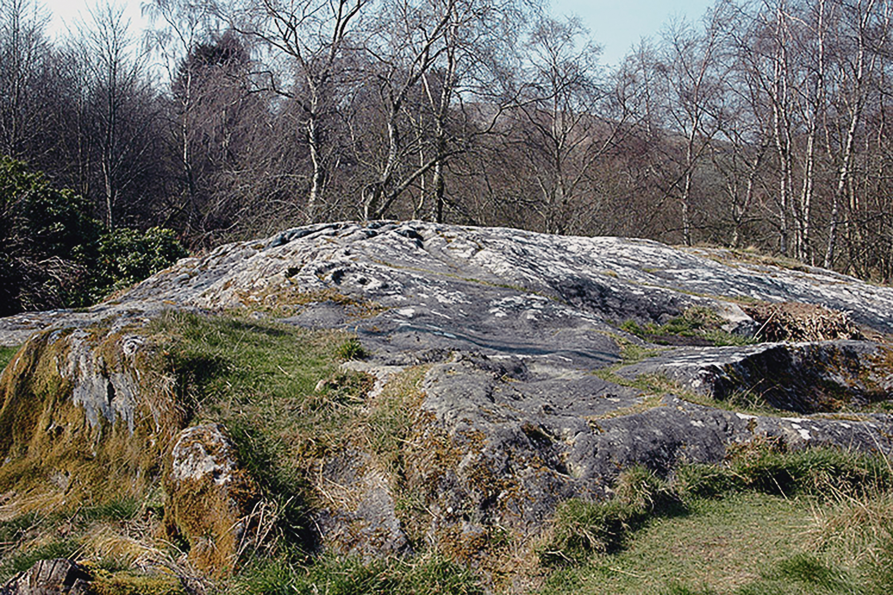
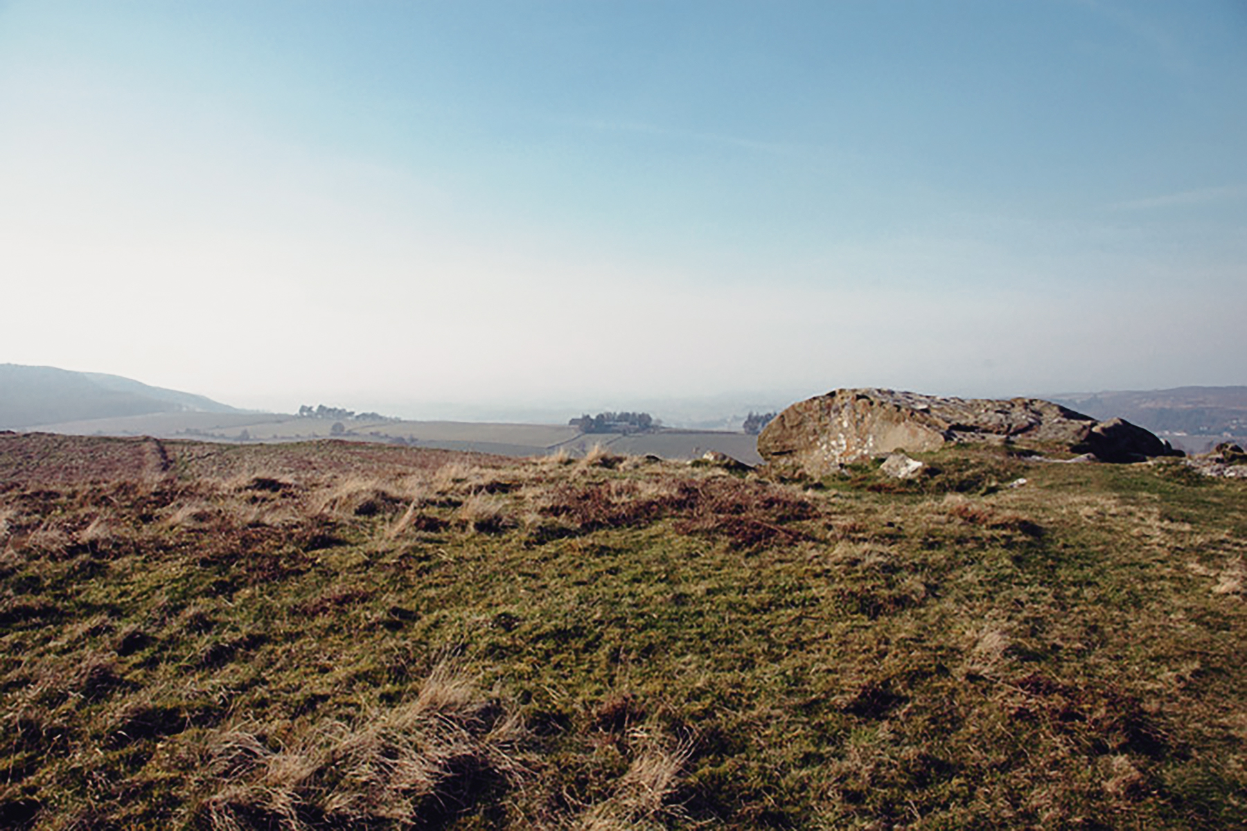
The name Weetwood means, the 'wet wood'. Weetwood Moor is located near Weetwood Hall, Wooler.

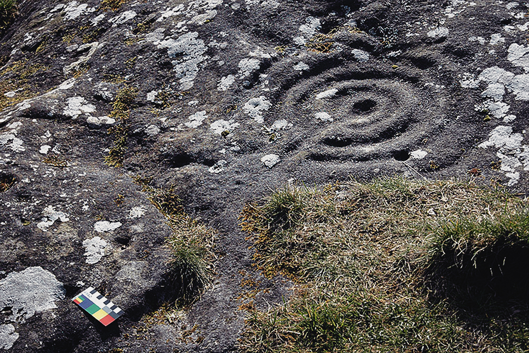
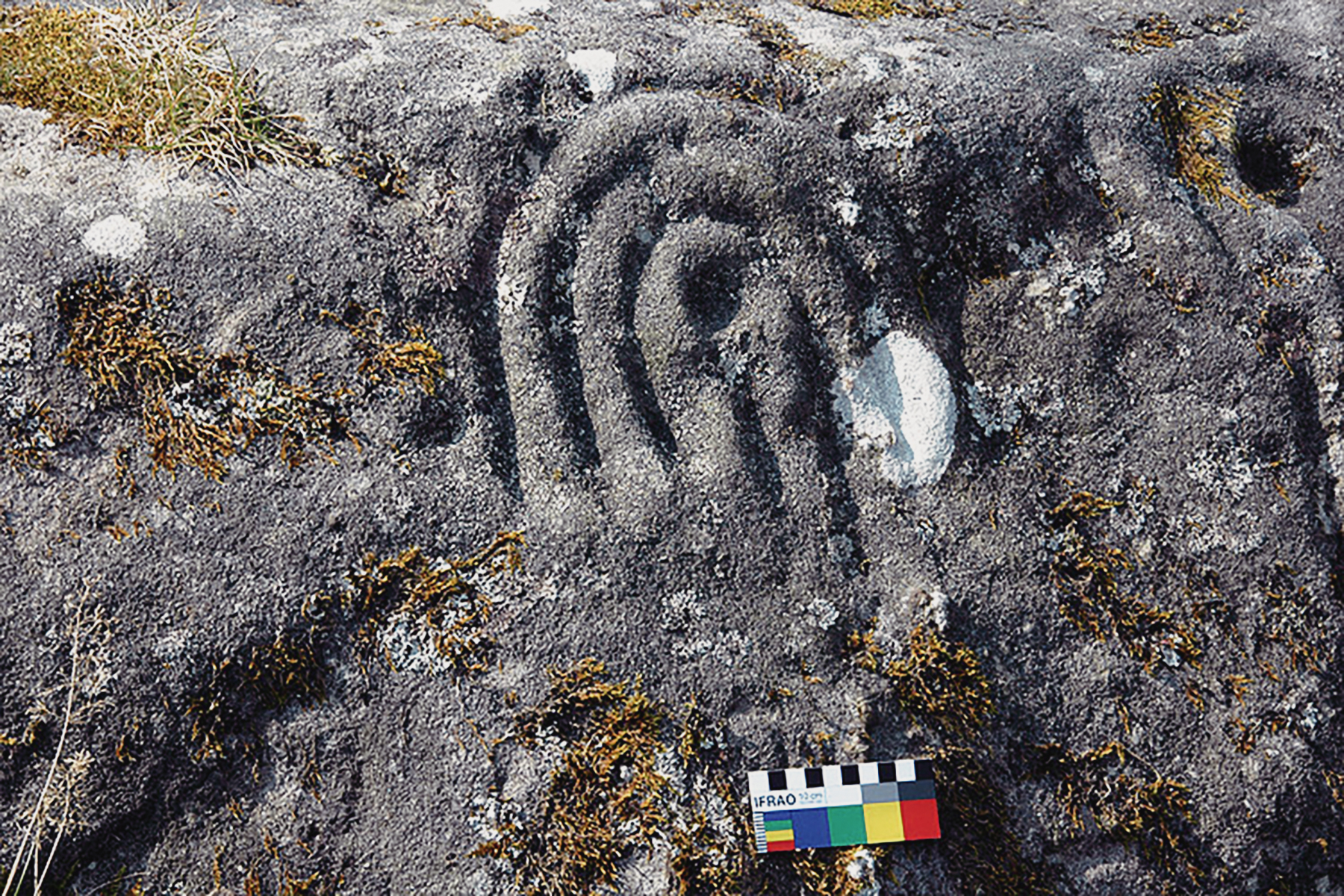
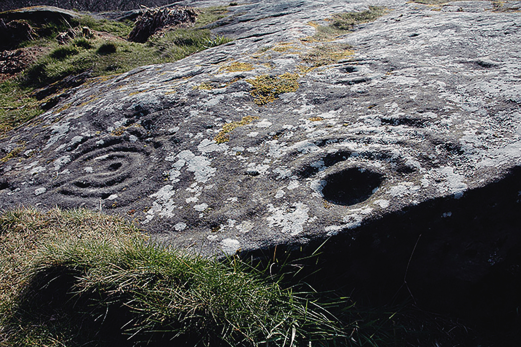
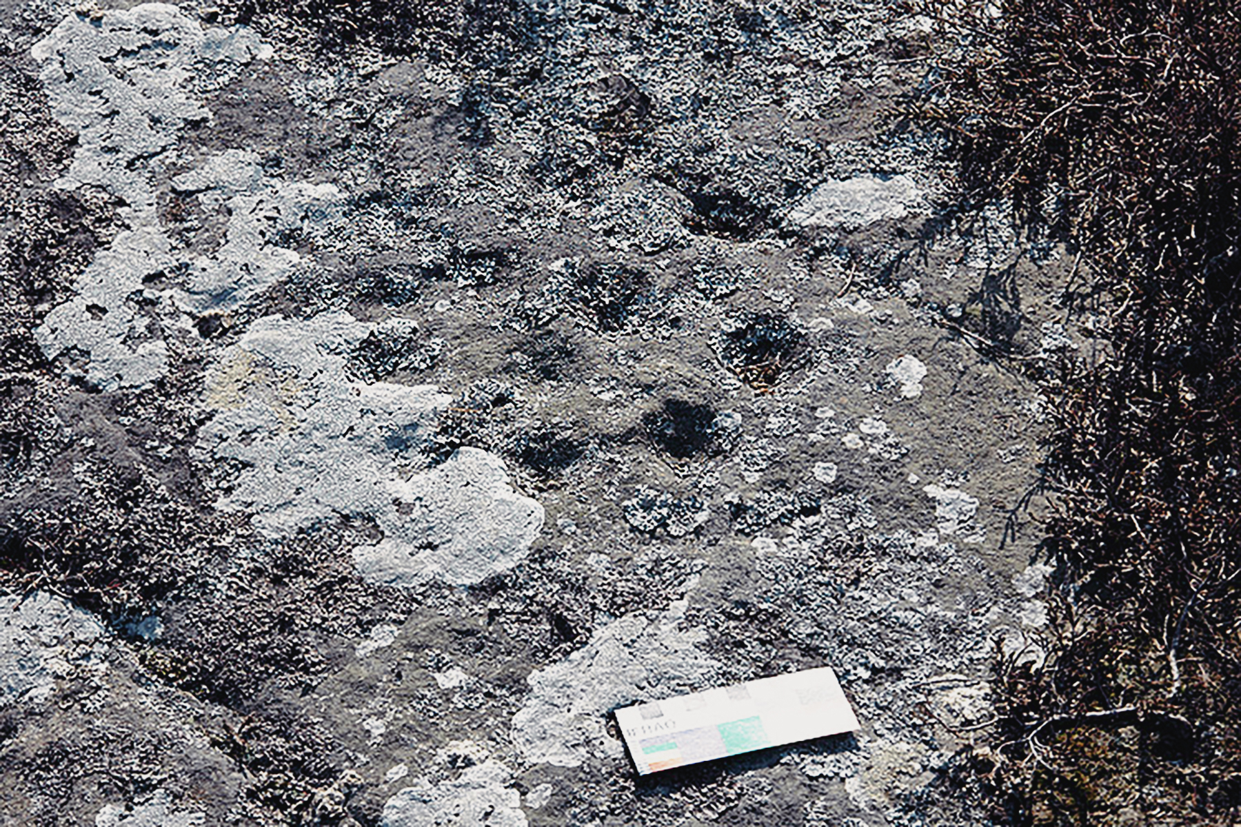
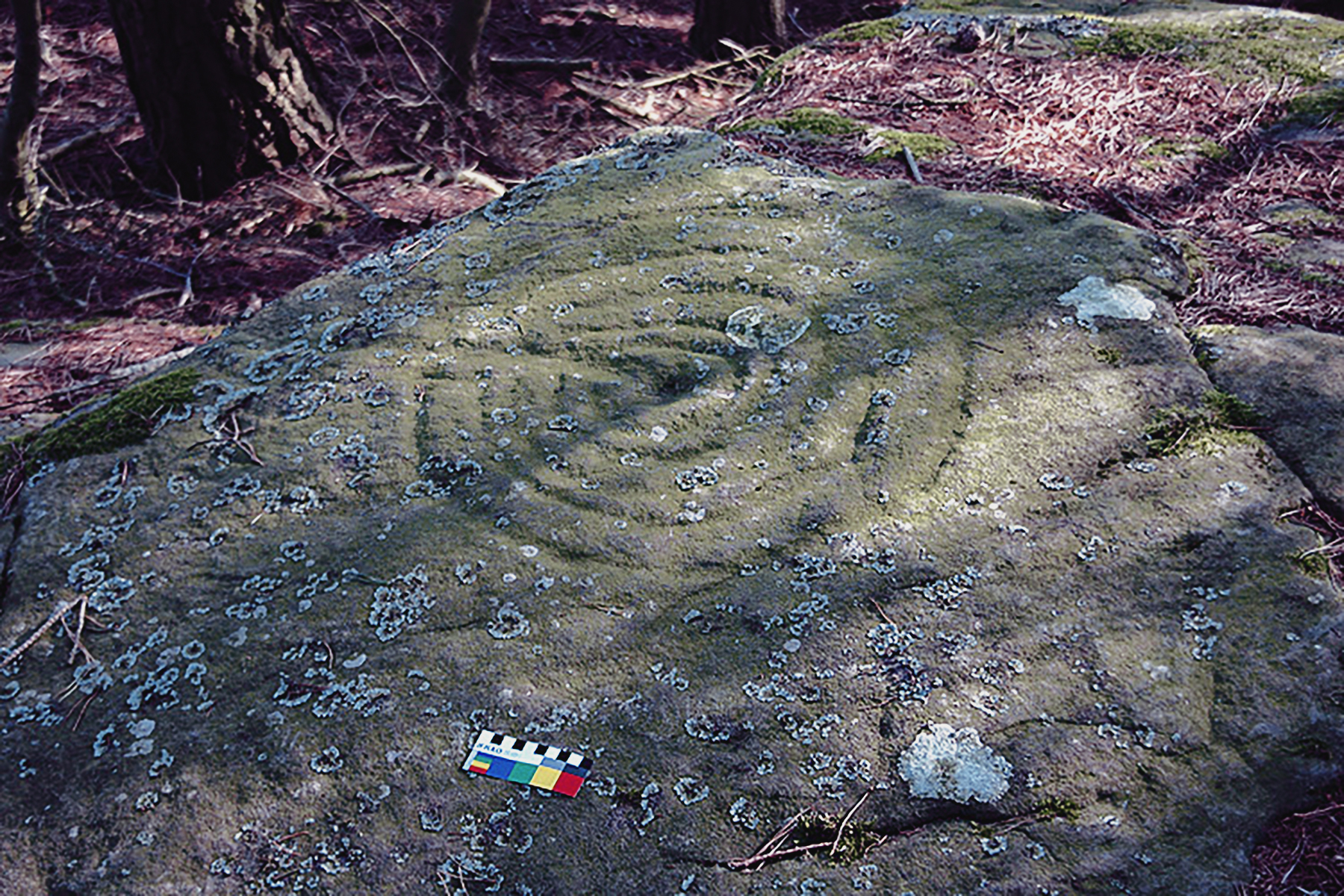
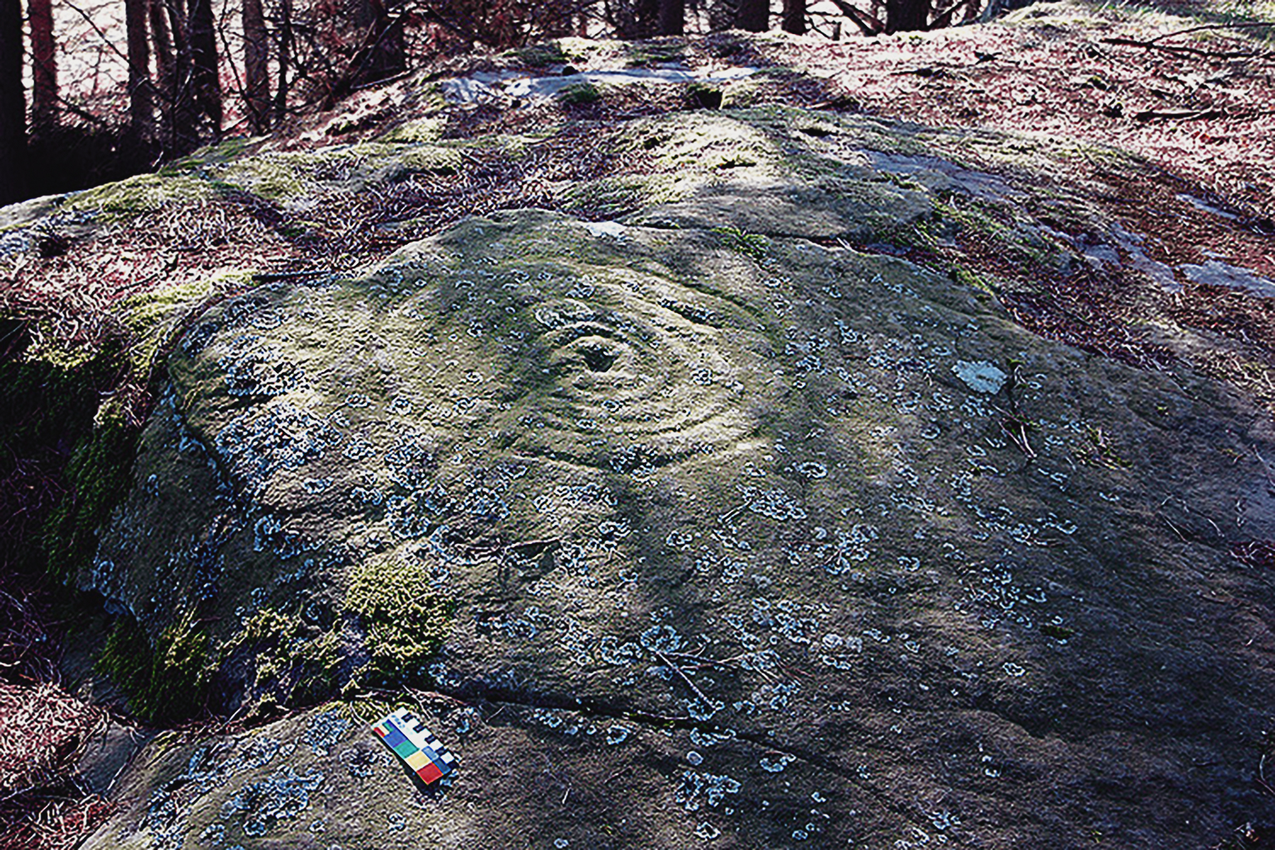
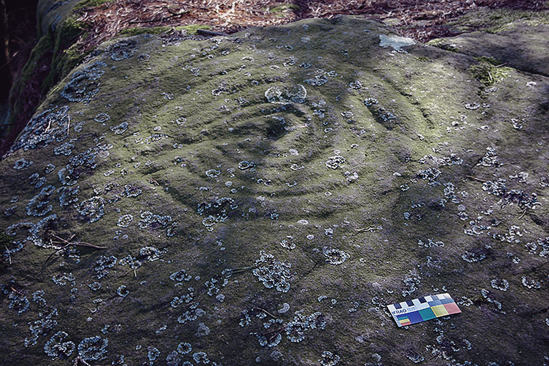
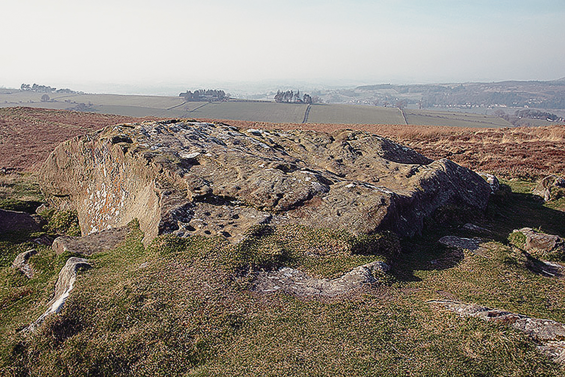
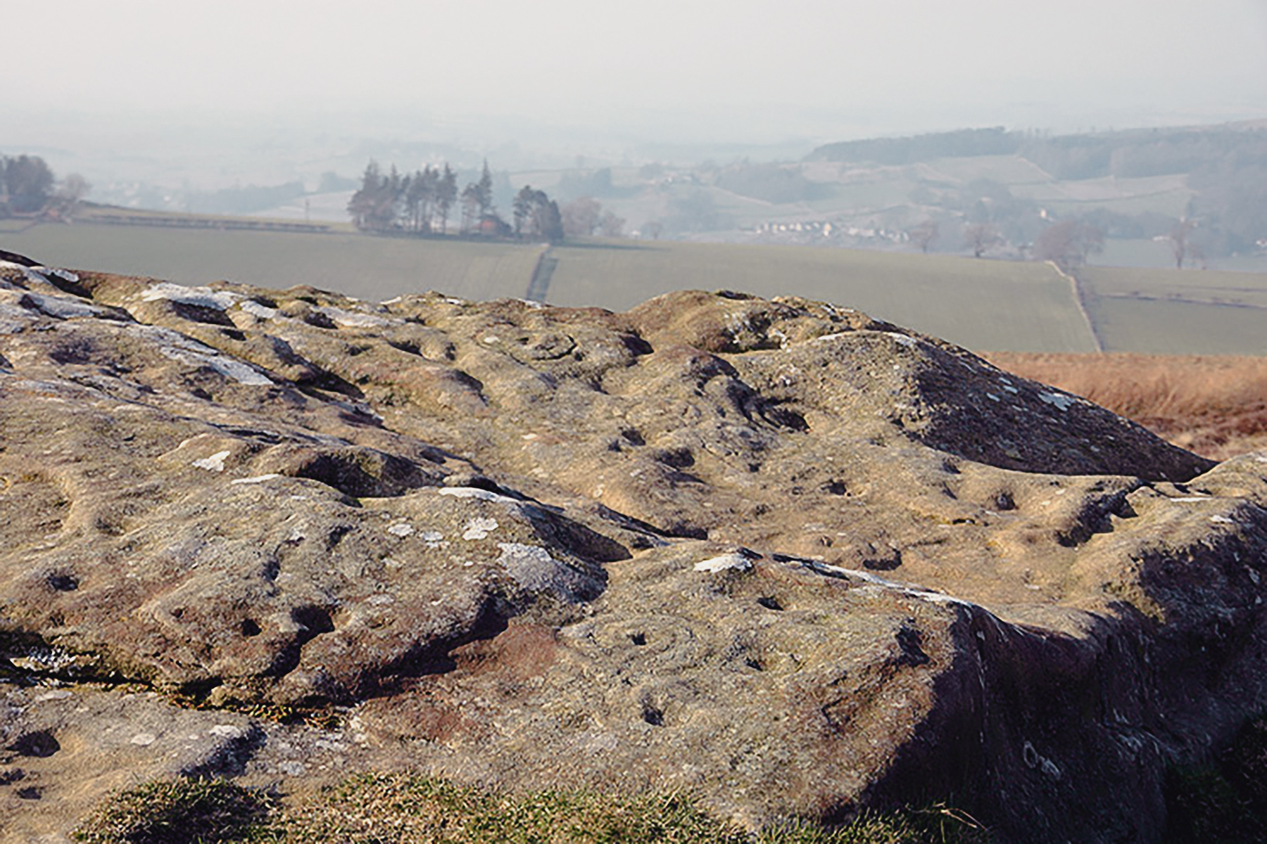
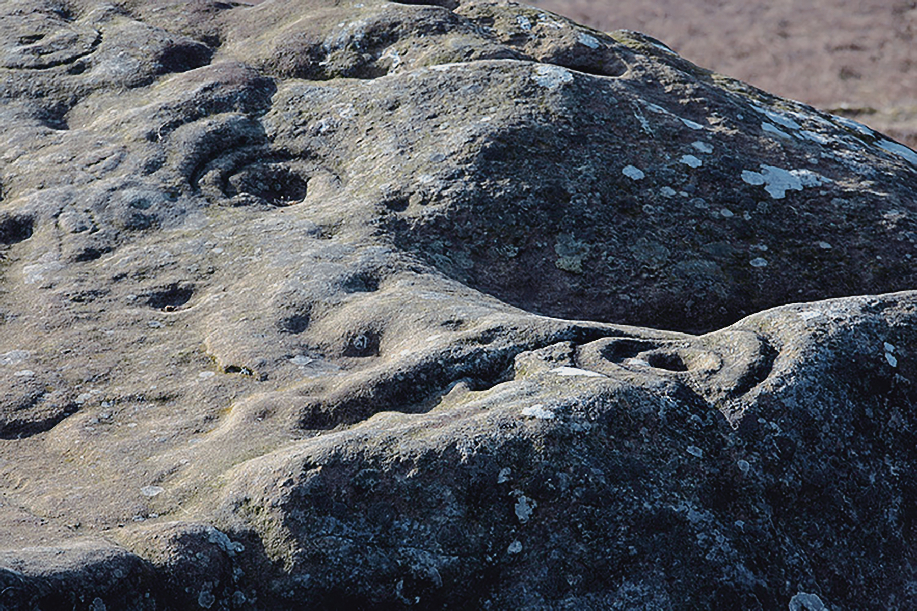
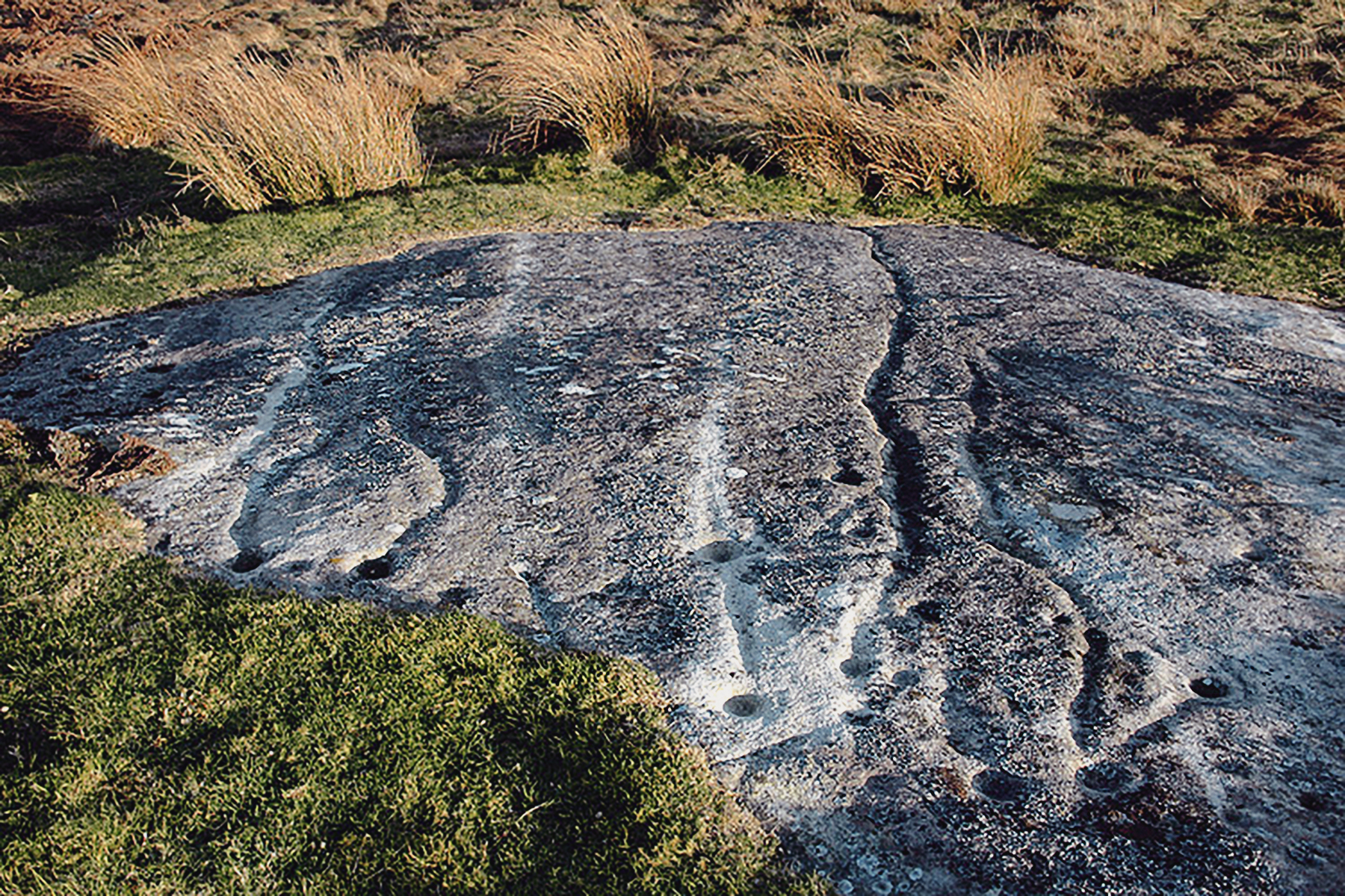
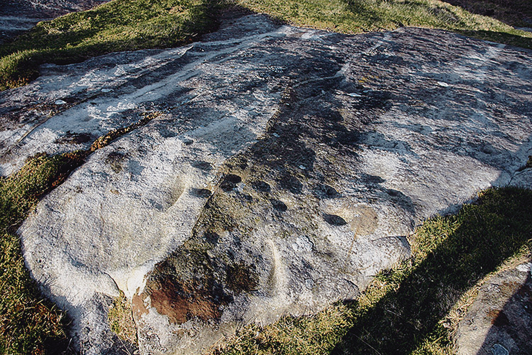
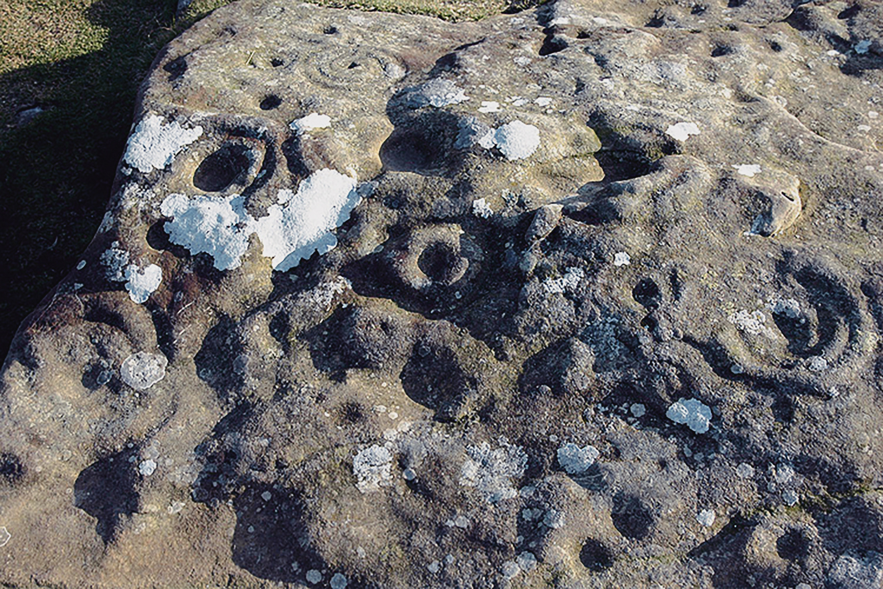
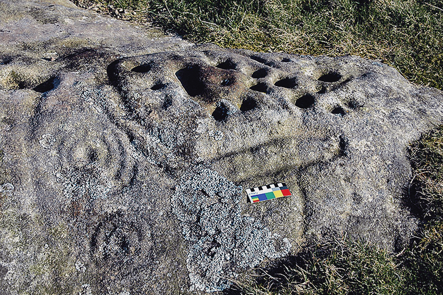
A horizontal, relatively smooth outcrop has been selected for rock art motifs of high quality. Weetwood 3A has natural cracks from north to south, and when the rock is viewed from the south, they help to draw the eye in that direction. The rock is also crossed from east to west by a serpentine groove that links the cups of the most southerly figures, and two other figures project grooves away from their central cups to the east.

To the south west is a separate motif; a cup at the centre of two complete rings. To the south east, a series of three connected motifs begins with a cup and duct and five penannulars. The duct runs on to join the outer circle of a cup, ring and three penannulars, the duct from the cup in this case aligned eastward towards a cup.

A faint linking groove from the outside penannular touches the outer ring of the largest figure: a large cup with five penannulars which flatten out at the bottom. A serpentine groove from the central cup bends to the west to reach the central ring around a cup, with three penannulars outside that ring.

To the east of the largest figure is a small cup with a duct running south east, and two penannulars. This is a very well-executed design, and although it has been exposed for at least 100 years, the pick markings are clear. There is a strong sense of fluidity, of inter-connection, in the arrangement of the motifs, and to the modern eye it is impressive.

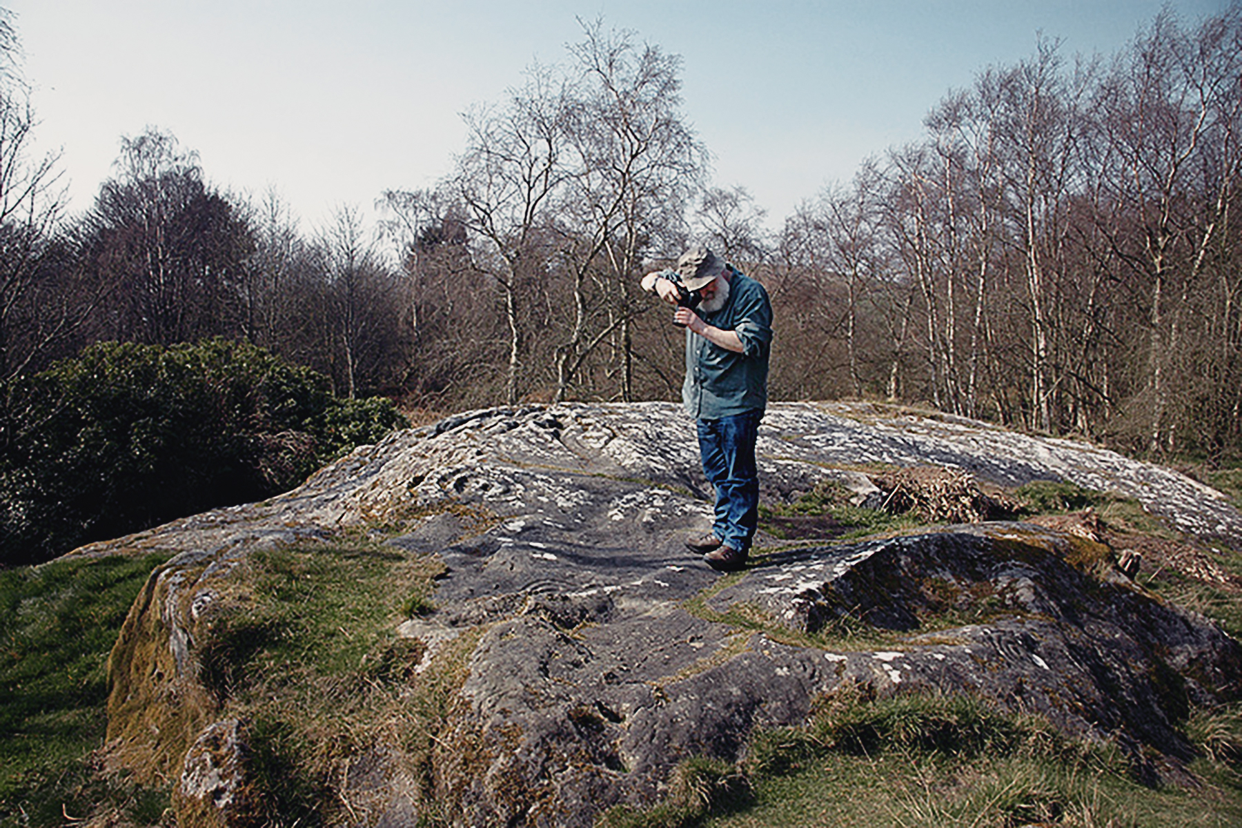
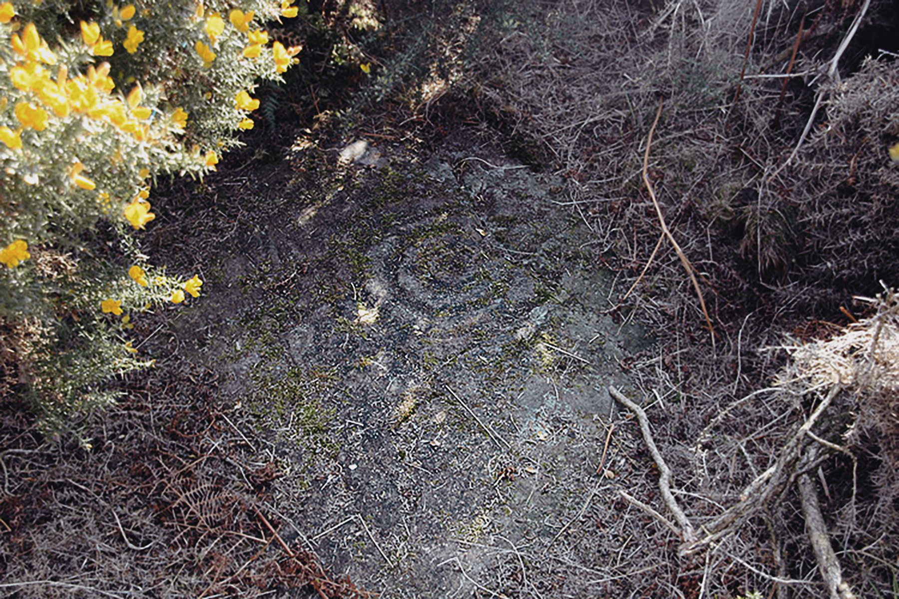
The ultimate rock art site of Weetwood Moor lies within a small coniferous wood. This woodland was not here at the time of carving but the present effect of dappled sunlight is very dramatic.

Weetwood Moor Northumberland Rock Art Carvings Archaeology
Weetwood Moor
© Bradshaw Foundation
 
Weetwood Moor Northumberland Rock Art Carvings Archaeology
Weetwood Moor
© Bradshaw Foundation
 
Weetwood Moor Northumberland Rock Art Carvings Archaeology
Weetwood Moor
© Bradshaw Foundation
 
Weetwood Moor Northumberland Rock Art Carvings Archaeology
Weetwood Moor
© Bradshaw Foundation
 
Weetwood Moor Northumberland Rock Art Carvings Archaeology
Weetwood Moor
© Bradshaw Foundation
 
Weetwood Moor Northumberland Rock Art Carvings Archaeology
Weetwood Moor
© Bradshaw Foundation
Weetwood Moor Northumberland Rock Art Carvings Archaeology
Weetwood Moor
© Bradshaw Foundation
 
Weetwood Moor Northumberland Rock Art Carvings Archaeology
Weetwood Moor
© Bradshaw Foundation
 
Weetwood Moor Northumberland Rock Art Carvings Archaeology
Weetwood Moor
© Bradshaw Foundation
 
Weetwood Moor Northumberland Rock Art Carvings Archaeology
Weetwood Moor
© Bradshaw Foundation
 
Weetwood Moor Northumberland Rock Art Carvings Archaeology
Weetwood Moor
© Bradshaw Foundation
 
Weetwood Moor Northumberland Rock Art Carvings Archaeology
Weetwood Moor
© Bradshaw Foundation
Weetwood Moor Northumberland Rock Art Carvings Archaeology
Weetwood Moor
© Bradshaw Foundation
 
Weetwood Moor Northumberland Rock Art Carvings Archaeology
Weetwood Moor
© Bradshaw Foundation
 
Weetwood Moor Northumberland Rock Art Carvings Archaeology
Weetwood Moor
© Bradshaw Foundation
 
Weetwood Moor Northumberland Rock Art Carvings Archaeology
Weetwood Moor
© Bradshaw Foundation
 
Weetwood Moor Northumberland Rock Art Carvings Archaeology
Weetwood Moor
© Bradshaw Foundation
 
Weetwood Moor Northumberland Rock Art Carvings Archaeology
Weetwood Moor
© Bradshaw Foundation
Weetwood Moor Northumberland Rock Art Carvings Archaeology
Weetwood Moor
© Bradshaw Foundation
 
Weetwood Moor Northumberland Rock Art Carvings Archaeology
Weetwood Moor
© Bradshaw Foundation
 
Weetwood Moor Northumberland Rock Art Carvings Archaeology
Weetwood Moor
© Bradshaw Foundation
 
Weetwood Moor Northumberland Rock Art Carvings Archaeology
Weetwood Moor
© Bradshaw Foundation
 
Weetwood Moor Northumberland Rock Art Carvings Archaeology
Weetwood Moor
© Bradshaw Foundation
 
Weetwood Moor Northumberland Rock Art Carvings Archaeology
Weetwood Moor
© Bradshaw Foundation
Lordenshaw
Northumberland Rock Art Carvings

Lordenshaw Prehistoric open-air cup ring rock art carvings from Northumberland Archaeology
Lordenshaw
© Bradshaw Foundation
Lordenshaw is located near Rothbury. The sandstone promontory on which Lordenshaw stands is to the north east of the Simonside - Dove Crags range of hills. Its north west and south east flanks drop respectively to Whitton Dean, a tributary of the Coquet and to a narrow glaciated valley overlooked to the east by another outlying sandstone hill that rises to the same height as Lordenshaw. There is a rise to the hillfort from the south west, then the land slopes away to the north east, finger-like, to the Whitton Burn.

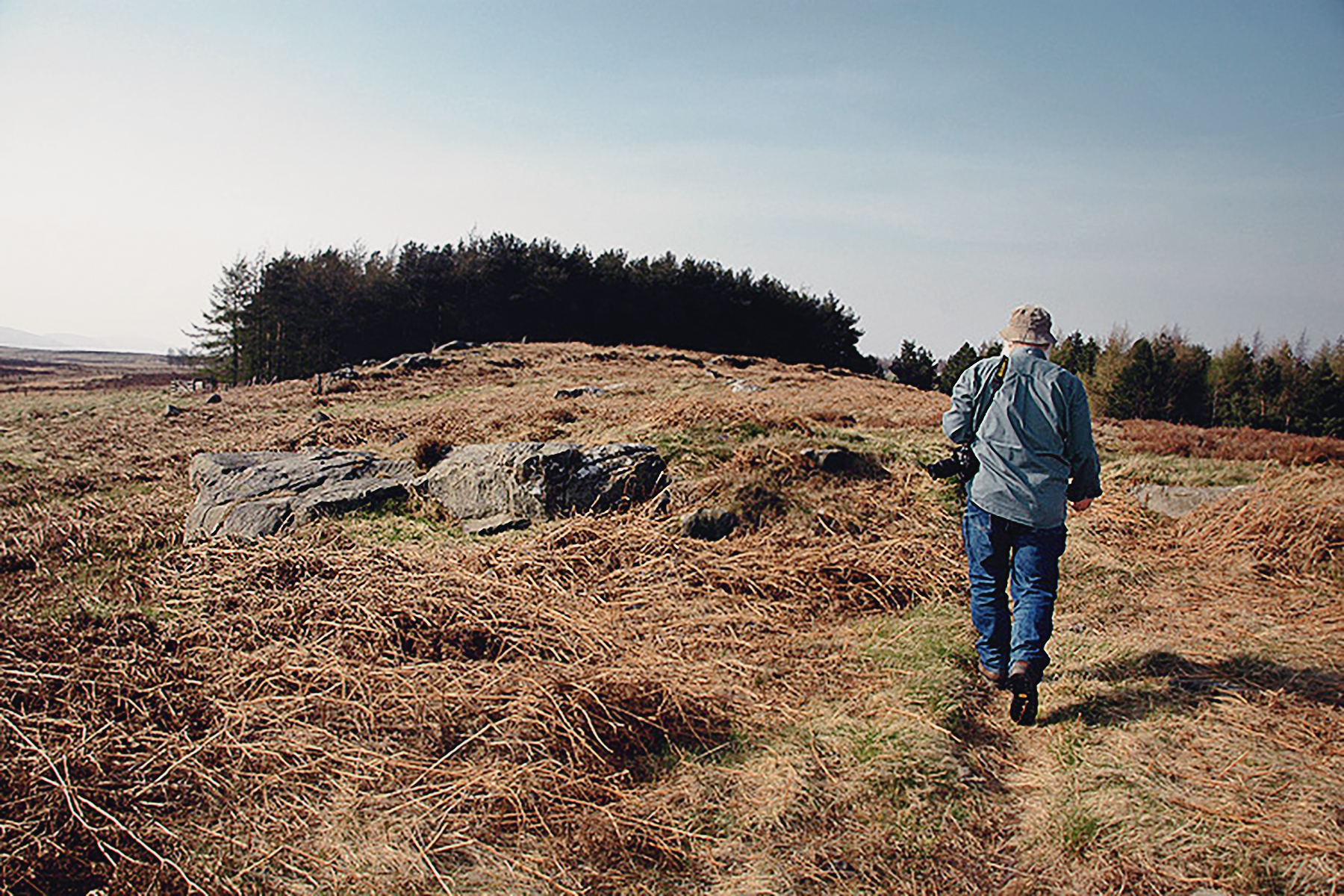
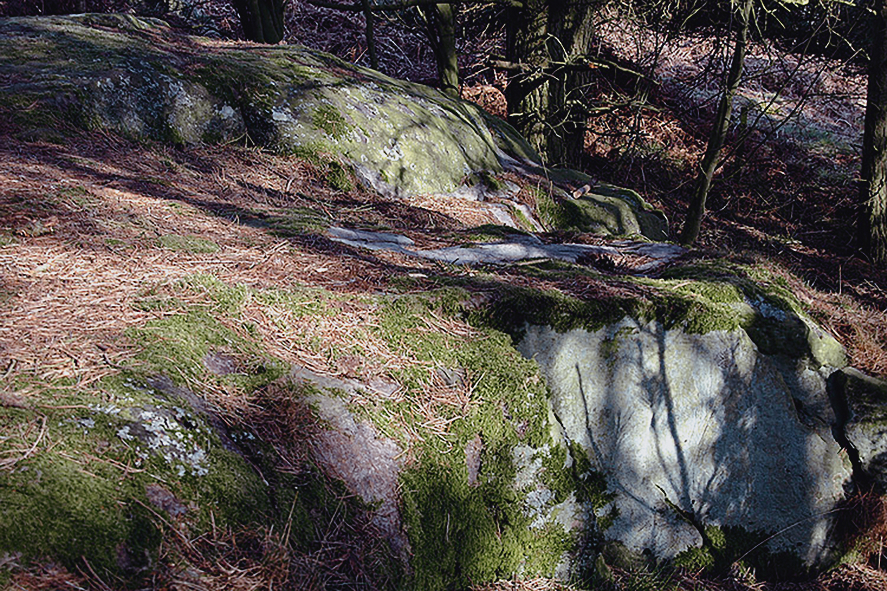
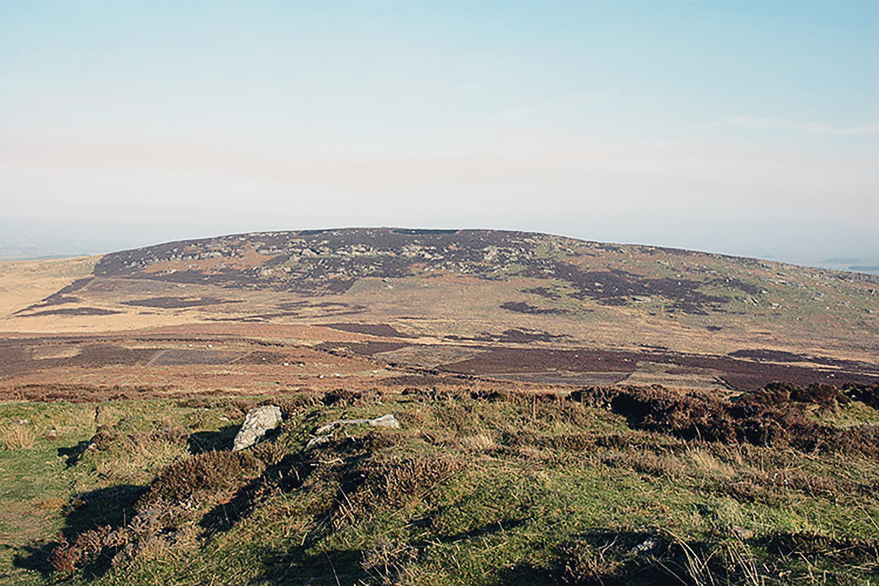
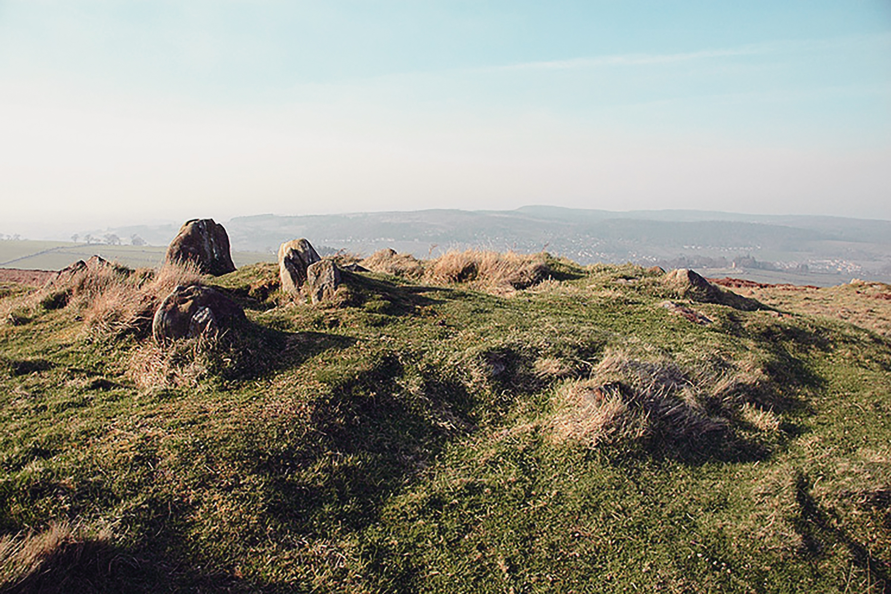
This raised, prominent extension of the Simonside Hills reaches 268m.OD, and is made up of outcrop Fell sandstone, with only a thin layer of acidic soil. There are patches of bright orange soil thrown up by rabbits, and a dark grey soil elsewhere.

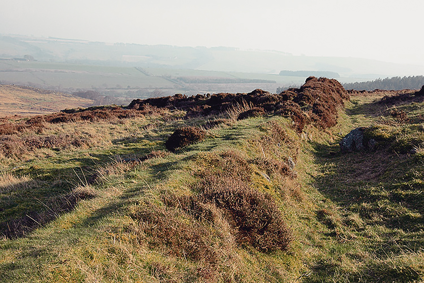
The whole area has archaeology of many different periods, one of the most recent and most significant being the clearance of much of the land to the east for 'improvement' for the growing of grain on a regular close-running rig and furrow system. This must have destroyed some surface archaeology, and may have resulted in some of the stone heaps that could also be prehistoric burial mounds.

Dr Aron Mazel recording the rock art carvings at Lordenshaw Archaeology
Dr Aron Mazel recording the rock art carvings at Lordenshaw
© Bradshaw Foundation
Prominent on the hilltop is a 'fort', a ditched Iron Age enclosure that has been re-used as a Romano-British settlement. The slope southwards to the modern road and car park has many field walls, some of cobble and soil construction, and others of vertically-set sandstones. Some of these walls cross one another, and represent different episodes in the use of the land.

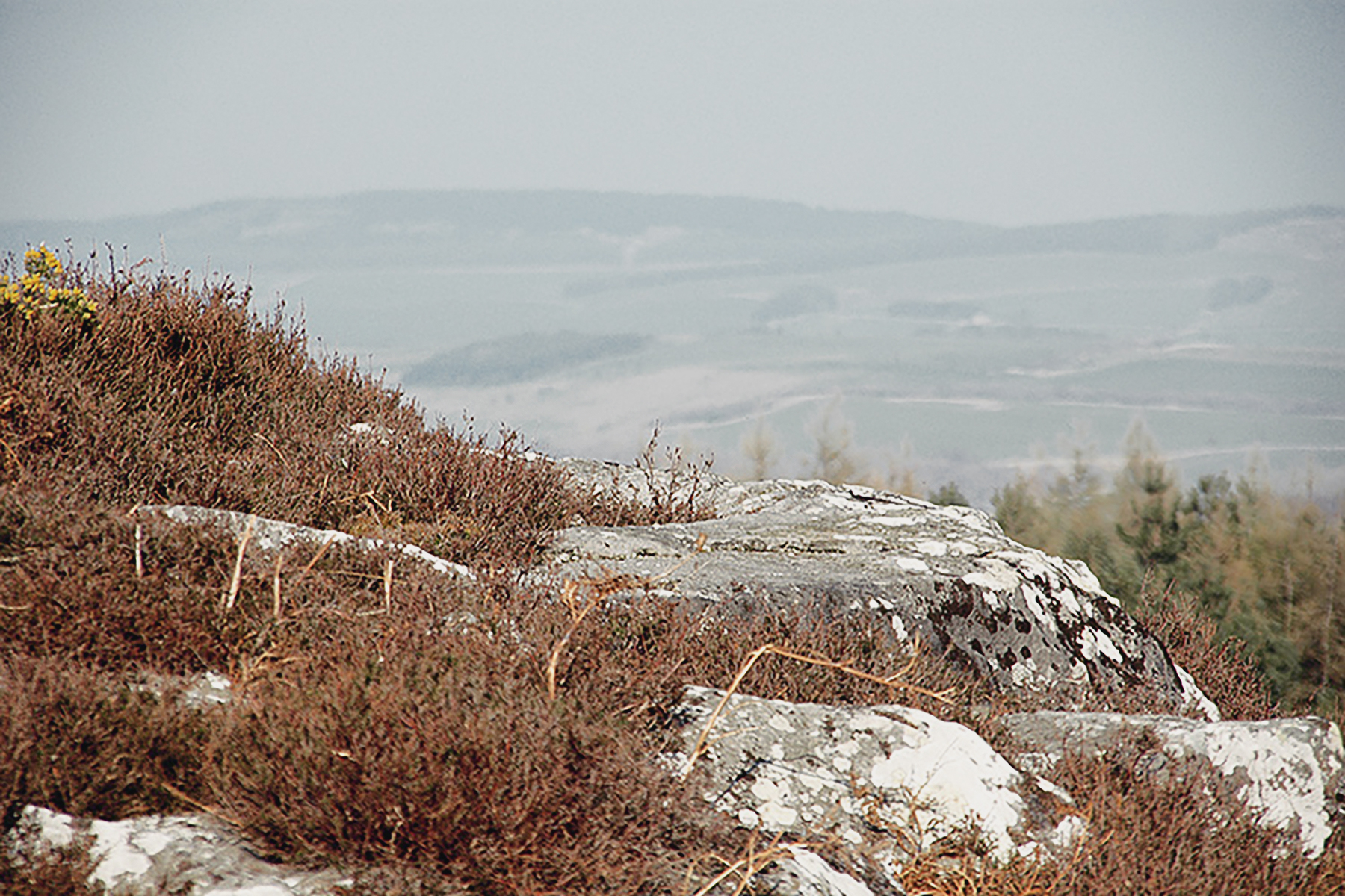
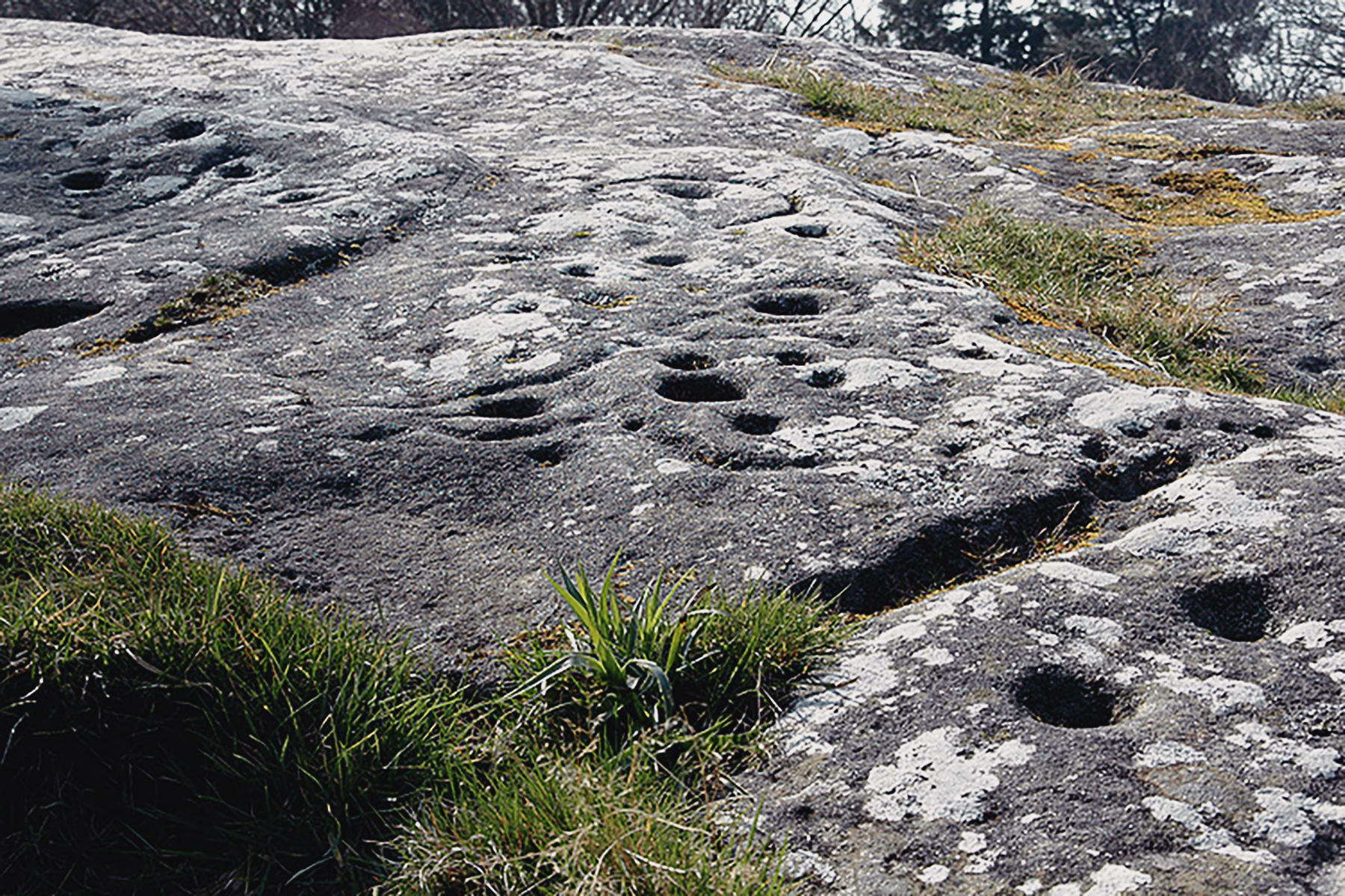
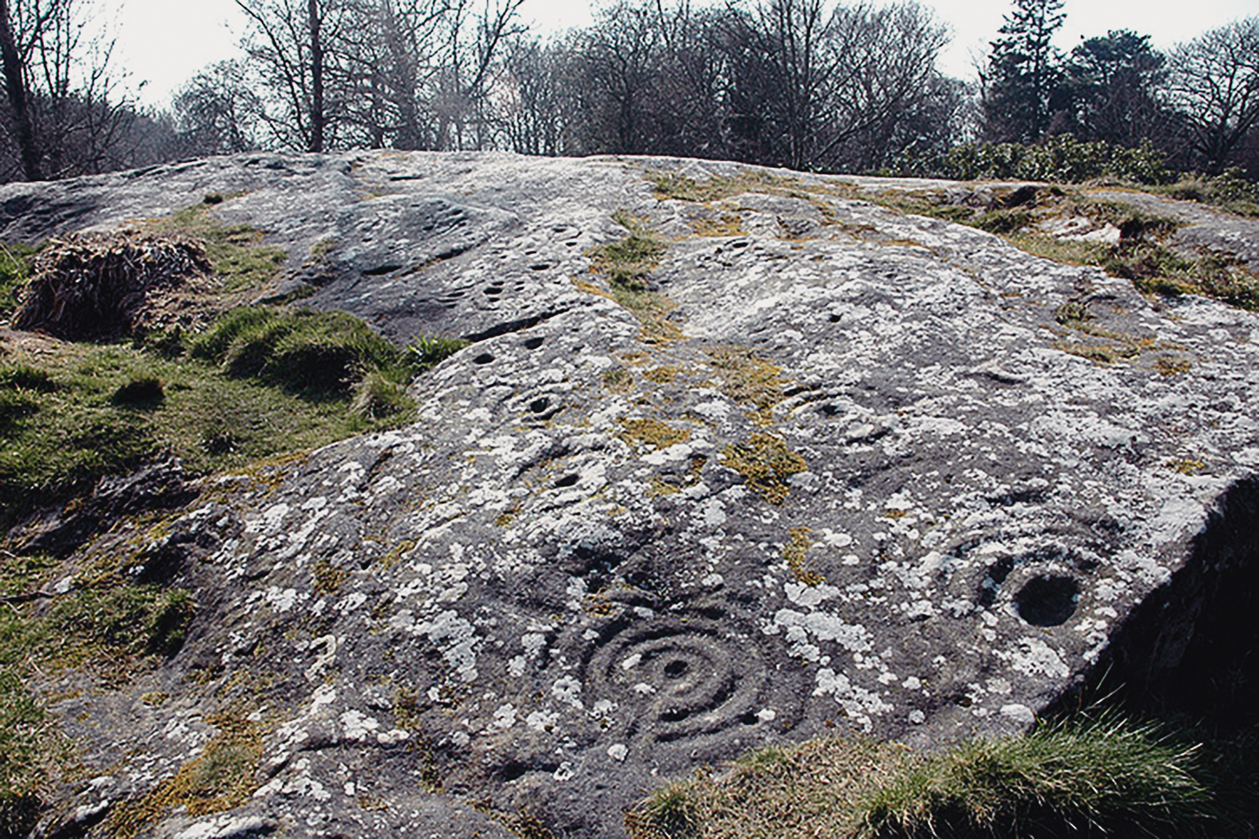
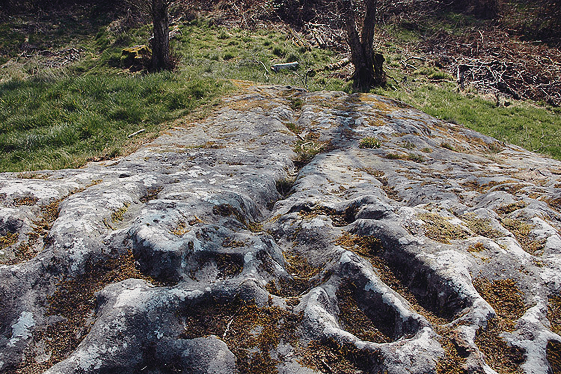
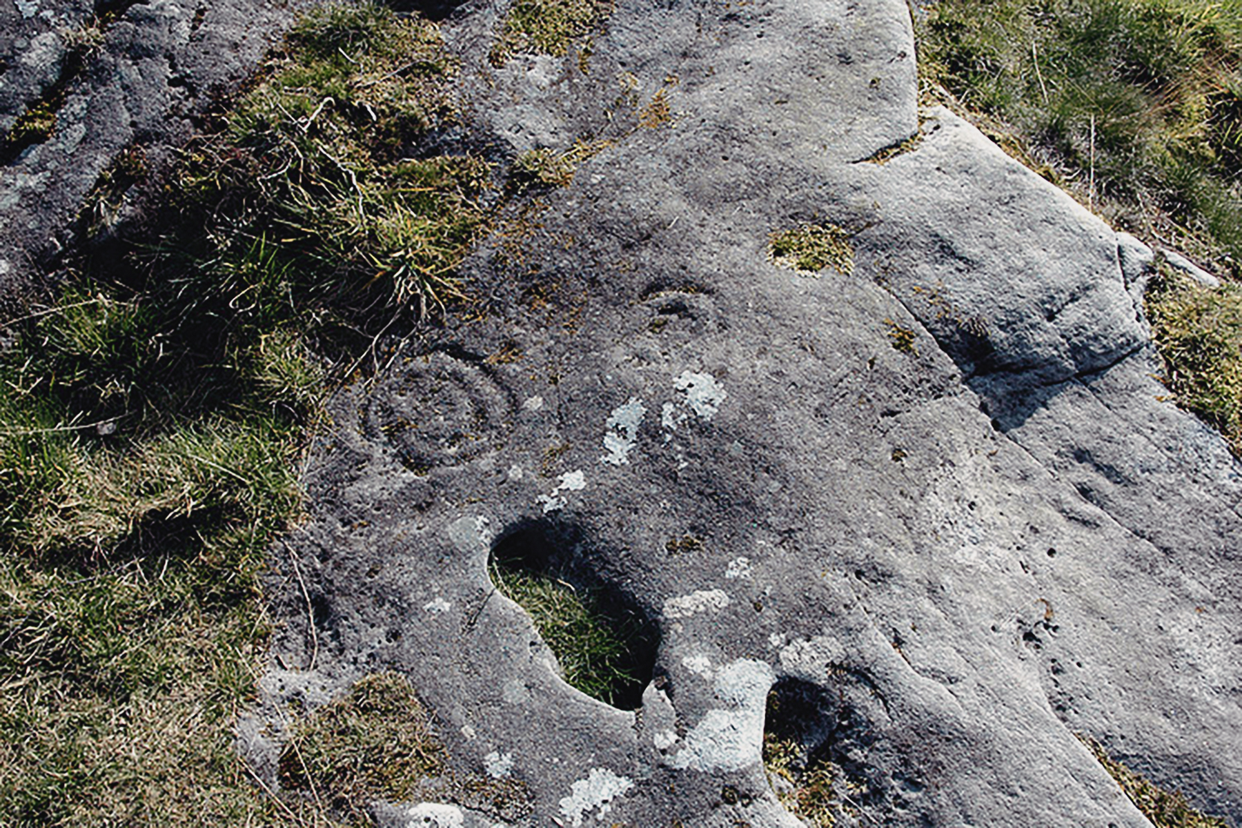
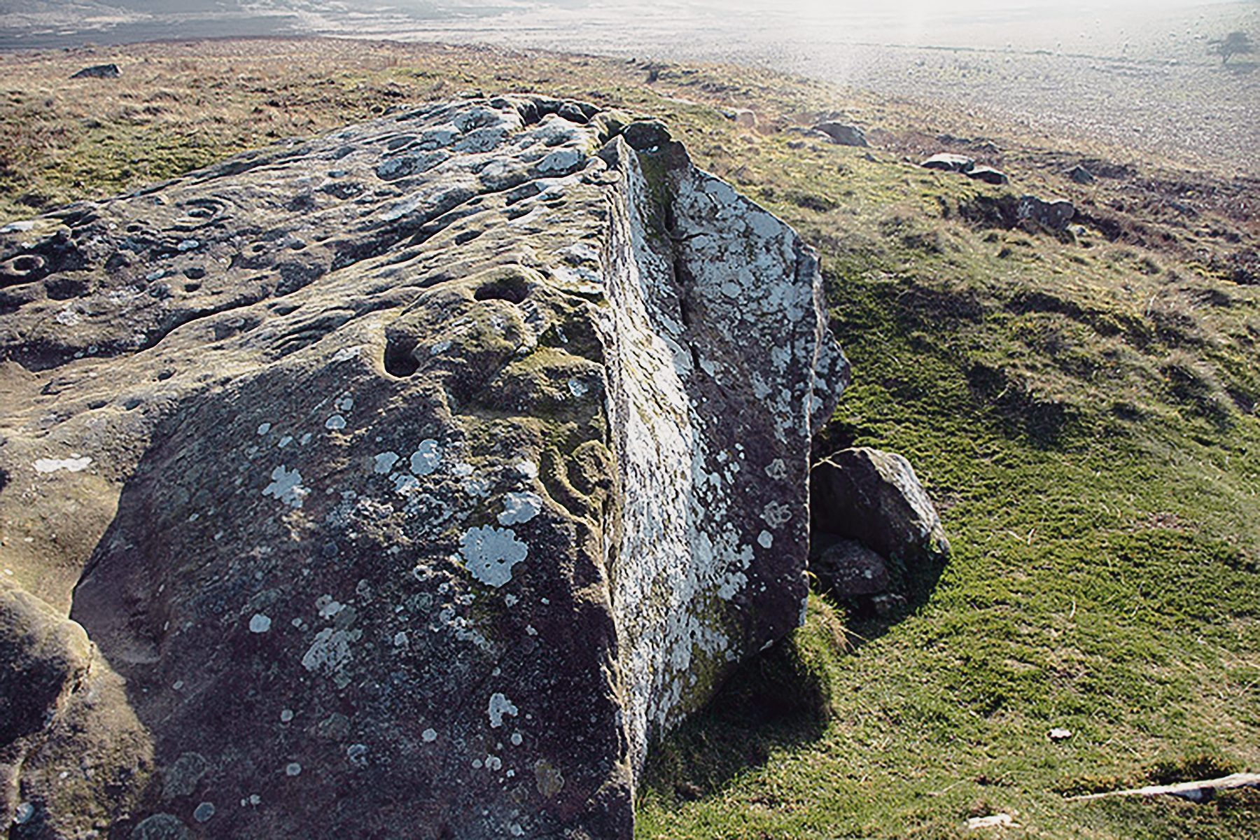
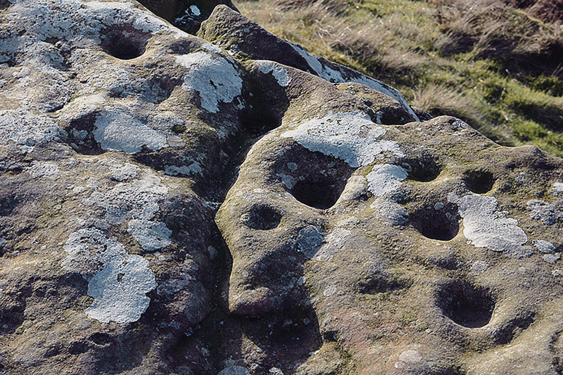
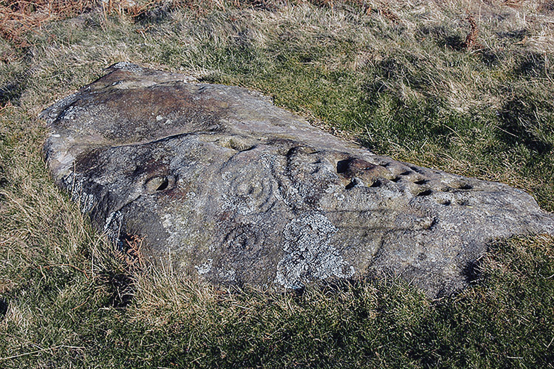
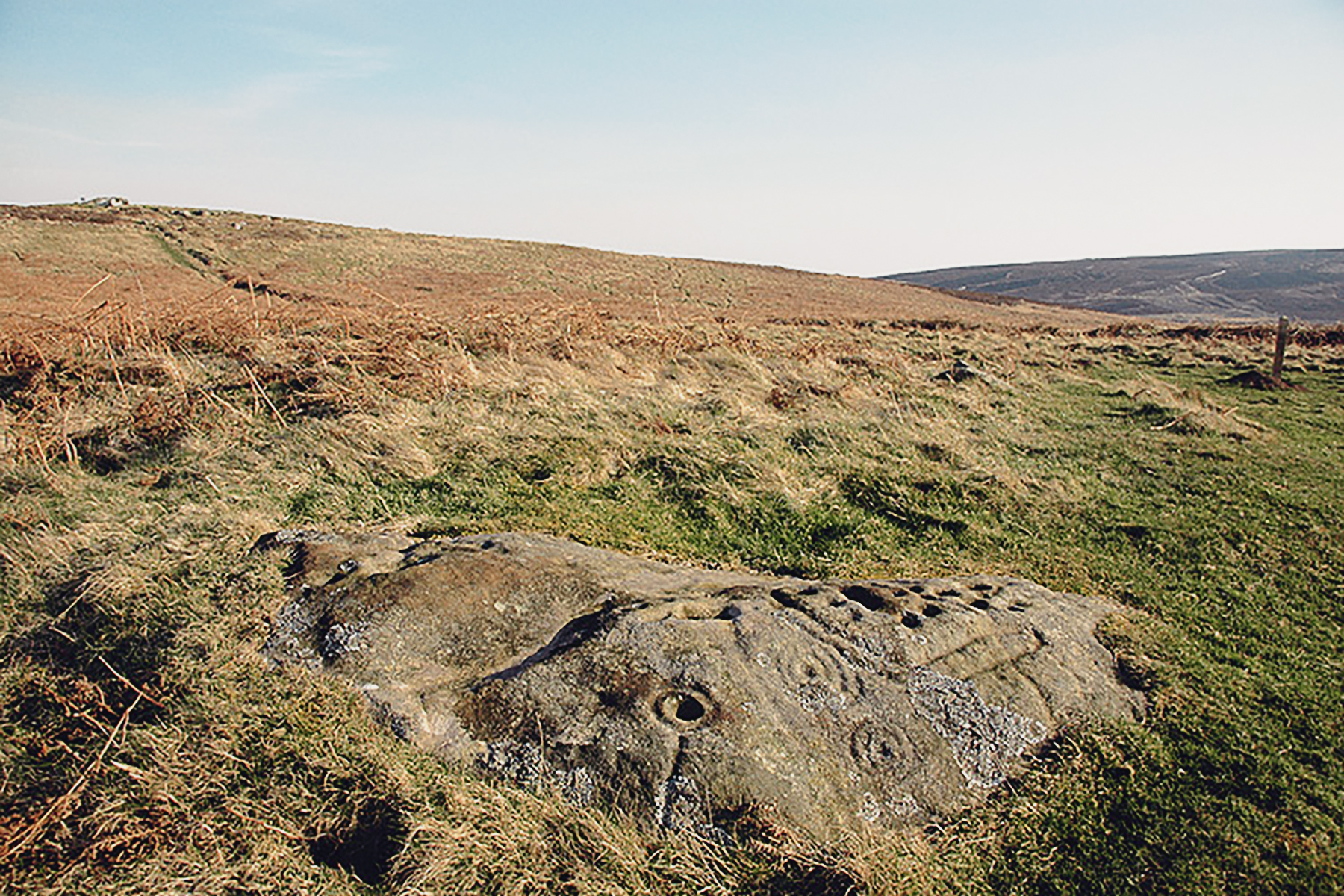
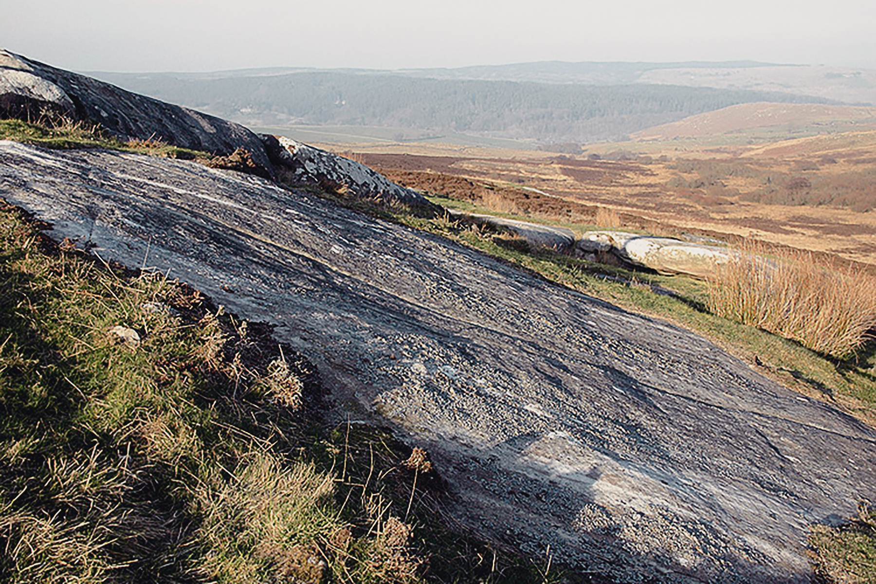
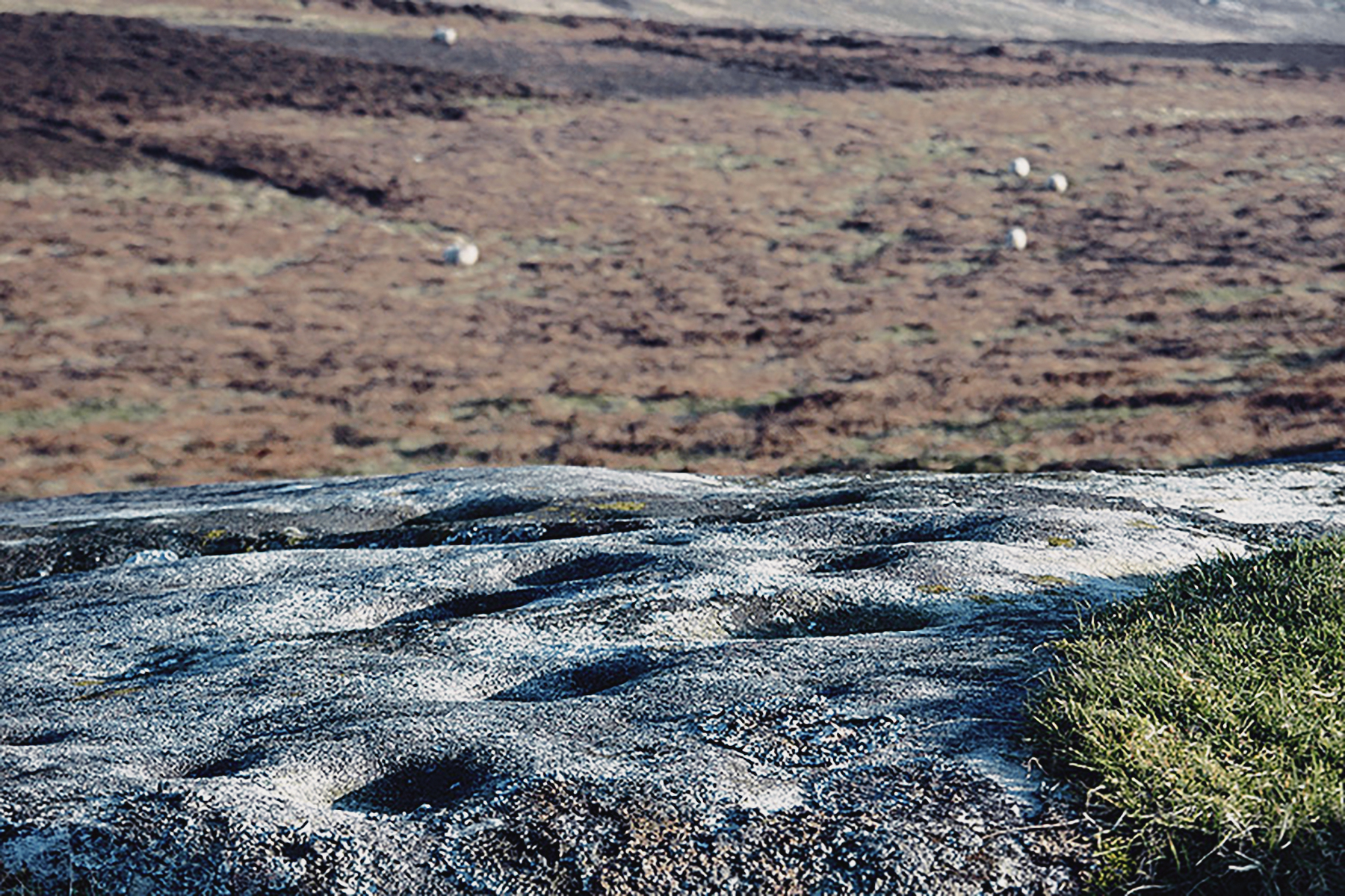
The oldest features belong to either the early or late Neolithic period, represented by cup and ring marked rocks over a wide area. The motifs vary from simple cups to more complex ringed cups and grooves, but there is a characteristic regional phenomenon of long grooves or channels that follow the slope of the outcrop sheets on the east side of the hill. There are over 100 carved rocks at Lordenshaw making it the mostconcentrated assemblage of rock art in Northumberland and perhaps the UK.

It is impossible to date outcrop markings, but in this area three possible Early Bronze Age cairns have been built on marked outcrop rock, showing that the latter are either contemporary or earlier, and also showing that the sites were already of great importance in the landscape before the cairns were added.

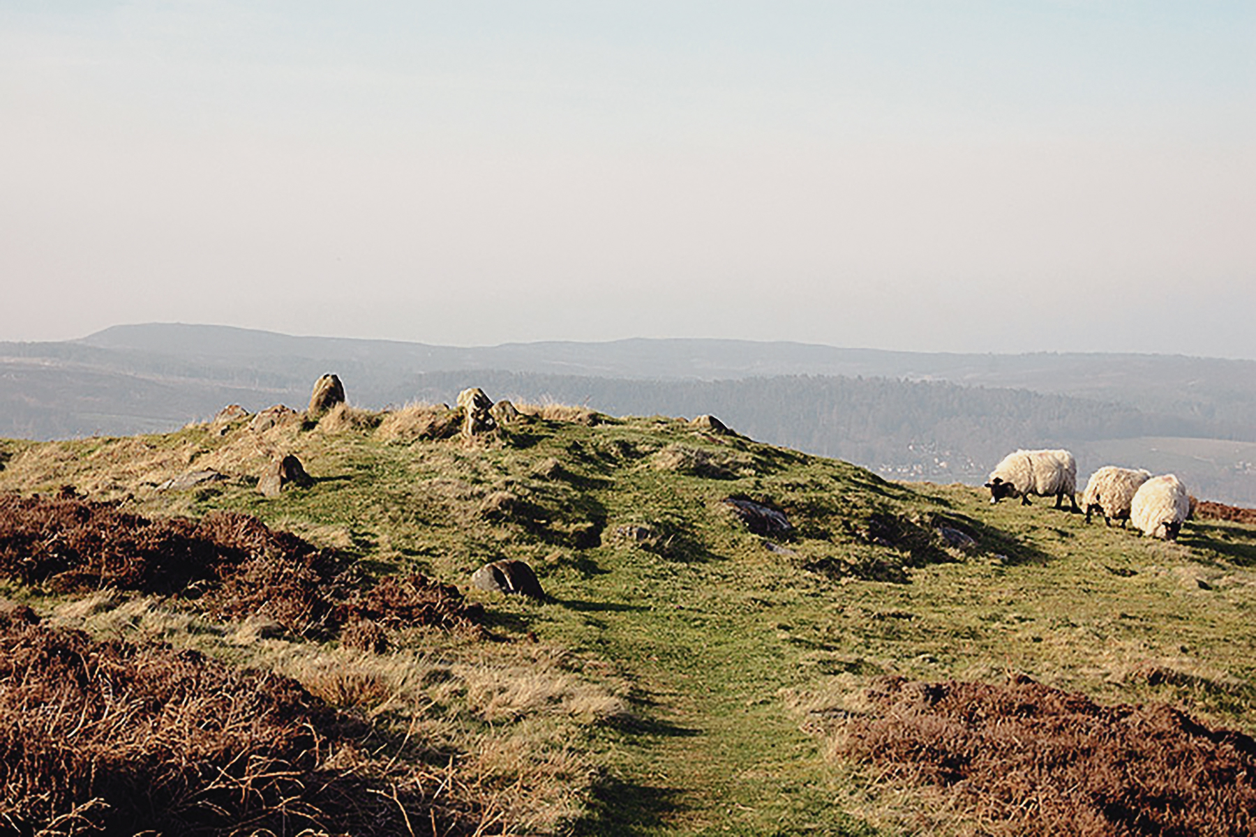
Most of the marked rocks in situ are at prominent viewpoints, some commanding many miles of territory. A few cupped rocks in the hillfort allow the possibility that some marked surfaces may have been destroyed during its construction, and the medieval Deer Park wall may account for others being broken up and reused. Modern quarrying has certainly taken its toll, especially on the north west, where masses of freestone have been removed, leaving holes in the ground like bomb craters, and the main block of rock art (West Lordenshaw) bears every sign of the quarrying process. Add to that a network of other walls, including those for sheilings (temporary herds' houses and gardens), and it is likely that we have lost a large proportion of rock art. Lordenshaw represents a highly important archaeological area, given the number periods clearly represented, set in a stunning Northumberland landscape.

Lordenshaw Northumberland Rock Art Carvings Archaeology
Lordenshaw
© Bradshaw Foundation
 
Lordenshaw Northumberland Rock Art Carvings Archaeology
Lordenshaw
© Bradshaw Foundation
 
Lordenshaw Northumberland Rock Art Carvings Archaeology
Lordenshaw
© Bradshaw Foundation
 
Lordenshaw Northumberland Rock Art Carvings Archaeology
Lordenshaw
© Bradshaw Foundation
 
Lordenshaw Northumberland Rock Art Carvings Archaeology
Lordenshaw
© Bradshaw Foundation
 
Lordenshaw Northumberland Rock Art Carvings Archaeology
Lordenshaw
© Bradshaw Foundation
Lordenshaw Northumberland Rock Art Carvings Archaeology
Lordenshaw
© Bradshaw Foundation
 
Lordenshaw Northumberland Rock Art Carvings Archaeology
Lordenshaw
© Bradshaw Foundation
 
Lordenshaw Northumberland Rock Art Carvings Archaeology
Lordenshaw
© Bradshaw Foundation
 
Lordenshaw Northumberland Rock Art Carvings Archaeology
Lordenshaw
© Bradshaw Foundation
 
Lordenshaw Northumberland Rock Art Carvings Archaeology
Lordenshaw
© Bradshaw Foundation
 
Lordenshaw Northumberland Rock Art Carvings Archaeology
Lordenshaw
© Bradshaw Foundation
Lordenshaw Northumberland Rock Art Carvings Archaeology
Lordenshaw
© Bradshaw Foundation
 
Lordenshaw Northumberland Rock Art Carvings Archaeology
Lordenshaw
© Bradshaw Foundation
 
Lordenshaw Northumberland Rock Art Carvings Archaeology
Lordenshaw
© Bradshaw Foundation
 
Lordenshaw Northumberland Rock Art Carvings Archaeology
Lordenshaw
© Bradshaw Foundation
 
Lordenshaw Northumberland Rock Art Carvings Archaeology
Lordenshaw
© Bradshaw Foundation
 
Lordenshaw Northumberland Rock Art Carvings Archaeology
Lordenshaw
© Bradshaw Foundation
Lordenshaw Northumberland Rock Art Carvings Archaeology
Lordenshaw
© Bradshaw Foundation
 
Lordenshaw Northumberland Rock Art Carvings Archaeology
Lordenshaw
© Bradshaw Foundation
 
Lordenshaw Northumberland Rock Art Carvings Archaeology
Lordenshaw
© Bradshaw Foundation
 
Lordenshaw Northumberland Rock Art Carvings Archaeology
Lordenshaw
© Bradshaw Foundation
 
Lordenshaw Northumberland Rock Art Carvings Archaeology
Lordenshaw
© Bradshaw Foundation
 
Lordenshaw Northumberland Rock Art Carvings Archaeology
Lordenshaw
© Bradshaw Foundation
Lordenshaw Northumberland Rock Art Carvings Archaeology
Lordenshaw
© Bradshaw Foundation
 
Lordenshaw Northumberland Rock Art Carvings Archaeology
Lordenshaw
© Bradshaw Foundation
 
Lordenshaw Northumberland Rock Art Carvings Archaeology
Lordenshaw
© Bradshaw Foundation
 
Lordenshaw Northumberland Rock Art Carvings Archaeology
Lordenshaw
© Bradshaw Foundation
 
Lordenshaw Northumberland Rock Art Carvings Archaeology
Lordenshaw
© Bradshaw Foundation
 
Lordenshaw Northumberland Rock Art Carvings Archaeology
Lordenshaw
© Bradshaw Foundation
Lordenshaw Northumberland Rock Art Carvings Archaeology
Lordenshaw
© Bradshaw Foundation
 
Lordenshaw Northumberland Rock Art Carvings Archaeology
Lordenshaw
© Bradshaw Foundation
 
Lordenshaw Northumberland Rock Art Carvings Archaeology
Lordenshaw
© Bradshaw Foundation
 
Lordenshaw Northumberland Rock Art Carvings Archaeology
Lordenshaw
© Bradshaw Foundation
 
Lordenshaw Northumberland Rock Art Carvings Archaeology
Lordenshaw
© Bradshaw Foundation
 
Lordenshaw Northumberland Rock Art Carvings Archaeology
Lordenshaw
© Bradshaw Foundation
Lordenshaw Northumberland Rock Art Carvings Archaeology
Lordenshaw
© Bradshaw Foundation
 
Lordenshaw Northumberland Rock Art Carvings Archaeology
Lordenshaw
© Bradshaw Foundation
 
Lordenshaw Northumberland Rock Art Carvings Archaeology
Lordenshaw
© Bradshaw Foundation
 
Lordenshaw Northumberland Rock Art Carvings Archaeology
Lordenshaw
© Bradshaw Foundation
 
Lordenshaw Northumberland Rock Art Carvings Archaeology
Lordenshaw
© Bradshaw Foundation
 
Lordenshaw Northumberland Rock Art Carvings Archaeology
Lordenshaw
© Bradshaw Foundation
Research, Management & Presentation

Rock Art on Mobile Phones RAMP
It was at the third site we visited - Lordenshaw - that Aron demonstrated a wonderful example of 'Research, Management & Presentation'. At the style leading onto the moorland a new and concise sign informed me of the route and rock art sites. There was also a QR matrix barcode. I scanned this with my smart phone, which promptly downloaded the URL for the rock art of Lordenshaw.

It is a mobile website rather than a platform-specific app. This mobile experience allowed me to explore the archaeological landscape at Lordenshaw Moor, showing me the route to some of the sites, as well as images and descriptions of the various panels, with text and audio explanations.

The thought of finding yourself on top of a moor in Northumberland, with distant views and a light breeze, standing on an outcrop that has been decorated with geometric carvings made thousands of years ago for reasons we are not entirely sure, and reaching for your smart phone may at first seem at odds. But not so! Primarily, it is not obligatory. Moreover, on this introductory visit to the rock art sites of Northumberland, I was fortunate enough to be guided by an expert; Aron was able to tell me everything I needed to know.

Rock Art on Mobile Phones
© Bradshaw Foundation
The information on rock art and the rock art sites provided by the Rock Art on Mobile Phones (RAMP) project is very extensive, and I have absolutely no objection to this ground-breaking project, which is using some of our latest technology to explain some of our earliest art. Ultimately, it can only lead to two things: a greater understanding of the rock art and a more certain degree of its preservation.

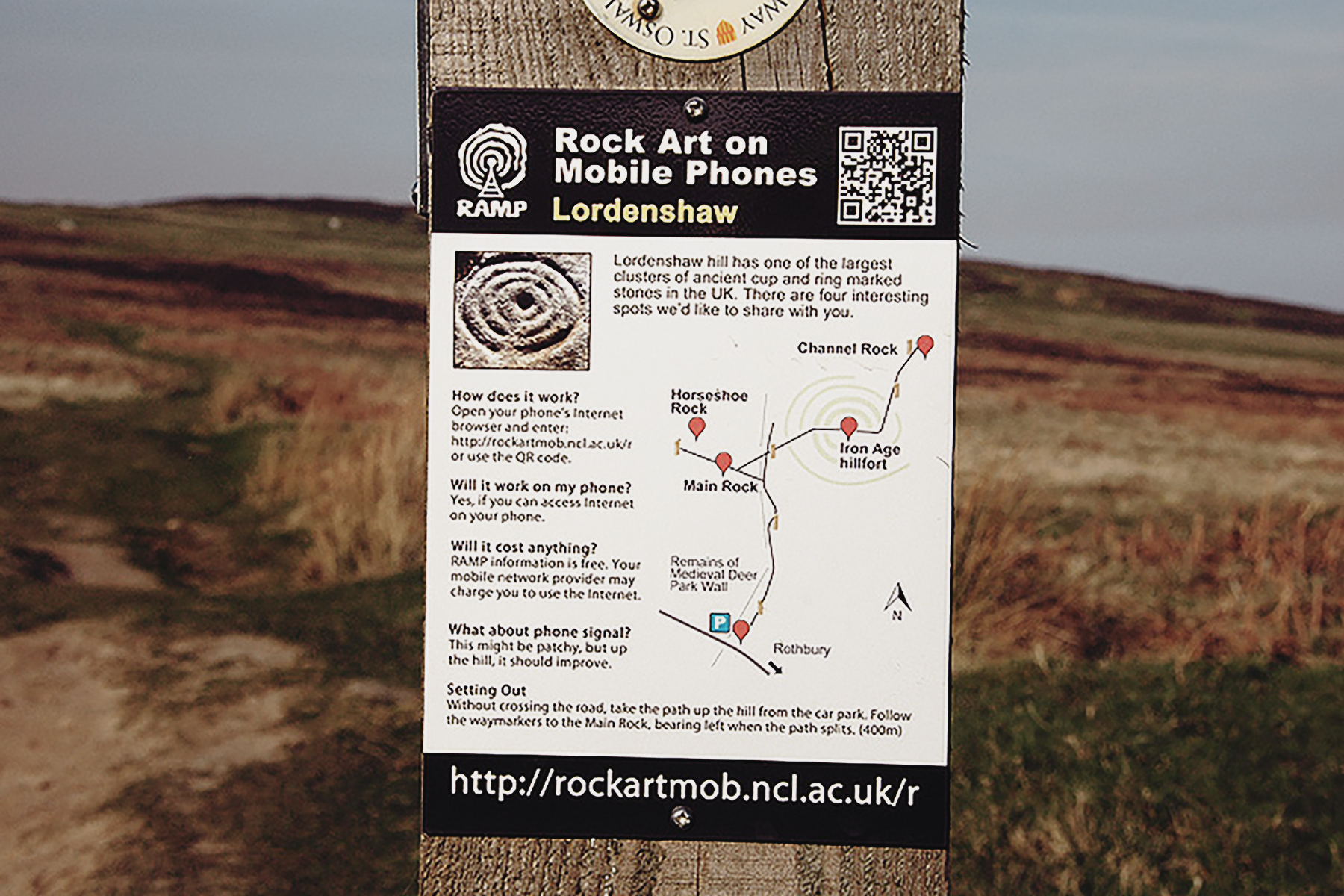
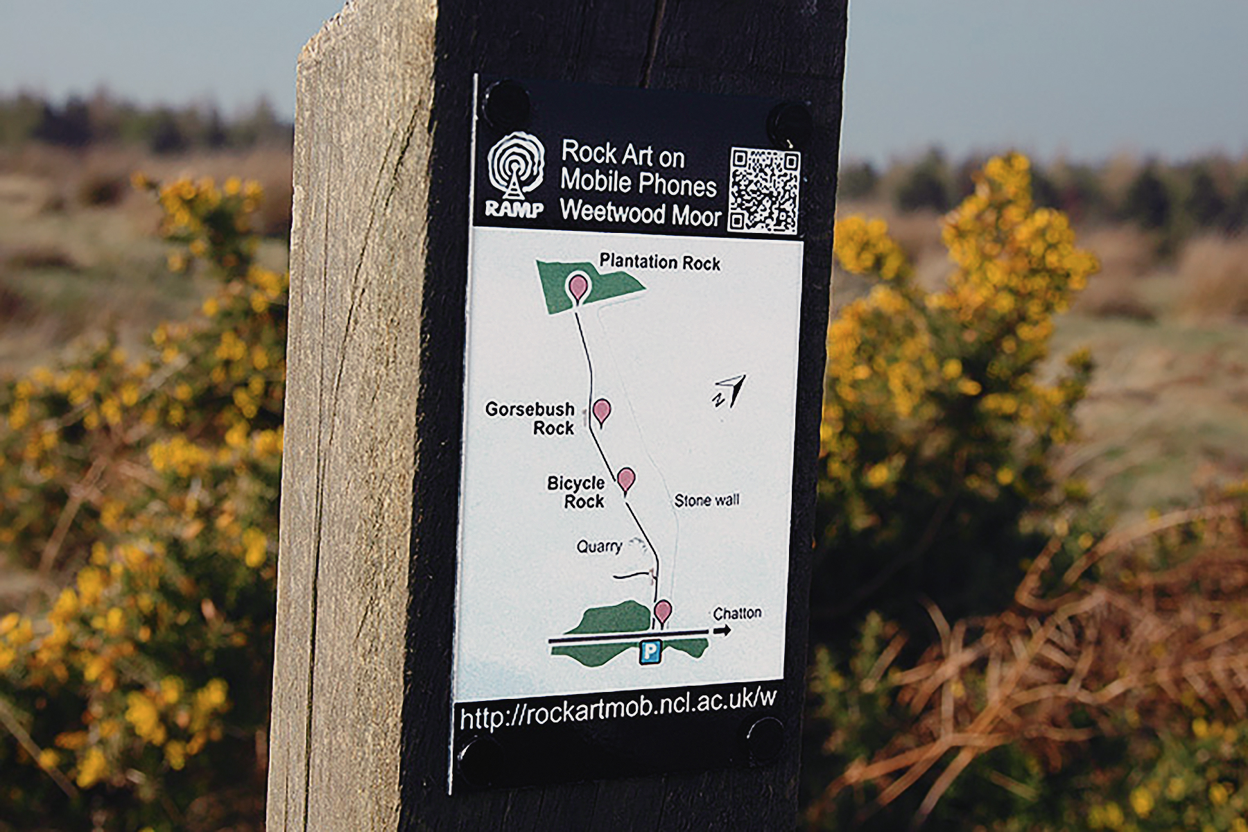
The RAMP Project brings photographs, diagrams and commentaries about rock art directly to mobile phones in the Northumberland countryside. It builds on the resources developed as part of the Beckensall Northumberland Rock Art and the Englandís Rock Art (ERA) databases. RAMP focuses on three key rock art areas in Northumberland: Lordenshaw (near Rothbury), Weetwood and Dod Law (both near Wooler). These sites were chosen on the strength and diversity of their rock art, their accessibility and, crucially, their ability to withstand visitor numbers. RAMP was undertaken by the International Centre for Cultural and Heritage Studies, at Newcastle University in 2010/11. It was funded by the Arts and Humanities Research Council (AHRC) and Newcastle University.

Mobile Rock Art
http://rockartmob.ncl.ac.uk/main/about.php

Rock Art Links

→  Subscribe free to the Bradshaw Foundation YouTube Channel

→ British Isles Prehistory Archive
→ British Isles Introduction
→ Stonehenge
→ Avebury
→ The Rock Art of Northumberland
→ The Red Lady of Paviland
→ The Prehistory of the Mendip Hills
→ Rock Art on the Gower Peninsula
→ Megaliths of the British Isles
→ Stone Age Mammoth Abattoir

→ Bradshaw Foundation
→ Rock Art Network

Follow the Bradshaw Foundation on social media for news & updates
Follow the Bradshaw Foundation
on social media for news & updates
Follow the Bradshaw Foundation on social media for news & updates
Follow the Bradshaw Foundation
on social media for news & updates
If you have enjoyed visiting this website
please consider adding a link © Bradshaw Foundation
 
 
Bradshaw Foundation Donate Friends
Support our work & become a
Friend of the Foundation


Bradshaw Foundation YouTube
Bradshaw Foundation Rock Art Network Getty Conservation Institute
Bradshaw Foundation iShop Shop Store