

By analysing satellite imagery and aerial photographs, archaeologists have detected patterns of avenues, ditches and enclosures that have lain concealed for centuries under a dense tangle of trees. These structures, up to 200 in number and collectively known as geoglyphs, give the lie to the theory that there were no complex societies in the Amazon Basin until the arrival of the Spanish and Portuguese in the 15th century. They haven't been precisely dated, but could be up to 2,000 years old. Spanning a distance of 155 miles, the earthworks are the remains of roads, bridges and squares that formed the basis for a lost civilization - the vestiges of a sophisticated pre-Columbian monument-building society.
The geoglyphs represent enourmous structures, with diameters ranging from 100 to 300 meters, connected by straight orthogonal roads. They are strategically located on plateaux tops above the river valleys. Their builders took advantage of the natural topography in order to construct spaces that were full of symbolic meaning. They were probably villages and ceremonial centres, indicating a society of a complex nature that allowed organization, planning, and large labor force. This suggests a substantial population was living in an area long believed to be too harsh to sustain permanent settlements.
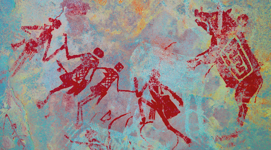
However, this should not come as a great surprise; thermoluminescence and EPR dating of a calcite veneer which covers a rock painting at the Toca da Bastiana shelter in the Serra da Capivara National Park in the Piaui region of Brazil provides dates from 35 to 43 ka ago, implying that the painting is at least 36,000 years old.
The existence of rock art, and therefore a complex and sophisticated society, at such an early date fits perfectly with totally different and independent data obtained from the famous Pedra Furada
rock shelter in the same region.
Bradshaw Foundation
by Bradshaw Foundation
Monday 04 December 2023
by Bradshaw Foundation
Friday 30 June 2023
by Bradshaw Foundation
Thursday 06 April 2023
by Bradshaw Foundation
Thursday 24 November 2022
by Bradshaw Foundation
Tuesday 27 September 2022
by Bradshaw Foundation
Thursday 08 September 2022
by Bradshaw Foundation
Tuesday 19 July 2022
by Bradshaw Foundation
Monday 06 June 2022
by Bradshaw Foundation
Friday 11 March 2022
by Bradshaw Foundation
Wednesday 02 March 2022
by Bradshaw Foundation
Thursday 26 August 2021
by Bradshaw Foundation
Monday 16 August 2021
by Bradshaw Foundation
Tuesday 06 July 2021
by Bradshaw Foundation
Thursday 06 May 2021
by Bradshaw Foundation
Thursday 06 May 2021
by Bradshaw Foundation
Tuesday 16 March 2021
by Bradshaw Foundation
Monday 04 December 2023
by Bradshaw Foundation
Friday 30 June 2023
by Bradshaw Foundation
Thursday 06 April 2023
by Bradshaw Foundation
Thursday 24 November 2022
by Bradshaw Foundation
Tuesday 27 September 2022
by Bradshaw Foundation
Thursday 08 September 2022
by Bradshaw Foundation
Tuesday 19 July 2022
by Bradshaw Foundation
Monday 06 June 2022
by Bradshaw Foundation
Friday 11 March 2022
by Bradshaw Foundation
Wednesday 02 March 2022
by Bradshaw Foundation
Thursday 26 August 2021
by Bradshaw Foundation
Monday 16 August 2021
by Bradshaw Foundation
Tuesday 06 July 2021
by Bradshaw Foundation
Thursday 06 May 2021
by Bradshaw Foundation
Thursday 06 May 2021
by Bradshaw Foundation
Tuesday 16 March 2021
Friend of the Foundation


